Delaware Water Gap National Recreation Area
A recreation area along the Delaware River.
Last updated
Where it is
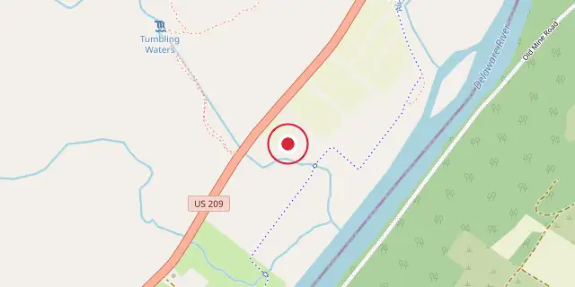
Coordinates: 41°09′14″N 74°54′50″W (41.1540, -74.9140) · Open in OpenStreetMap
Coordinates and connected clubs: the infobox of Wikipedia: Delaware Water Gap National Recreation Area (CC BY-SA 4.0). Map: drawn by Codexery from OpenStreetMap tiles.
Over 4 million people visit this 70,000-acre recreation area each year, many from the New York City region. Created in 1965 due to a dam project that was later canceled, it now offers hiking, canoeing, and other outdoor activities along the Delaware River.
History
At European contact, the Minisink was inhabited by Munsee, the northern branch of the Lenape. Dutch and French Huguenot families from New York's Hudson River Valley settled there in the late 17th and early 18th centuries.
A dam project at Tocks Island, proposed for flood control, hydroelectric power, and water supply, led to the 1965 authorization of the recreation area. The U.S. Army Corps of Engineers acquired land through eminent domain, displacing about 15,000 people and demolishing an estimated 3,000 to 5,000 dwellings and outbuildings, including historical sites. The dam project was canceled in 1978, and the land transferred to the recreation area.
Description
Stretching across five counties in New Jersey and Pennsylvania, the recreation area lies about an hour from New York City. The Appalachian Trail, cared for by the New York–New Jersey Trail Conference, traces much of its eastern edge.
Visitors can explore the Minisink Archaeological Site, Millbrook Village, and the Peters Valley arts center. Outdoor activities include hiking, canoeing, camping, and swimming, while fishing and hunting require state licenses. Notable waterfalls include Buttermilk Falls, New Jersey’s tallest at roughly 90 feet, and Raymondskill Falls, Pennsylvania’s tallest at about 150 feet.
Geology and geography
The gap is less than 1,000 ft wide at river level and less than 1 mi wide at the ridge line; the river is about 350 ft wide there. A road was built through the gap in 1793, and today I-80, PA 611, and the Delaware-Lackawanna Railroad pass through. The area incorporates much of the historical Minisink, a region named by Dutch colonists from the Munsee name, reflecting early European contact with Native Americans.
More in National Park Service National Recreation Areas
Sources
Compiled from Wikipedia and the sources listed below. Text from Wikipedia is available under CC BY-SA 4.0; this entry is adapted from it.
- Wikipedia: Delaware Water Gap National Recreation Area (CC BY-SA 4.0).
Spotted an error? Know more?
Reader corrections go straight into our review queue. Suggest an edit · How this site is sourced