Chickasaw National Recreation Area
Former Platt National Park and Arbuckle Recreation Area in Oklahoma.
Last updated
Where it is
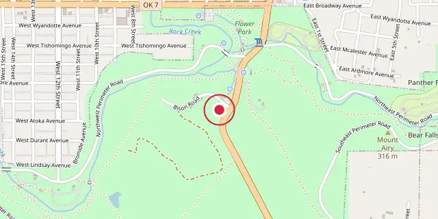
Coordinates: 34°30′04″N 96°58′19″W (34.5010, -96.9720) · Open in OpenStreetMap
Coordinates and connected clubs: the infobox of Wikipedia: Chickasaw National Recreation Area (CC BY-SA 4.0). Map: drawn by Codexery from OpenStreetMap tiles.
Chickasaw National Recreation Area sits in the Arbuckle Mountains foothills near Sulphur, Oklahoma, encompassing the former Platt National Park and Arbuckle Recreation Area. Its 9,888 acres include 2,409 acres of water and feature 1930s Civilian Conservation Corps rustic architecture. Named for the Chickasaw Nation, who sold the original 640 acres, the park charges no admission fee as part of their agreement with the U.S. government.
History
Forced from the Southeast, the Choctaw and Chickasaw discovered springs in their new nation they considered healing. Worried developers would privatize them like Hot Springs, the Chickasaw sold 640 acres to the U.S. in 1902, creating the Sulphur Springs Reservation. In 2024, the Sulphur tornado struck the park, causing severe damage from Lake of the Arbuckles through the Travertine District.
Platt National Park
It opened to the public on April 29, 1904, and was redesignated Platt National Park on June 29, 1906, a year after Platt's death. It was the seventh and smallest national park in the United States and the only one in Oklahoma until 1976. In 1914, Platt had more visitors than Yellowstone or Yosemite. The Civilian Conservation Corps developed infrastructure in the 1930s, and this environment was designated a National Historic Landmark in 2011.
Congress abolished Platt National Park in 1976, merging it into the larger Chickasaw National Recreation Area, which included Lake of the Arbuckles. In 1983, Sulphur traded 67 acres to the recreation area for land above the State Highway 7 bridge. In 2011, a U.S. quarter featured the Chickasaw's Lincoln Bridge, a limestone bridge built in 1909 for Abraham Lincoln's 100th birthday.
Travertine district
The Travertine district, which includes the former Platt National Park, is a narrow, three-mile-long area less than a mile wide. A single loop road leads visitors past parking lots, campsites, picnic areas, the Travertine Nature Center, swimming spots, and springs. The Civilian Conservation Corps built a bison pasture here during the 1930s.
Travertine Creek begins at Antelope and Buffalo Springs, flowing through the district and merging with Rock Creek. These springs release 5 million gallons of clear, cool water each day. Miles of hiking and biking trails meander through the dense forest along the creek bottomland.
Frequently Asked Questions
Where is Chickasaw National Recreation Area?
Chickasaw National Recreation Area is located in Murray County, Oklahoma, USA.
When was Chickasaw National Recreation Area founded?
Chickasaw National Recreation Area was founded on July 1, 1902.
More in National Park Service National Recreation Areas
Sources
Compiled from Wikipedia and the sources listed below. Text from Wikipedia is available under CC BY-SA 4.0; this entry is adapted from it.
- Wikipedia: Chickasaw National Recreation Area (CC BY-SA 4.0).
Spotted an error? Know more?
Reader corrections go straight into our review queue. Suggest an edit · How this site is sourced