Gateway National Recreation Area
Urban recreation area spanning New York and New Jersey.
Last updated
Where it is
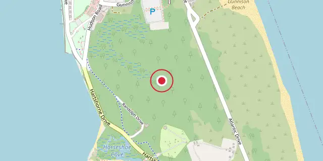
Coordinates: 40°27′14″N 73°59′49″W (40.4540, -73.9970) · Open in OpenStreetMap
Coordinates and connected clubs: the infobox of Wikipedia: Gateway National Recreation Area (CC BY-SA 4.0). Map: drawn by Codexery from OpenStreetMap tiles.
It offers recreational opportunities uncommon in dense urban settings, such as ocean swimming, bird watching, boating, hiking, and camping. In 2022, it was the fourth-most visited unit of the National Park Service, with over 8.7 million visitors.
Creation
In 1969, the Regional Plan Association proposed a national seashore for the New York metropolitan area under the Department of the Interior. President Richard Nixon supported a similar proposal in 1970, but recommended a national park designation instead. The House of Representatives approved Gateway's creation in September 1972, transferring most land to the National Park Service and rejecting a housing development at Floyd Bennett Field.
Units and park sites
The recreation area consists of three units and 11 park sites. Law enforcement in the New York units is handled by the United States Park Police, while National Park Service Rangers cover the New Jersey unit. Gateway contains roughly 800 historic buildings, structures, and sites, many already in poor condition when the area was established.
The Jamaica Bay Unit, the largest of the three, lies in Brooklyn and Queens and includes shoreline, water, and islands in Jamaica Bay, a tidal estuary. Shirley Chisholm State Park, built atop the former Pennsylvania Ave landfill, is operated by New York State but owned by the National Park Service under a 60-year lease. The park cost $20 million to develop as of 2019 and offers bike paths, free bike rentals, kayaking, fishing, and walking trails; its first phase opened in July 2019, with the second half completed in 2021.
Animal wildlife
Gateway National Recreation Area supports a wide range of animal life, all of which have adapted to the surrounding urban landscape of New York City and New Jersey. Over 325 bird species, such as the American Oystercatcher and Osprey, make it a prime spot for birdwatching.
Other residents include the Eastern Gray Tree Frog, Atlantic Horseshoe Crab, Monarch Butterfly, and Eastern Tent Caterpillar. Reptiles like the Diamondback Terrapin and Snapping Turtle are most active in warm weather. Mammals include foxes, harbor seals, raccoons, white-tailed deer, and muskrat.
Environmental assessment
The National Park Service conducts an annual air quality survey measuring overall air quality, visibility, and ground ozone levels. White-tailed deer in the Staten Island unit may wander onto roads, with increased risk at dawn, dusk, and during autumn mating season. After radioactive contamination was discovered at Great Kills Park in 2005, public access to parts of the park was restricted while the NPS investigates and cleans up the site under CERCLA authority.
Artificial fill, commonly used in the early to mid-20th century to fill wetlands and level ground, has reduced infiltration to hardened trails and roads at some sites. Deep dredging and other engineering have altered hydrology in marine environments such as Jamaica Bay. Invasive species removal and native species planting are conducted at several park sites to support native plant growth and biodiversity.
More in National Park Service National Recreation Areas
Sources
Compiled from Wikipedia and the sources listed below. Text from Wikipedia is available under CC BY-SA 4.0; this entry is adapted from it.
- Wikipedia: Gateway National Recreation Area (CC BY-SA 4.0).
- Word definitions: the Codexery glossary, each quoted from its Wikipedia article.
Spotted an error? Know more?
Reader corrections go straight into our review queue. Suggest an edit · How this site is sourced