Bighorn Canyon National Recreation Area
A canyon reservoir straddling Wyoming and Montana, named for a Crow leader.
Last updated
Where it is
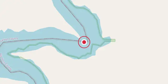
Coordinates: 45°11′38″N 108°07′52″W (45.1940, -108.1310) · Open in OpenStreetMap
Coordinates and connected clubs: the infobox of Wikipedia: Bighorn Canyon National Recreation Area (CC BY-SA 4.0). Map: drawn by Codexery from OpenStreetMap tiles.
Bighorn Canyon National Recreation Area is a U.S. National Park Service site established by Congress on October 15, 1966, following the construction of the Yellowtail Dam by the Bureau of Reclamation. Spanning 120,296.22 acres across the Wyoming-Montana border, it is divided into a North District accessed via Fort Smith, Montana, and a South District accessed through Lovell, Wyoming, with no thru road connecting them. The recreation area is named after the Crow leader Robert Yellowtail and centers on Bighorn Lake, a 71-mile reservoir created by the dam.
History
Archaeological evidence indicates human presence near Bighorn Canyon as early as 12,000 years ago. The Bad Pass trail, running along the canyon's west side, served as a seasonal route for Indigenous peoples traveling from the Bighorn basin to the Grapevine Creek area in present-day Montana, where buffalo were available. The Crow people, also called Apsáalooke or Absarokaa, arrived in the region during the 16th century and had settled in Bighorn country by the 18th century, though conflicts with tribes such as the Blackfeet, Sioux, and Cheyenne occurred.
In the late 1800s, the Crow allied with the U.S. government and served as scouts. The Fort Laramie Treaty of 1851 identified 38 million acres of Crow territory, but the 1868 treaty reduced it to eight million acres. By the 1950s, the federal government moved to dam the Bighorn River under the Pick-Sloan Flood Control Act of 1944, despite Crow opposition because the canyon is considered sacred. Robert Yellowtail, a Crow leader and former Superintendent, fought the dam.
The government initially sought 7,000 acres of Crow land for $1.5 million, but after negotiations purchased 12,000 acres for $5 million. The Bureau of Reclamation named the 525-foot structure Yellowtail Dam after him. The Bad Pass trail was added to the National Register of Historic Places on October 29, 1975.
Park management
Bighorn Canyon National Recreation Area is managed as part of the Powder River group, which also includes Little Bighorn Battlefield National Monument, Fort Laramie National Historic Site, and Devils Tower National Monument. This group falls within the Intermountain Region of the National Park Service. The Yellowtail Dam Visitor Center in Fort Smith, Montana, is currently closed, along with its access road. The Cal S. Taggart Visitor Center in Lovell, Wyoming, is open year-round but closed on Sundays during fall, winter, and spring.
Recreation
The recreation area contains seven designated campgrounds. Medicine Creek Campground, with five sites in the South District, is accessible only by boating or hiking. Backcountry camping is allowed below the reservoir's high water mark of 3,640 feet or in undeveloped areas near Bighorn Lake, but fires are prohibited.
Two developed waterway campsites exist at Big Bull Elk Creek and Dry Head Creek. Two handicap-accessible trails in the South District are the Visitor Center Pond path (0.26 miles) and Two Eagles Interpretive Trail (0.25 miles). Pets are allowed on trails but must be leashed.
Park features
Below Yellowtail Dam, Afterbay Lake draws anglers for trout fishing and offers views of ducks, geese, and other wildlife. The Bighorn River downstream from Afterbay Dam is also known as a world-class trout fishing destination. The recreation area holds four historic ranches. Caroline Lockhart, an early 1900s journalist and novelist, owned L Slash Heart Ranch.
Mason-Lovell Ranch, from the 1880s open range era, once grazed 25,000 cattle across the Bighorn Basin. Cedarvale Ranch, a dude ranch in the ghost town of Hillsboro, Montana, was owned by Grosvener W. "Doc" Barry and hosted his friend President Teddy Roosevelt. Ewing-Snell Ranch began when Erastus Ewing turned to ranching after failing at gold mining. North of Lovell along Sullivan Knob's Trail, a spot on the canyon rim produces a triple echo when someone shouts across the canyon.
Did You Know?
- About one-third of the park unit is located on the Crow Indian Reservation.
- Nearly one-quarter of the Pryor Mountains Wild Horse Range lies within the recreation area.
- The northwestern wolf has been observed in the Wyoming region where the South District is located.
More in National Park Service National Recreation Areas
Sources
Compiled from Wikipedia and the sources listed below. Text from Wikipedia is available under CC BY-SA 4.0; this entry is adapted from it.
- Wikipedia: Bighorn Canyon National Recreation Area (CC BY-SA 4.0).
Spotted an error? Know more?
Reader corrections go straight into our review queue. Suggest an edit · How this site is sourced