National Capital Parks
Former NPS unit encompassing D.C. federal parklands.
Last updated
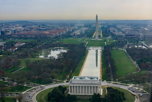
Once a single unit of the U.S. National Park System, National Capital Parks has since been split into several separate management areas. It covered a wide range of federally owned sites in and near Washington, D.C., such as memorials, monuments, parks, the interiors of traffic circles and squares, triangles from odd intersections, and other open spaces. The original lands were acquired under the Residence Act of 1790, and by 1867, 301 separate reservations in the original City of Washington had been obtained as public properties.
In 1933, title and control of parklands in the District was transferred to the National Park Service, creating the National Capital Parks unit—not by legislation, but through an Executive Order that consolidated several federal agencies into the Office of National Parks, Buildings, and Reservations. In 1975, the Baltimore–Washington Parkway was incorporated into the unit.
Quick Facts
- Established
- 1790 (land acquisition authorized)
- Original designer
- Pierre Charles L'Enfant
- Original surveyor
- Andrew Ellicott
- Number of original reservations
- 301
- Civil war fortifications period
- 1861–1865
- Fort circle parks legislation
- 1926
Facts from the source article.
History
In 1790, Congress authorized President George Washington through the Residence Act to procure land along the Potomac River for a new national capital. The following year, Washington appointed Pierre Charles L'Enfant to design the City of Washington under three Commissioners overseeing the District of Columbia's development. L'Enfant's plan was later modified by Andrew Ellicott after a dispute with the commissioners led to L'Enfant's dismissal. This design created many spaces that became National Capital Parks.
Between 1790 and 1867, lands including The Mall, Monument Grounds, Capitol Grounds, President's Park, Lafayette Park, Franklin Park, Garfield Park, and 301 separate reservations were acquired as public properties. During the Civil War, the Union Army built fortifications around the city, adding more federally owned land. In 1924, Congress created the National Capital Park Commission to acquire land for preserving Civil War fortification sites and interconnecting parkways.
Legislation in 1926 authorized a park system from these fortifications, allowing acquisition for a parkway ring around the city, known as the Fort Circle Parks, though the roadway was never built.
Administration
Administration of the parklands formerly in National Capital Parks is now divided among several National Park Service units. National Capital Parks-East handles neighborhood parks, circles, and Maryland properties. National Mall and Memorial Parks administers properties in and around the Mall. White House and President's Park oversees The White House, a visitor center, Lafayette Square, and The Ellipse.
Rock Creek Park manages properties in the north and northwest of the District. George Washington Memorial Parkway administers several D.C. properties including Clara Barton Parkway, Theodore Roosevelt Island, and Columbia Island parks. Chesapeake and Ohio Canal National Historical Park manages the entire C&O Canal NHP within the District.
More in National Park Service Areas in Washington, D.C.
Sources
Compiled from Wikipedia and the sources listed below. Text from Wikipedia is available under CC BY-SA 4.0; this entry is adapted from it.
- Wikipedia: National Capital Parks (CC BY-SA 4.0).
Spotted an error? Know more?
Reader corrections go straight into our review queue. Suggest an edit · How this site is sourced