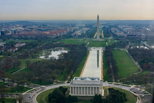
Chesapeake and Ohio Canal National Historical Park
Preserving the historic C&O Canal and towpath along the Potomac River.
Last updated
Where it is
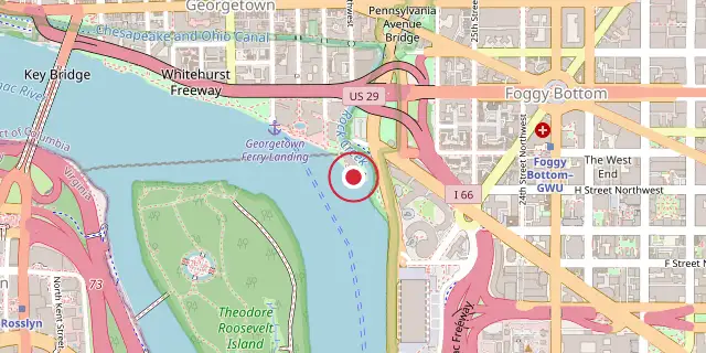
Coordinates: 38°54′00″N 77°03′29″W (38.9000, -77.0580) · Open in OpenStreetMap
Coordinates and connected clubs: the infobox of Wikipedia: Chesapeake and Ohio Canal National Historical Park (CC BY-SA 4.0). Map: drawn by Codexery from OpenStreetMap tiles.
The Chesapeake and Ohio Canal National Historical Park preserves a 184.5-mile canal and towpath along the Potomac River from Georgetown in Washington, D.C., to Cumberland, Maryland. Established as a National Monument in 1961 by President Dwight D. Eisenhower, it became a National Historical Park in 1971. With over four million visitors in 2022, it is the most-visited national historical park in the National Park Service system.
The Chesapeake and Ohio Canal
Construction on the Chesapeake and Ohio Canal, also called the Grand Old Ditch or the C&O Canal, began in 1828 and ended in 1850 when it reached Cumberland, far short of its intended destination of Pittsburgh, Pennsylvania. An 1874 proposal to dig an 8.4-mile tunnel through the Allegheny Mountains was considered, and a tunnel was built to connect with the Pennsylvania canal. The Baltimore and Ohio Railroad reached Cumberland eight years before the canal, but the canal remained viable until the mid-1870s, when larger locomotives and air brakes allowed the railroad to set lower rates.
The canal operated from 1831 to 1924, primarily transporting coal from the Allegheny Mountains to Washington, D.C. It closed in 1924 partly due to severe floods that devastated its finances. In 1938, the United States obtained the abandoned canal from the B&O Railroad in exchange for a loan from the Reconstruction Finance Corporation, planning to restore it as a recreation area and provide employment during the Great Depression. By 1940, African-American enrollees with the Civilian Conservation Corps had repaired and rewatered the first 22 miles from Georgetown to Violettes lock (Lock 23).
The first Canal Clipper boat, offering mule-driven rides, began in 1941 and was replaced by the John Quincy Adams in the 1960s. The project halted when the United States entered World War II. In 1941, Harry Athey suggested converting the canal into an underground highway or bomb shelter, but the idea was deemed impractical due to periodic flooding. In 1942, freshets destroyed the rewatered sections.
National Park Service official Arthur E. Demaray pressed for restoration from Dam #1 to supply water to the Dalecarlia Reservoir as a national security measure, and the War Production Board approved the work. By 1943, Congress funded repairs, and the Park Service resumed boat trips in October 1943.
Creation of the national park
United States Supreme Court Associate Justice William O. Douglas opposed turning the canal over to automobiles. In March 1954, he led an eight-day hike of the towpath from Cumberland to D.C.; 58 people participated in parts, and nine, including Douglas, Merlo J. Pusey, and Olaus Murie, hiked the full 184.5 miles. Douglas formed a committee, renamed the C&O Canal Association in 1957, which drafted preservation plans, with Douglas as chairman. In 1958, the entire path was cleared for hiking, and a 12-mile bicycle trail was built on the towpath from Georgetown's Mule Bridge at 34th Street to Widewater, opening on November 22, 1958.
Cyclists were biking the full route by 1960. Within ten years, the national river plan proved unsupportable, and the idea of a historic park faced little opposition. The Chesapeake and Ohio Canal National Historical Park Act established the canal as a National Historical Park, and President Richard Nixon signed it into law on January 8, 1971. Two floods in 1996—after a January blizzard and from Hurricane Fran—caused extensive damage to the canal and towpath, requiring volunteer help for repairs.
Today
Stretching along the Potomac River, this national historical park covers nearly 20,000 acres. A short stretch of its towpath near Harpers Ferry also serves as part of the Appalachian Trail. The canal starts at its zero mile marker, which can only be reached through Thompson's Boat House, directly across from the Watergate complex. In Allegany County, Maryland, the park includes the Western Maryland Railroad Right-of-Way from Milepost 126 to Milepost 160, a section added to the National Register of Historic Places in 1981.
Flooding remains a constant threat to the canal's historic structures, and while the Park Service has rewatered some sections, most of the canal is dry. The towpath and the river offer running, hiking, biking, fishing, boating, kayaking, and rock climbing in certain spots, plus plenty of wildlife and birdwatching. Seven visitor centers feature exhibits on the canal's history. During spring, summer, and fall, visitors can take rides on two reproduction canal boats, the Georgetown and the Charles F. Mercer, pulled by mules.
Park rangers in period dress work the locks and present a historical program. The park gets about five million recreation visits each year. Access through the Great Falls Tavern Visitor Center costs money, but all other entry points are free. In January 2015, the Park Service proposed adding fees at nearly all access points, but withdrew the plan the next month after strong opposition from nearby communities.
On February 9, 1963, Robert F. Kennedy hiked from Great Falls, Maryland, to Harpers Ferry, West Virginia, along the towpath as part of the 50-mile frenzy. Free hiker/biker campsites are spaced every 5 to 7 miles along the towpath, available on a first-come, first-served basis. Each site has a water pump (operating from mid-April to mid-November), a picnic area, a firepit, and a latrine.
More in National Park Service Areas in Washington, D.C.
Sources
Compiled from Wikipedia and the sources listed below. Text from Wikipedia is available under CC BY-SA 4.0; this entry is adapted from it.
- Wikipedia: Chesapeake and Ohio Canal National Historical Park (CC BY-SA 4.0).
Spotted an error? Know more?
Reader corrections go straight into our review queue. Suggest an edit · How this site is sourced