Natchez National Historical Park
Four sites interpret Natchez's colonial, free Black, plantation, and slave trade history.
Last updated
Where it is
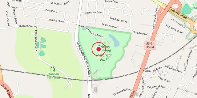
Coordinates: 31°32′35″N 91°22′59″W (31.5430, -91.3830) · Open in OpenStreetMap
Coordinates and connected clubs: the infobox of Wikipedia: Natchez National Historical Park (CC BY-SA 4.0). Map: drawn by Codexery from OpenStreetMap tiles.
Natchez National Historical Park, managed by the National Park Service, preserves and interprets the history of Natchez, Mississippi. The park comprises four separate sites: Fort Rosalie, the William Johnson House, Melrose, and the Forks of the Road Market. It encompasses colonial fortifications, a free Black businessman's home, a plantation estate, and a major slave market site.
Legal history
Established in 1988, this National Historical Park is part of the National Park Service and therefore appears on the National Register of Historic Places. The William Johnson House, added to the park in 1990, stands at 210 State Street, a few blocks from the Fort Rosalie site.
That fort was already on the Register as part of the 1972 Natchez Bluffs and Under-the-Hill Historic District. Johnson’s house is also individually listed and falls within the Natchez On-Top-of-the-Hill Historic District. Melrose sits roughly two miles southeast of Fort Rosalie.
More in National Historical Parks of the United States
Sources
Compiled from Wikipedia and the sources listed below. Text from Wikipedia is available under CC BY-SA 4.0; this entry is adapted from it.
- Wikipedia: Natchez National Historical Park (CC BY-SA 4.0).
Spotted an error? Know more?
Reader corrections go straight into our review queue. Suggest an edit · How this site is sourced