New Bedford Whaling National Historical Park
Park honoring the world's preeminent nineteenth-century whaling port.
Last updated
Where it is
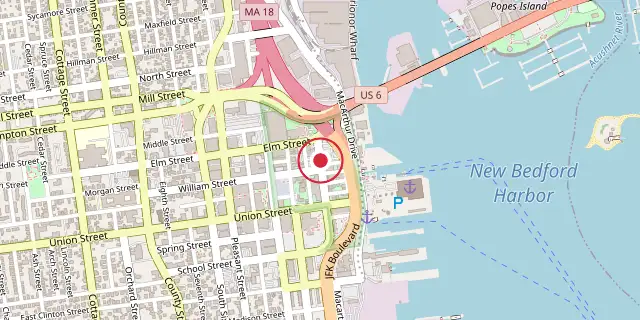
Coordinates: 41°38′10″N 70°55′23″W (41.6360, -70.9230) · Open in OpenStreetMap
Coordinates and connected clubs: the infobox of Wikipedia: New Bedford Whaling National Historical Park (CC BY-SA 4.0). Map: drawn by Codexery from OpenStreetMap tiles.
New Bedford Whaling National Historical Park, established in 1996, commemorates the heritage of the world's preeminent nineteenth-century whaling port. The 34-acre park spans 13 city blocks and includes a visitor center, the New Bedford National Historic Landmark District, the New Bedford Whaling Museum, the Seamen's Bethel, the schooner Ernestina, and the Rotch–Jones–Duff House and Garden Museum. It is administered through a partnership among the National Park Service, the City of New Bedford, and private building owners.
More in National Historical Parks of the United States
Sources
Compiled from Wikipedia and the sources listed below. Text from Wikipedia is available under CC BY-SA 4.0; this entry is adapted from it.
- Wikipedia: New Bedford Whaling National Historical Park (CC BY-SA 4.0).
Spotted an error? Know more?
Reader corrections go straight into our review queue. Suggest an edit · How this site is sourced