New Orleans Jazz National Historical Park
Park celebrating jazz origins and evolution in New Orleans.
Last updated
Where it is
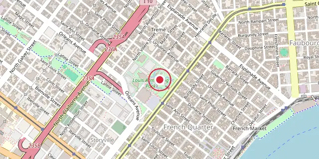
Coordinates: 29°57′47″N 90°04′05″W (29.9630, -90.0680) · Open in OpenStreetMap
Coordinates and connected clubs: the infobox of Wikipedia: New Orleans Jazz National Historical Park (CC BY-SA 4.0). Map: drawn by Codexery from OpenStreetMap tiles.
New Orleans Jazz National Historical Park, located in the Tremé neighborhood near the French Quarter, was created in 1994 to celebrate the origins and evolution of jazz. The park consists of 4 acres within Louis Armstrong Park leased by the National Park Service, with a visitor center at 916 North Peters Street and a concert venue several blocks away in the French Quarter.
More in National Historical Parks of the United States
Sources
Compiled from Wikipedia and the sources listed below. Text from Wikipedia is available under CC BY-SA 4.0; this entry is adapted from it.
- Wikipedia: New Orleans Jazz National Historical Park (CC BY-SA 4.0).
Spotted an error? Know more?
Reader corrections go straight into our review queue. Suggest an edit · How this site is sourced