Kaloko-Honokōhau National Historical Park
Preserving traditional Native Hawaiian culture and ancient settlements.
Last updated
Where it is
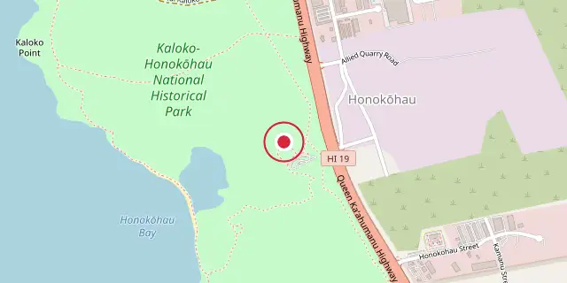
Coordinates: 19°40′44″N 156°01′19″W (19.6790, -156.0220) · Open in OpenStreetMap
Coordinates and connected clubs: the infobox of Wikipedia: Kaloko-Honokōhau National Historical Park (CC BY-SA 4.0). Map: drawn by Codexery from OpenStreetMap tiles.
On Hawaii Island, Kaloko-Honokōhau National Historical Park protects the Honokōhau Settlement, a National Historic Landmark. Created on November 10, 1978, it preserves and interprets traditional Native Hawaiian culture and practices.
History
The park encompasses two of four traditional ahupuaʻa, Kaloko and Honokōhau, which are mountain-to-sea land divisions. Despite the arid lava rock area being called kekaha ʻaʻole wai (lands without water), abundant sea life supported settlement for hundreds of years. Kaloko, meaning "the pond," contains ancient fishponds on the north end of the park. The first reference to the pond appears in the story of Kamalalawalu, from about 300 years ago.
The kuapā (seawall) is over 30 feet wide and 6 feet high, stretching 750 feet; built by hand without mortar, its stone angle and gaps deflected surf better than many modern concrete seawalls. ʻAimakapā fishpond is a wetland protecting native birds such as the koloa maoli, ʻalae keʻokeʻo, āeʻo, and auʻkuʻu. The area is under reforestation after removal of non-native invasive plants. Honokōhau, meaning "bay drawing dew," refers to the ancient settlement on the south part of the park, reachable via trails from the visitor center or from the small boat harbor access road.
Features include loko iʻa, kahua, kiʻi pōhaku, hōlua, and heiau. The ʻAiʻopio Fishtrap is a 1.7-acre pond with a stone wall forming an artificial enclosure along a naturally curved shoreline; small openings let young fish enter from the sea, and at low tide or as they grew larger they were caught with nets inside the trap.
Did You Know?
- The park was added to the Register of Historic Places in 1978.
- The Māmalahoa Trail was built in the mid-19th century.
More in National Historical Parks of the United States
Sources
Compiled from Wikipedia and the sources listed below. Text from Wikipedia is available under CC BY-SA 4.0; this entry is adapted from it.
- Wikipedia: Kaloko-Honokōhau National Historical Park (CC BY-SA 4.0).
Spotted an error? Know more?
Reader corrections go straight into our review queue. Suggest an edit · How this site is sourced