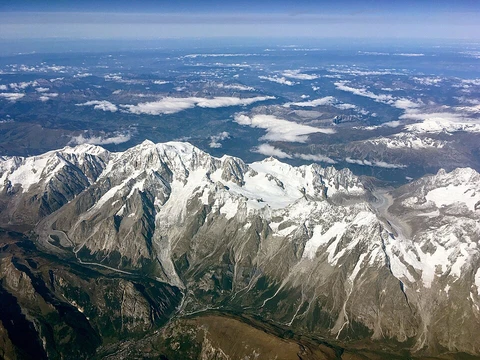
Blue Mountains (Pacific Northwest)
Mountain range in Oregon and Washington, home to largest fungus.

The Blue Mountains stretch across northeastern Oregon and into the southeastern corner of Washington, covering roughly 15,000 square miles. This range runs east and southeast of Pendleton, Oregon, all the way to the Snake River along the Oregon-Idaho border. Ten counties are involved: Union, Umatilla, Grant, Baker, Wallowa, and Harney in Oregon, plus Walla Walla, Columbia, Garfield, and Asotin in Washington. The name comes from the bluish tint the mountains take on when seen from a distance—a color partly caused by smoke from forest and range fires set by Indigenous people each fall as a land management tool. Hidden beneath the ground here is the world’s largest living organism: a sprawling, subterranean mycelial mat of the fungus *Armillaria ostoyae*.
Geographically, the Blue Mountains include several smaller ranges. To the west, near Prineville, Oregon, are the Ochoco Mountains and Maury Mountains. Moving east, you’ll find the Greenhorn Mountains, the Aldrich Mountains, the Strawberry Range, and the Elkhorn Mountains. The highest peaks are Rock Creek Butte in the Elkhorns, at 9,106 feet, and Strawberry Mountain in the Strawberry Range, at 9,042 feet. Much of the range lies within the Malheur, Umatilla, and Wallowa-Whitman National Forests. Several wilderness areas protect remote sections: the North Fork Umatilla, North Fork John Day, Strawberry Mountain, and Monument Rock wildernesses, all in Oregon, plus the Wenaha-Tucannon Wilderness straddling the Oregon-Washington border. Land management is shared by the U.S. Forest Service, the Bureau of Land Management, private owners, and the Confederated Tribes of the Umatilla Indian Reservation.
The range is drained by rivers feeding into the Snake River—like the Grande Ronde and Tucannon—and into the Columbia River, including the forks of the John Day, Umatilla, and Walla Walla rivers. The southernmost part drains into the Silvies River, which flows into the endorheic Harney Basin.
Geologically, the Blue Mountains are uplift mountains containing some of Oregon’s oldest rocks. Rocks as ancient as 400 million years poke through younger Columbia River Basalt flows and related volcanic deposits from about 16.7 million to 6 million years ago. The oldest rocks—400 million to roughly 150 million years old—formed as island arcs in the Pacific Ocean and later attached to the North American plate. The suture zone where they joined runs through western Idaho, near Riggins and McCall. Within these accreted terranes are igneous intrusions, some of which formed after the collision. The ranges were uplifted by folding into the “Blue Mountain Anticline,” a process driven by tectonic rotation starting about 14 million years ago. Limited faulting and extension in places like Baker Valley and the Grande Ronde Valley also shaped today’s landscape. Many geologists consider the Wallowa Mountains part of the Blues because they share the same accreted terranes as the Elkhorns, Greenhorns, and Strawberries, though their uplift mechanism differs. Similarly, the geology of Hells Canyon and the Seven Devils Mountains consists of similar accreted terranes.
Indigenous peoples lived in the river valleys and lower elevations for thousands of years. Historic tribes included the Walla Walla, Cayuse, and Umatilla, now united as the Confederated Tribes of the Umatilla Indian Reservation, mostly in Umatilla County, Oregon. The southern Blue Mountains were home to several bands of the Northern Paiute, a Great Basin culture. These tribes originally came to the mountains for hunting and salmon runs, and they deliberately burned small patches of forest to create pastures that attracted game.
During the mid-1800s, the Blue Mountains became a major obstacle for settlers on the Oregon Trail. Pioneers often had to cross this range as one of the last barriers before reaching southeast Washington near Walla Walla or descending the Columbia River Gorge to the trail’s end in the Willamette Valley near Oregon City.
Today, Interstate 84 crosses the range at a 4,193-foot summit between La Grande and Pendleton. Baker City sits along the southeastern flank. U.S. Route 26 crosses the southern part, reaching 5,098 feet at Blue Mountain Summit. The Union Pacific Railroad’s mainline between Portland, Oregon, and Pocatello, Idaho, also crosses the range, cresting at Kamela, Oregon, on the La Grande Subdivision between La Grande and Hinkle, where a major UP yard is located.
Wildlife includes bald eagles, Lewis’s woodpeckers, Williamson’s sapsuckers, red-breasted nuthatches, golden-crowned kinglets, and many migratory birds, with riverbanks providing key habitat. Mammals moving through the mountain grasslands include Rocky Mountain elk, bighorn sheep, and mule deer. Native fish include Chinook salmon, steelhead, redband trout, bull trout, and Pacific lamprey. In Washington, the Blue Mountains host one of the state’s ten identified elk herds, numbering about 4,500 animals.
- States
- Oregon and Washington
- Counties
- Union, Umatilla, Grant, Baker, Wallowa, Harney (Oregon); Walla Walla, Columbia, Garfield, Asotin (Washington)
- Notable feature
- World's largest living organism (Armillaria ostoyae)
Lore & Background
The Blue Mountains were named after the color of the mountains when seen from a distance and the blue hue imparted by the smoke of forest and range fires set by Indigenous people as management tools in the fall. The range includes several mountain ranges, from the Ochoco Mountains and Maury Mountains in the west near Prineville, Oregon, through the Greenhorn Mountains, the Aldrich Mountains, and the Strawberry Range, to the Elkhorn Mountains. The range is drained by several rivers, including the Grande Ronde and Tucannon, tributaries of the Snake, as well as the forks of the John Day, Umatilla and Walla Walla rivers, tributaries of the Columbia. The southernmost portion is drained by the Silvies River, in the endorheic Harney Basin. The oldest rocks were created as island arcs in the Pacific Ocean and accreted onto the North American plate.
Reader's Guide
The Blue Mountains hold significance as a major geographic feature of the Pacific Northwest, serving as a formidable obstacle for settlers on the Oregon Trail in the mid-1800s. The range is currently traversed by Interstate 84 and U.S. Route 26, as well as the Union Pacific Railroad's mainline. The mountains are home to diverse wildlife, including Rocky Mountain elk, Bighorn sheep, Mule deer, and numerous bird species such as bald eagle and Lewis's woodpecker. The range is managed by the United States Forest Service, Bureau of Land Management, private landowners, and the Confederated Tribes of the Umatilla Indian Reservation. The Blue Mountains are also notable for containing the world's largest living organism, a subterranean colonial mycelial mat of the fungus Armillaria ostoyae.
Did You Know?
- The Blue Mountains were named after the blue hue imparted by smoke from fires set by Indigenous people as management tools.
- The range is home to the world's largest living organism, a subterranean colonial mycelial mat of the fungus Armillaria ostoyae.
- The Blue Mountains cover ten counties across two states: Oregon and Washington.
Frequently Asked Questions
What is the Blue Mountains' most famous feature or 'power'?
The range shelters the world's largest known single living organism, a vast underground colonial network of the honey fungus Armillaria ostoyae. This mycelial mat spreads beneath the forest floor over an enormous area, dwarfing virtually every other living entity on the planet.
How did the Blue Mountains get their name?
The name comes from the distinctive blue-tinted haze that hovers over the peaks, produced by smoke from controlled burns historically set by Indigenous peoples as a land-management practice. That recurring blue glow, visible from a great distance, gave the range its enduring nickname.
Why is the Blue Mountains important in the broader landscape?
Beyond its sheer size, the range is ecologically significant because it hosts the planet's largest living organism and supports diverse dry-forest ecosystems. Its semi-arid climate and high elevation set it clearly apart from the wetter Cascades just to the west.
More in Mountain Ranges And Massifs 1-24
Spotted an error? Know more?
This is a living reference — every entry is fact-audited, and reader corrections feed straight into our audit queue. Suggest an edit · See this site's audit record