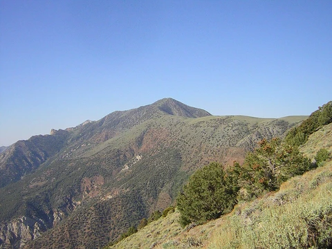
Lassen Peak
Southernmost active volcano in the Cascade Range.

via Wikipedia: Lassen Peak · see source
It is the southernmost active volcano in the Cascade Range of the Western United States, and part of the Cascade Volcanic Arc stretching from southwestern British Columbia to Northern California. On May 22, 1915, a powerful explosive eruption devastated nearby areas and spread volcanic ash as far as 280 mi to the east. Lassen Peak and Mount St. Helens in Washington were the only two volcanoes within the contiguous United States to erupt during the 20th century.
Quick Facts
- Elevation (ft)
- 10457
- Prominence (ft)
- 5229
- Listing
- US most prominent peaks 113th
- US most isolated peaks 91st
- California county high points 13th
- Range
- Cascade Range
- Location
- Shasta County, California, U.S.
- Age
- Less than 27,000 years
- Volcanic arc
- Cascade Volcanic Arc
- Last eruption
- 1914 to 1921
Facts from the source article.
Did You Know?
- Lassen Peak has a volume of 0.6 cubic miles, making it the largest lava dome on Earth.
- Lassen Peak has the highest known winter snowfall amounts in California, with an average annual snowfall of 660 inches.
- The volcano arose from the former northern flank of now-eroded Mount Tehama about 27,000 years ago.
Geography
Lassen Peak lies within Lassen Volcanic National Park in Shasta County, California, 55 miles east of Redding. The park and peak are surrounded by the Lassen National Forest, which covers 1,200,000 acres. Nearby towns include Mineral in Tehama County and Viola in Shasta County. It is the second tallest peak in the California segment of the Cascades, behind Mount Shasta (14,179 feet) 80 miles to the north. The area receives more precipitation than anywhere in the Cascade Range south of Oregon's Three Sisters volcanoes. Fourteen permanent snow patches exist on and around the summit, but no glaciers.
Geology
Lassen Peak lies near the southern end of the Cascade Volcanic Arc, at the western edge of the Basin and Range Province. Like other Cascade volcanoes, it is fed by magma chambers produced by subduction of the Juan de Fuca tectonic plate under the North American plate. The region is also affected by the Cascadia subduction zone and by horizontal crustal stretching in the Basin and Range Province. About 3 million years ago, the southern limit of active Cascade volcanoes corresponded to the Yana Volcanic Center 30 km south of Lassen Peak; currently the southern edge of Lassen Volcanic National Park marks that border, indicating the arc's southern end migrates at 0.4 to 1 inch annually.
The Lassen volcanic center is fed by two magma chambers: one calc-alkaline reservoir common to other Cascade volcanoes, and a smaller volume of low-potassium olivine tholeiitic basalt associated with the Basin and Range province. Most volcanic rock in the region has erupted in the past 3 million years. During this period, at least five large andesitic stratovolcanoes formed in the vicinity, building cones before going extinct and eroding. Volcanism follows a pattern of intermittent, episodic eruptions punctuating long dormancy, persisting through the late Pleistocene and Holocene. Over the past 825,000 years, hundreds of explosive eruptions have occurred across 200 square miles.
Human history
The areas around Lassen Peak, especially to its east, south, and southeast, were a meeting ground for Maidu, Yana, Yahi, and Atsugewi Native Americans. The volcano is known among some native populations as Amblu Kai, meaning 'Mountain Ripped Apart' or 'Fire Mountain,' and as Kom Yamani, meaning 'Snow Mountain,' among the Mountain Maidu. The first white man to reach Lassen Peak was Jedediah Smith, who passed through in 1821. After the California Gold Rush, the peak was named for Danish blacksmith Peter Lassen, who guided immigrants past it to the Sacramento Valley during the 1830s.
The trail was later replaced by the Nobles Emigrant Trail, pioneered in 1851 by William Nobles. The first recorded ascent was in 1851, led by Grover K. Godfrey. In 1864, painter Helen Tanner Brodt became the first woman to summit, and a tarn lake on the peak is named Lake Helen in her honor. President Theodore Roosevelt established Lassen Peak National Monument in 1907, based on the belief the volcano was extinct. After eruptions began in 1914, the monument was expanded to create Lassen Volcanic National Park on August 9, 1916.
Eruptive history
About 385,000 to 315,000 years ago, the Lassen volcanic center stopped building andesitic stratovolcanoes and started making dacite domes. In the last 300,000 years, over 30 lava domes have appeared, with Lassen Peak as the biggest. Its dome formed 27,000 years ago through several eruptions over a few years, then was heavily eroded by glaciers from 25,000 to 18,000 years ago. The area went quiet from 190,000 to roughly 90,000 years ago, but the past 100,000 years have seen at least 12 eruptive periods.
The Twin Lakes sequence, active for the last 90,000 years, has produced mixed lavas like andesite and basaltic andesite flows, plus fused pyroclastic cones near the Lassen dome field. This sequence includes the Chaos Crag dome complex, built 1,100 to 1,000 years ago, and eruptions at Lassen Peak that started in 1914. Before that, Lassen Peak likely had an explosive eruption that carved a summit crater 360 feet deep and 1,000 feet across.
More in Highest Points of United States National Parks
Spotted an error? Know more?
Reader corrections go straight into our review queue. Suggest an edit · How this site is sourced