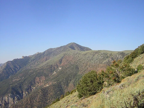
Longs Peak
Highest point in Rocky Mountain National Park and Boulder County.

via Wikipedia: Longs Peak · see source
Longs Peak is a fourteener in the northern Front Range of the Rocky Mountains, located in the Rocky Mountain National Park Wilderness, 15.5 km southwest by south of Estes Park, Colorado. It is the highest point in Rocky Mountain National Park and Boulder County, and is the northernmost fourteener in the Rocky Mountains. The mountain is named for explorer Stephen Harriman Long and appears on the Colorado state quarter.
Quick Facts
- Elevation system
- NAPGD2022
- Elevation
- 14,259.9 ft / 4.35 km
- Prominence
- 2940 ft (896 m)
- Isolation
- 43.6 mi (70.2 km)
- Range
- Front Range, Highest summit; of the Twin Peaks Massif
- First ascent
- 1868 by John Wesley Powell and party
- Easiest route
- Keyhole: Scramble, 3
Facts from the source article.
Description
Longs Peak can be seen behind Mt. Meeker from Longmont, Colorado, and more directly from Loveland, Colorado, as well as from most of the northern Front Range Urban Corridor. It rises 9000 ft above the western edge of the Great Plains. The peak is named for Major Stephen Harriman Long, who is said to have been the first to spot the Front Range on June 30, 1820, during an expedition on behalf of the U.S. government. Together with nearby Mount Meeker, elevation 13,911 feet, the two mountains are sometimes referred to as the Twin Peaks.
History of ascents
Longs Peak is the only fourteener in Rocky Mountain National Park and has long been of interest to climbers. The easiest route was probably first used by pre-Columbian indigenous people collecting eagle feathers. The first recorded ascent was on August 23, 1868 by the surveying party of John Wesley Powell via the south side. Addie Alexander was the first woman to summit Longs Peak in 1871.
Isabella L Bird also recounts an ascent in the 1870s in A Lady’s Life in the Rocky Mountains. The East Face is 1,675 feet steep, surmounted by a 1,000 feet steep sheer cliff known as 'The Diamond' (named for its shape, approximately that of a cut diamond seen from the side and inverted). Lumena Wortman Buhl was the first woman to summit the east face. In 1954 the first proposal to climb The Diamond was met with an official closure, not changed until 1960.
The Diamond was first ascended by Dave Rearick and Bob Kamps that year, by a route that would come to be known as D1, later listed in Fifty Classic Climbs of North America. The easiest route on the face is the Casual Route (5.10a), first climbed in 1977. Clark's Arrow (4th-class) is a climb named after John Michael Clark, a park ranger in the 1950s. The oldest person to summit was Rev. William 'Col. Billy' Butler, who climbed it on September 2, 1926, his 85th birthday.
In 1932, Clerin 'Zumie' Zumwalt summited 53 times. The record number of ascents is 428, by Jim Detterline, a rescue Ranger who died in an accident while solo climbing on October 23, 2016. He rescued over 1,000 people and received the U.S. Interior Department's Valor Award. On June 6, 2016, a group of US Special Forces were rescued after members suffered from altitude sickness.
Climbing Longs Peak
Trails that ascend Longs Peak include the East Longs Peak Trail, the Longs Peak Trail, the Keyhole Route, Clark's Arrow and the Shelf Trail. Only some technical climbing is required during the summer season, typically mid July through early September. Outside this window the Keyhole route is upgraded to all 'technical', requiring crampons and an ice axe. It is one of the most difficult Class 3 fourteener scrambles in Colorado.
The hike from trailhead to summit is 8.4 miles each way, with a total elevation gain of 4,875 feet. Most hikers begin before dawn to reach the summit and return below tree line before afternoon thunderstorms, often the most frequent cause of death on Colorado fourteeners. The most difficult portion begins at the Boulder Field, 6.4 miles in. After scrambling boulders, hikers reach the Keyhole at 6.7 miles.
The next quarter-mile involves a scramble along a catwalk of narrow ledges with sheer cliffs of 1,000 feet or more. Next is climbing 600 vertical feet up 'the Trough', then the Narrows, the Notch, and the Homestretch, a steep climb up a shallow couloir to the flat summit. Overnight camping in the Boulder Field requires a permit. Fifty-nine people have died climbing or hiking Longs Peak.
According to the National Park Service, two people, on average, die every year. Less experienced mountaineers are encouraged to use a guide. For hikers not climbing to the summit, Peacock Pool and Chasm Lake are popular destinations. Camping is available at the Boulder Field and lower portions like Goblin's Forest.
Technical climbers with permits can use sites at the base of the East Face and at Chasm View. The North Face Cables route follows the Keyhole route to the Boulder Field, then ascends the North Face. In August 1925, Walter Kiener proposed fixed metal cables; approved by superintendent Roger Toll and installed under park ranger Jack Moomaw, they were removed in 1973. Kieners Route involves a climb of Lambs Slide, an exposed traverse of Broadway ledge, and low-5th class climbing.
In literature
Longs Peak appears in Jules Verne's From the Earth to the Moon as the site of a 16-foot reflecting telescope used to track a projectile to the Moon. Isabella Bird describes climbing the peak in A Lady's Life in the Rocky Mountains. In James A. Michener's Centennial, the mountain is called Beaver Mountain because from the east it resembles a granite beaver climbing toward the summit.
More in Highest Points of United States National Parks
Spotted an error? Know more?
Reader corrections go straight into our review queue. Suggest an edit · How this site is sourced