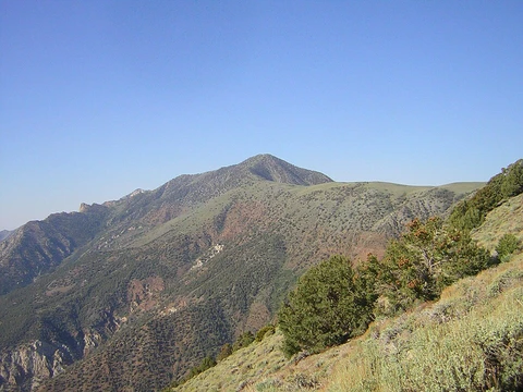
Mauna Loa
Earth's largest active volcano by both mass and volume.

via Wikipedia: Mauna Loa · see source
Mauna Loa is one of five volcanoes that form the Island of Hawaii in the U.S. state of Hawaii in the Pacific Ocean. It is Earth's largest active volcano by both mass and volume, a shield volcano with relatively gentle slopes. Its volume is estimated at 18000 mi3, though its peak is about 125 ft lower than that of its neighbor, Mauna Kea. Lava eruptions from Mauna Loa are silica-poor and very fluid, and tend to be non-explosive. The volcano's most recent eruption began on November 27, 2022, and ended on December 13 of that year, its first since 1984.
Quick Facts
- Elevation (ft)
- 13679
- Prominence (ft)
- 7079
- Listing
- US highest major peaks 66th
- US most prominent peaks 38th
- Hawaii highest major peaks 2nd
- Location
- Hawaii, U.S.
- Range
- Hawaiian Islands
- Age
- 700,000–1 million
- Volcanic zone
- Hawaiian-Emperor seamount chain
- Last eruption
- November 27 – December 13, 2022
Facts from the source article.
Did You Know?
- Mauna Loa rises 9170 m from base to summit, greater than Mount Everest's 8848 m elevation above sea level.
- The summit caldera Mokuʻāweoweo is named after the Hawaiian ʻāweoweo fish, due to the resemblance of its eruptive fires to the fish's coloration.
- The slow drift of the Pacific Plate will carry Mauna Loa away from the hotspot within 500,000 to one million years, at which point it will become extinct.
Geology
Mauna Loa formed when the Pacific tectonic plate drifted over the Hawaii hotspot in the mantle. This same process, ongoing for 70 million years, produced the 3700-mile Hawaiian–Emperor seamount chain, with the island of Hawaiʻi’s volcanoes being its newest expression. Scientists generally think the hotspot has stayed mostly fixed in the mantle during the Cenozoic Era, though the exact workings of hotspots remain poorly understood. Mauna Loa is one of five volcanoes above sea level on the island of Hawaiʻi.
Its age falls between 1 million and 600,000 years, making it the second youngest of these five and the third youngest in the entire Hawaiian–Emperor chain. Like other Hawaiian volcanoes, it began underwater, building up through eruptions of alkali basalt, then broke the ocean surface in a series of surtseyan eruptions roughly 400,000 years ago. It has stayed active ever since. Mauna Loa is the largest active volcano on Earth and the third largest overall, after Pūhāhonu (also in the Hawaiian chain) and Tamu Massif.
It covers 5271 square kilometers of land, reaches 120 kilometers at its widest point, and holds between 65,000 and 80,000 cubic kilometers of solid rock—more than half the surface area of the island of Hawaiʻi. When you add its submarine flanks (which descend 5000 meters to the seafloor) to its 4170-meter subaerial height, Mauna Loa rises 9170 meters from base to summit, surpassing Mount Everest’s 8848-meter elevation above sea level. Moreover, the volcano’s weight pushes the crust down by another 8 kilometers, creating an inverted mountain shape, so its total height from the start of its eruptive history is about 17,170 meters.
Eruptive history
Mauna Loa reached its massive size in a geologically brief span of 600,000 to 1,000,000 years, implying a very rapid growth rate. This is supported by an extensive record of nearly two hundred reliably dated lava flows, established through charcoal-based radiocarbon dating. Lava samples date back at least 470,000 years, though the oldest reliable age, 657,000 years, carries a margin of error around 200,000 years. The Ninole Hills on the southern flank contain some of the oldest exposed flows, subaerial basalt roughly 100,000 to 200,000 years old.
These are overlain by two lava units separated by the Pāhala ash layer: the older Kahuka basalt, found sparsely on the lower southwest rift, and the younger, more widespread Kaʻu basalt. The Pāhala ash was deposited over a long period around 13,000 to 30,000 years ago, but heavy vitrification and interaction with flows make precise dating difficult. This ash's age aligns with Mauna Loa's glaciation during the last ice age, suggesting it may have formed from phreatomagmatic eruptions where lava met glacial ice.
Human history
When the first Ancient Hawaiians settled on the big island, they stayed near the coast where food and fresh water were easy to find. They hunted flightless birds that had never faced predators, making them a key food source. These early communities caused major changes to the environment, wiping out many bird species and bringing in foreign plants and animals, which sped up erosion. The lowland forests turned into grasslands, mostly because of the Polynesian rat.
In traditional Hawaiian religion, the island’s five volcanic peaks are sacred, and Mauna Loa, the largest, is deeply respected. Most surviving stories say the volcano goddess Pele lives at Halemaʻumaʻu on Kilauea, but a few place her at Mauna Loa’s summit crater, Mokuʻāweoweo. Because Kilauea lacks a clear shape and is closely tied to Mauna Loa’s volcanic activity, the Ancient Hawaiians saw it as part of Mauna Loa, so much of the mythology now linked to Kilauea originally belonged to Mauna Loa as well.
The Ancient Hawaiians built a vast trail network across the island, now called the Ala Kahakai National Historic Trail. One path, the Ainapo Trail, climbed from Kapāpala village over 3,400 meters in about 56 kilometers, ending at Mokuʻāweoweo. During eruptions, Hawaiians likely made this tough journey, carrying offerings and prayers to honor Pele, just as they did at Kilauea’s more accessible Halemaʻumaʻu.
Climate
Trade winds blow from east to west across the Hawaiian islands, and Mauna Loa strongly affects the local climate. At low elevations, the eastern side receives heavy rain; Hilo is the wettest city in Hawaii and the fourth-wettest city in the United States. The western side has a much drier climate. At higher elevations, precipitation decreases and skies are often clear.
Very low temperatures mean precipitation often occurs as snow, and the summit is described as a periglacial region. Mauna Loa has a tropical climate with warm temperatures at lower elevations and cool to cold temperatures higher up year-round. The highest recorded temperature at the slope observatory was 78 F and the lowest was 18 F. Hundreds of lava flows impact the surrounding land and vegetation, creating soil that is more nutrient dense. The climate in combination with lava flow allows plant matter to decompose faster.
The Volcanoes National Park has been split into seven different zones depending on elevation levels, forests, coast, and mountains. Plant matter that provides more nutrients has been collected by locals for religious and traditional purposes, with limits on what plants are collected and the quantity to ensure the land stays regulated.
More in Highest Points of United States National Parks
Spotted an error? Know more?
Reader corrections go straight into our review queue. Suggest an edit · How this site is sourced