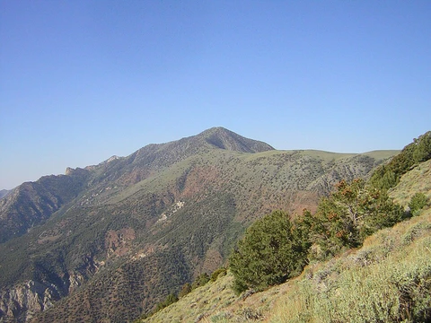
Mount Lyell (California)
Highest point in Yosemite National Park.
Mount Lyell, at 13114 feet, is the highest point in Yosemite National Park. Located at the southeast end of the Cathedral Range, it is named for the 19th century geologist Charles Lyell. The peak once held Lyell Glacier, one of the last remaining glaciers in Yosemite, now considered a permanent ice field rather than a living glacier.
Quick Facts
- Elevation
- 13,120 ft / 4 km
- Prominence (ft)
- 1927
- Parent peak
- Mount Ritter
- Location
- Madera and Tuolumne counties, California, U.S.
- Range
- Cathedral Range, Sierra Nevada
- First ascent
- August 29, 1871 by John Boies Tileston
- Easiest route
- Exposed scramble, 3
Facts from the source article.
Climbing
The standard route up Mount Lyell begins at Tuolumne Meadows, following a busy stretch of the John Muir Trail. From the Tuolumne Wilderness Office, the round trip covers about 25 miles and gains 4500 feet in elevation. The first part is easy, winding through the meadows and along the Tuolumne River to the head of Lyell Canyon, then gets moderately steeper as it approaches Donohue Pass. Just before that pass, the path leaves the trail and turns south toward the peak.
Most climbers tackle the summit by crossing or skirting the Lyell Glacier, but conditions on the ice shift with the seasons and from year to year, so checking the latest reports is essential before picking a route. The northwest ridge, accessed from the saddle between Mount Lyell and nearby Mount Maclure, works well when the glacier has deep snow; if snow levels are low, the climbing becomes class 3 to 4 on exposed granite ledges, and a more direct glacier ascent might be simpler.
The summit block is made of dark volcanic granite, like the neighboring peaks Rodgers Peak, Mount Davis, Banner Peak, and Mount Ritter. This rock is crumbly and unstable, making the final push to the summit plateau risky when the glacier is low and exposes the lower part of the block. Because of this, some climbers consider Mount Lyell and Mount Maclure to be part of the Ritter Range geologically. The east arete also gets harder with less snow, moving from class 3 to class 4, and the loose rock beneath the glacier there adds danger in low-snow conditions. Other routes exist on the south and west sides, but they are more difficult and require longer approaches.
Frequently Asked Questions
Where is Mount Lyell (California)?
Mount Lyell is located in Madera and Tuolumne counties, California, U.S.
How high is Mount Lyell (California)?
Mount Lyell has an elevation of 13,120 ft / 4 km.
More in Highest Points of United States National Parks
Spotted an error? Know more?
Reader corrections go straight into our review queue. Suggest an edit · How this site is sourced