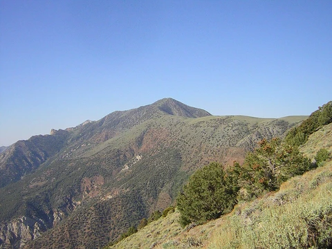
Kuwohi
Highest peak in Great Smoky Mountains National Park and Tennessee.
Kuwohi, once called Clingmans Dome, rises 6,643 feet in the Great Smoky Mountains along the Tennessee-North Carolina border. It is the third-highest peak in eastern mainland North America, trailing only Mount Mitchell and Mount Craig.
Quick Facts
- Other names
- Clingmans Dome
- Elevation (ft)
- 6643
- Prominence (ft)
- 4503
- Listing
- U.S. state high point 17th, Great Smoky Mountains high point
- Range
- Great Smoky Mountains
- Easiest route
- Short paved trail hike
Facts from the source article.
Description
Kuwohi has two subpeaks: Mount Buckley at 6,560 feet to the west and Mount Love at 6,400 feet to the east. Several streams originate on its slopes, including Little River on the north side and Forney Creek and Noland Creek—both tributaries of the Tuckasegee River—on the south side; the entire mountain lies within the Tennessee River watershed. A paved road connects the summit to U.S. Highway 441 at Newfound Gap, 6.7 miles away. At the top stands a 45-foot-tall concrete observation tower built in 1959 and listed on the National Register of Historic Places, offering panoramic views.
An air quality monitoring station operated by the Environmental Protection Agency is the second highest in eastern North America. The Southern Appalachian spruce–fir forest covering Kuwohi occurs only at the highest elevations in the Southeast and resembles northern forests more than those of adjacent valleys. The mountain rises nearly 5,000 feet from base to summit. A large die-off of Fraser fir has been caused by the non-native balsam woolly adelgid.
The tower’s circular observation platform is accessed by a 375-foot spiral ramp rising at a 12 percent grade. The 28-foot-diameter platform provides a 360-degree panorama; cantilevered signs identify peaks, ridges, and cities, with visibility ranging from 20 miles on hazy days to 100 miles on clear days. The tower was one of nine built under the Mission 66 program (1955–1966) to accommodate post-World War II visitor increases. Designed by Hubert Bebb of Bebb and Olson, its modern concrete design departed from earlier rustic park structures. Similar towers were later built at Look Rock along Foothills Parkway and at Shark Valley in Everglades National Park.
History
The Cherokee name for the mountain is Kuwahi or Kuwohi, meaning 'mulberry place.' A Cherokee myth recorded by ethnologist James Mooney in the late 19th century describes the mountain as the home of the White Bear, chief of all bears, and the site of a bear council house. The enchanted lake Ataga'hi ('Gall Place'), whose waters could heal wounded bears, was believed to lie between Kuwohi and the headwaters of the Oconaluftee River to the east. In 1789, the North Carolina legislature ceded what is now Tennessee to the federal government, fixing part of the boundary along the crest of the 'Great Iron or Smoky Mountains,' which included the mountain later called Clingmans Dome.
American settlers dubbed it 'Smoky Dome.' In 1859, geographer Arnold Guyot renamed it Clingmans Dome for Thomas L. Clingman, who had explored and measured the area in the 1850s and later became a Confederate general. The name arose from a dispute between Clingman and University of North Carolina professor Elisha Mitchell over which peak was highest: Clingman argued for Smoky Dome, Mitchell for Black Dome (Mount Mitchell). Clingman first accurately measured Smoky Dome’s elevation in 1858 using triangulation and barometers, though he never set foot on the mountain.
Guyot later determined Black Dome was 39 feet higher. On June 12, 1946, a Boeing B-29 Superfortress crashed near the summit, killing all twelve aboard.
Geology
Kuwohi is part of the Copperhill Formation, composed mainly of massive, coarse-grained metagreywacke and metaconglomerate. The lower northern flanks are underlain by thick layers of sulfidic, quartz-garnet-muscovite phyllite and schist within these rocks. Near the summit, thin, southward-dipping, discontinuous beds of garnetiferous (locally graphitic and sulfidic) metasiltstone occur. The Copperhill Formation belongs to the Ocoee Supergroup, a body of clastic metasedimentary rocks formed 560 million years ago, unconformably overlying Precambrian granitic and gneissic rocks.
The original sediments accumulated in narrow, deep-water rift basins formed by the rifting of Rodinia along the southern-central Appalachian margin from Tennessee and North Carolina to Georgia. Initial metamorphism of the Ocoee Supergroup occurred about 400 million years ago during the Taconic orogeny, followed by Devonian-Mississippian metamorphism during the Acadian orogeny and additional Pennsylvanian to Permian retrograde metamorphism and deformation during the Alleghanian orogeny.
In the latest part of this orogeny, thrust faulting and folding uplifted these strata as complexly deformed thrust sheets, forming this segment of the Appalachians. Gradual uplift and erosion continued through the Mesozoic and Cenozoic. Outcrops of the Copperhill Formation are visible at the Forney Ridge Parking Lot, exposing massive metaconglomerate with 6-meter-thick beds of micaceous quartzite containing coarse quartz and feldspar pebbles, flat pebbles of fine-grained black graywacke, and egg-shaped concretions up to 30 centimeters in diameter that weather into rust-stained cavities.
Soils are mostly moderately deep to shallow, well-drained dark brown loam or sandy loam of strong to extreme acidity, with Breakneck and Pullback series most common.
More in Highest Points of United States National Parks
Spotted an error? Know more?
Reader corrections go straight into our review queue. Suggest an edit · How this site is sourced