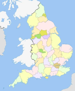
Wiltshire
Chalk downlands, ancient stone circles, and the heart of rural England.
Wiltshire (; abbreviated to Wilts) is a ceremonial county in South West England. It borders Gloucestershire to the north, Oxfordshire to the north-east, Berkshire to the east, Hampshire to the south-east, Dorset to the south, and Somerset to the west. The largest settlement is Swindon. The county has an area of 3485 km2. The county is mostly rural, and the centre and south-west are sparsely populated. Swindon is in the north-east of the county, and its other major settlements include the city of Salisbury in the south-east and the towns of Trowbridge and Chippenham in the west. For local government purposes, the county comprises two unitary authority areas, Swindon and Wiltshire.
- Major Rivers
- Bristol Avon and Hampshire Avon (or Salisbury Avon)
Quick Facts
- Official Name
- Wiltshire
- Locator Map
- Wiltshire UK locator map 2010.svg
- Region
- South West
- Established Date
- Ancient
- Lord Lieutenant Office
- Lord Lieutenant of Wiltshire
- Lord Lieutenant Name
- Sarah Troughton
- High Sheriff Office
- High Sheriff of Wiltshire
- Ethnicity
- 85.1% White British (2021)
- Unitary Council1
- Wiltshire Council
- Unitary Council2
- Swindon Borough Council
- Districts Key
- #FEFE77 Unitary
- Districts List
- #Wiltshire / #Swindon
Facts from the source article.
Lore & Background
The county, in the 9th century written as Wiltunscir, is named after the former county town of Wilton. Wiltshire is notable for its pre-Roman archaeology. The Mesolithic, Neolithic and Bronze Age people who occupied southern Britain built settlements on the hills and downland that cover Wiltshire. Stonehenge and Avebury are perhaps the most famous Neolithic sites in the UK. In the 6th and 7th centuries, Wiltshire was at the western edge of Saxon Britain, as Cranborne Chase and the Somerset Levels prevented the advance to the west. In 878 the Danes invaded the county. Following the Norman Conquest in 1066, large areas of the country came into the possession of the crown and the church. At the time of the Domesday Survey, the industry of Wiltshire was largely agricultural; 390 mills are mentioned, and vineyards at Tollard and Lacock. In the succeeding centuries, sheep-farming was vigorously pursued, and the Cistercian monastery of Stanley exported wool to the Florentine and Flemish markets in the 13th and 14th centuries. In the 17th century, during the English Civil War, Wiltshire was largely Parliamentarian. The Battle of Roundway Down, a Royalist victory, was fought near Devizes. In 1794, it was decided at a meeting at the Bear Inn in Devizes to raise a body of ten independent troops of Yeomanry for the county of Wiltshire, which formed the basis for what would become the Royal Wiltshire Yeomanry, who served with distinction both at home and abroad, during the Boer War, World War I and World War II. The Royal Wiltshire Yeomanry lives on as Y (RWY) Squadron, based in Swindon, and B (RWY) Squadron, based in Salisbury, of the Royal Wessex Yeomanry. Around 1800, the Kennet and Avon Canal was built through Wiltshire, providing a route for transporting cargoes from Bristol to London until the development of the Great Western Railway.
Reader's Guide
Salisbury Plain is noted for the Stonehenge and Avebury stone circles, which together form a UNESCO World Heritage Site, as well as other ancient landmarks. Much of the plain is a training area for the British Army. Salisbury is notable for its medieval cathedral. Large country houses open to the public include Longleat, which also features a safari park, and the National Trust's Stourhead. The north-west of Wiltshire is part of the limestone Cotswolds, and the remainder of the county is characterised by chalk downlands. The Marlborough Downs lie in the north-east of the county and encompass Savernake Forest. To their south is the Vale of Pewsey, south of which, in the centre of the county, is Salisbury Plain. The south-west contains the West Wiltshire Downs, to the south of which is the Vale of Wardour, and the far south comprises part of Cranborne Chase. The south-east contains part of the New Forest. The county's two major rivers are both called the Avon. The northern Avon enters the county in the north-west and flows south-westward before exiting near Bradford-on-Avon, its vale separating the Cotswolds from the rest of the county. The southern Avon rises on Salisbury Plain and flows south through Salisbury, then into Hampshire. Much of the county is protected: the Marlborough Downs, West Wiltshire Downs, Vale of Wardour, Cranbourne Chase, and the Cotswolds are each part of national landscapes, and the New Forest is a national park. Two-thirds of Wiltshire lies on chalk. The highest point in the county is the Tan Hill–Milk Hill ridge in the Pewsey Vale at 295 m above sea level. The chalk uplands run north-east into West Berkshire in the Marlborough Downs ridge, and south-west into Dorset as Cranborne Chase. The Marlborough Downs are part of the North Wessex Downs AONB. In the north-west of the county, the underlying rock is the resistant oolite limestone of the Cotswolds. Part of the Cotswolds AONB is also in Wiltshire. Between the areas of chalk and limestone downland are clay valleys and vales. The largest of these vales is the Avon Vale. The Vale of Pewsey has been cut through the chalk into Greensand and Oxford Clay. In the south west of the county is the Vale of Wardour. The south-east of the county lies on the sandy soils of the northernmost area of the New Forest. Chalk is a porous rock, so the chalk hills have little surface water, and the main se
Did You Know?
- The local nickname for Wiltshire natives is 'Moonrakers', originating from a story of smugglers who hid alcohol in a village pond and claimed they were raking a reflection of the full moon.
- Stonehenge and Avebury together form a UNESCO World Heritage Site.
- The county's two major rivers are the Bristol Avon and the Hampshire Avon (also known as the Salisbury Avon).
- The highest point in Wiltshire is the Tan Hill–Milk Hill ridge at 295 m above sea level.
More in English Counties 1-24
Spotted an error? Know more?
This is a living reference — every entry is fact-audited, and reader corrections feed straight into our audit queue. Suggest an edit · See this site's audit record