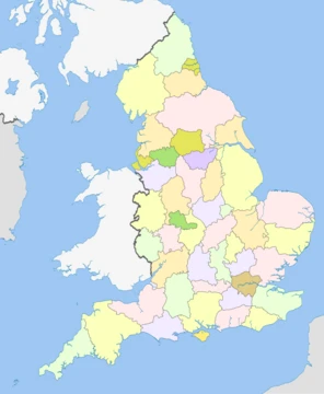
Gloucestershire
A ceremonial county in South West England, bisected by the River Severn and home to the Cotswolds, Forest of Dean, and Wye Valley.
Gloucestershire ( , ; abbreviated Glos.) is a ceremonial county in South West England. It is bordered by Herefordshire to the north-west, Worcestershire to the north, Warwickshire to the north-east, Oxfordshire to the east, Wiltshire to the south, Bristol and Somerset to the south-west, and the Welsh county of Monmouthshire to the west. The largest settlement is the city of Gloucester.
- Area
- 3,150 square kilometres (1,220 sq mi)
- Estimated Population (2024)
- 975,712
- Largest Settlement
- Gloucester
- Established
- Tenth century (expanded in eleventh)
- Ceremonial County
- Gloucestershire
- Notable Rivers
- River Severn
Quick Facts
- Official Name
- Gloucestershire
- Region
- South West
- Established Date
- Ancient
- Lord Lieutenant Office
- Lord Lieutenant of Gloucestershire
- Lord Lieutenant Name
- Edward Gillespie
- High Sheriff Office
- High Sheriff of Gloucestershire
- Ethnicity
- 87.2% White British (2021)
- County Council
- Gloucestershire County Council
- Unitary Council1
- South Gloucestershire Council
- Admin Hq
- Gloucester
- Iso Code
- GB-GLS
- Gss Code
- E10000013
Facts from the source article.
Lore & Background
Gloucestershire is a historic county mentioned in the Anglo-Saxon Chronicle in the 10th century, though the areas of Winchcombe and the Forest of Dean were not added until the late 11th century. Gloucestershire originally included Bristol, then a small town. Bristol became a county in its own right, separate from Gloucestershire and Somerset, in 1373. It later became part of the administrative County of Avon from 1974 to 1996. Some northern parts of the county, including Long Marston and Welford-on-Avon, were transferred to Warwickshire in 1931. Upon the abolition of Avon in 1996, the region north of Bristol became a unitary authority area of South Gloucestershire and is now part of the ceremonial county of Gloucestershire. In March 2008, the ceremonial county of Gloucestershire adopted a flag through a contest judged by the High Sheriff of Gloucestershire, Jonathan Carr.
Reader's Guide
Gloucestershire is predominantly rural, with an area of 3150 km2. Gloucester is in the north-centre of the county, and the spa town of Cheltenham is immediately to the east. Other towns include Tewkesbury in the north, Cirencester in the east, Stroud in the centre, and Yate in the south. The far south of the county, including Filton and Kingswood, is densely populated and forms part of the Bristol built-up area. For local government purposes Gloucestershire comprises a non-metropolitan county, with six districts, and the unitary authority area of South Gloucestershire. South Gloucestershire Council is a member of the West of England Combined Authority. Gloucestershire is bisected by the River Severn, which enters the county near Tewkesbury and forms a wide valley down its centre before broadening into a large tidal estuary. The east of the county contains the majority of the Cotswolds, and the uplands in the west are part of the Forest of Dean and the Wye Valley. All three areas have been designated national landscapes.
Did You Know?
- Gloucestershire was likely established in the tenth century and expanded to approximately its current borders in the eleventh.
- The city of Bristol became an independent county in 1373, by which point it was the third-largest city in England.
- In July 2007, Gloucestershire was subject to some of the worst flooding in recorded British history, with damage estimated at around £1.3–1.5 billion.
- The Daffodil Way in the Leadon Valley, on the border of Gloucestershire and Herefordshire, is known for its spring flowers, orchards, and woodland.
More in English Counties 1-24
Spotted an error? Know more?
This is a living reference — every entry is fact-audited, and reader corrections feed straight into our audit queue. Suggest an edit · See this site's audit record