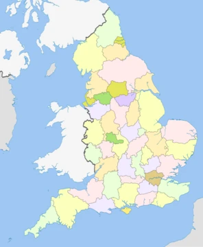
Lancashire
A ceremonial county in North West England, with a rich industrial heritage and diverse landscapes from coastal plains to upland moors.
Lancashire ( , ; abbreviated Lancs) is a ceremonial county in North West England. It is bordered by Cumbria to the north, North Yorkshire and West Yorkshire to the east, Greater Manchester and Merseyside to the south, and the Irish Sea to the west. The largest settlement is the city of Preston. The county has an area of 3079 km2. For local government purposes the county comprises a non-metropolitan county, with twelve districts, and two unitary authority areas: Blackburn with Darwen and Blackpool. Lancashire County Council and the two unitary councils collaborate through the Lancashire Combined County Authority. The county historically included the Furness and Cartmel peninsulas of Cumbria, northern Greater Manchester and Merseyside, and Warrington, but excluded the eastern part of the Forest of Bowland.
- area
- 3,079 square kilometres (1,189 sq mi)
- estimated_population_2024
- 1,601,645
- highest_point
- Gragareth or Green Hill, both approximately 628 m (2,060 ft)
- established
- 12th century
- ceremonial_county_status
- Yes
- major_rivers
- Lune, Wyre, Ribble
Quick Facts
- Official Name
- Lancashire
- Region
- North West England
- Established Date
- c. 1182
- Origin
- Honour of Lancaster
- Mps
- 16 MPs
- Police
- Lancashire Constabulary
- Largest City
- Preston
- Largest Town
- Blackpool
- Lord Lieutenant Office
- Lord Lieutenant of Lancashire
- Lord Lieutenant Name
- Amanda Parker
- High Sheriff Office
- High Sheriff of Lancashire
- Ethnicity
- 82.2% White · 9.2% Asian · 3.8% Black · 2.8% mixed · 2.0% other
Facts from the source article.
Lore & Background
Lancashire was founded in the 12th century; in the Domesday Book of 1086 much of what would become the county is treated as part of Yorkshire and Cheshire. Until the Early Modern period the county was a comparatively poor backwater, although in 1351 it became a palatine, with a semi-independent judicial system. This changed during the Industrial Revolution, when the county rapidly industrialised; until 1974 it included both Liverpool, a major port, and Manchester, which with its surrounding towns dominated the manufacture of textiles. The Lancashire coalfield was also exploited, with many collieries opening. By 1971 Lancashire had a population of 5,118,405, which made it the most heavily populated county in the United Kingdom after Greater London. The county was established in 1182, and came to be bordered by Cumberland, Westmorland, Yorkshire, and Cheshire. It was divided into the hundreds of Amounderness, Blackburn, Leyland, Lonsdale, Salford and West Derby. Lonsdale was further partitioned into Lonsdale North, the detached part north of the sands of Morecambe Bay including Furness and Cartmel, and Lonsdale South. On 1 April 1974, under the Local Government Act 1972, the local government structure of Lancashire was reorganised. The south-east of the county became part of the metropolitan county of Greater Manchester and the south-west became part of the metropolitan county of Merseyside; Widnes and Warrington in the south were transferred to Cheshire. In the north, the non-metropolitan county of Cumbria incorporated the Furness exclave. The remainder of Lancashire was reconstituted as a non-metropolitan county with thirteen districts. It included some areas formerly in the West Riding of Yorkshire, namely the urban districts of Barnoldswick and Earby, Bowland Rural District, and the parishes of Bracewell and Brogden and Salterforth from Skipton Rural District. In 1998, Blackpool and Blackburn with Darwen became unitary authorities, removing them from the non-metropolitan county but not from the ceremonial county.
Reader's Guide
The west of Lancashire contains flat coastal plains: the West Lancashire coastal plain to the south and the Fylde in the centre. The north-western coast is hilly and contains part of Arnside and Silverdale, a national landscape. The east of the county is upland, with the West Pennine Moors in the south-east and the Forest of Bowland in the north-east; Bowland has also been designated a national landscape. The major rivers of the county are, from north to south, the Lune, the Wyre, and the Ribble, which all flow west into the Irish Sea. The highest point in Lancashire is either Gragareth or Green Hill, both approximately 628 m high and located in the far north-east of the county. Preston and Blackburn are near the centre of the county, Burnley is in the east, the seaside resort of Blackpool on the coast in the west, and the city of Lancaster in the north.
Did You Know?
- The highest point in Lancashire is either Gragareth or Green Hill, both approximately 628 m high.
- Lancashire was the most heavily populated county in the UK after Greater London in 1971, with a population of 5,118,405.
- The county historically included the Furness and Cartmel peninsulas, now in Cumbria.
- The three main rivers of Lancashire are the Lune, Wyre, and Ribble, all flowing west into the Irish Sea.
More in English Counties 1-24
Spotted an error? Know more?
This is a living reference — every entry is fact-audited, and reader corrections feed straight into our audit queue. Suggest an edit · See this site's audit record