Hertfordshire
The county of deer crossings and garden cities.
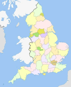
Hertfordshire ( , ; often abbreviated Herts) is a ceremonial county in the East of England. It borders Bedfordshire to the north-west, Cambridgeshire to the north-east, Essex to the east, Greater London to the south and Buckinghamshire to the west. The largest settlement is Watford.
- area
- 634 square miles (1,640 km2)
- estimated_population_2024
- 1,236,191
- largest_settlement
- Watford
- highest_point
- 244 m (801 ft) on the Ridgeway near Tring
- county_town
- Hertford
- established_as_shire
- 10th century
- patron_saint
- Saint Alban
Lore & Background
The county's landmarks span many centuries, ranging from the Six Hills in Stevenage built by local inhabitants during the Roman period, to Leavesden Film Studios. The volume of intact medieval and Tudor buildings surpasses London, in places in well-preserved conservation areas, especially in St Albans, which includes remains of the Roman town of Verulamium. In 913, Hertfordshire was the area assigned to a fortress constructed at Hertford under the rule of Edward the Elder. Hertford is derived from the Anglo-Saxon heort ford, meaning deer crossing (of a watercourse). The name Hertfordshire is first recorded in the Anglo-Saxon Chronicle in 1011. Deer feature in many county emblems. Many of the names of the current settlements date back to the Anglo-Saxon period, with many featuring standard placename suffixes attributed to the Anglo-Saxons: 'ford', 'ton', 'den', 'bourn', 'ley', 'stead', 'ing', 'lett', 'wood', and 'worth', are represented in this county by Hertford, Royston, Harpenden, Redbourn, Cuffley, Wheathampstead, Tring, Radlett, Borehamwood and Rickmansworth. There is evidence of human life in Hertfordshire from the Mesolithic period. It was first farmed during the Neolithic period and permanent habitation appeared at the beginning of the Bronze Age. This was followed by tribes settling in the area during the Iron Age. Following the Roman conquest of Britain in AD 43, the Catuvellauni tribe accepted peace and adapted to the Roman life; resulting in the development of several new towns, including Verulamium (St Albans) where in the first recorded British martyrdom is traditionally believed to have taken place. Saint Alban, a Romano-British soldier, took the place of a Christian priest and was beheaded on Holywell Hill. His martyr's cross of a yellow saltire on a blue field is reflected in the flag and coat of arms of Hertfordshire as the yellow field to the stag or Hart representing the county. He is the Patron Saint of Hertfordshire. With the departure of the Roman Legions in the early 5th century, the now-unprotected territory was invaded and colonised by the Anglo-Saxons. By the 6th century, the majority of the modern county was part of the Kingdom of Essex. Over time the Kingdom of Essex lost its western areas (including most of its areas that are now part of modern Hertfordshire) to the western Anglians of Mercia, and the core eastern area of Essex (
Reader's Guide
Hertfordshire is located in the south-eastern part of England and is the county immediately north of London. It is officially part of the East of England region, a mainly statistical unit. To the east is Essex, to the west is Buckinghamshire and to the north are Bedfordshire and Cambridgeshire. A significant minority of the population across all districts commute to Central London. The county's boundaries were roughly fixed by the Counties (Detached Parts) Act 1844 which eliminated exclaves; amended when, in 1965 under the London Government Act 1963, East Barnet Urban District and Barnet Urban District were abolished, their area was transferred to form part of the present-day London Borough of Barnet and the Potters Bar Urban District of Middlesex was transferred to Hertfordshire. The highest point in the county is at 244 m (AOD) on the Ridgeway long distance national path, on the border of Hastoe near Tring with Drayton Beauchamp, Buckinghamshire. At the 2011 census, among the county's ten districts, East Hertfordshire had the lowest population density (290 people per km2) while the Borough of Watford had the highest (4210 per km2).
Did You Know?
- The first shooting-down of a zeppelin over Great Britain during WW1 happened in Cuffley, Hertfordshire.
- Letchworth, in the far north of Hertfordshire, has served as the prototype garden city since 1903.
- Stevenage became the first town to expand under post-war Britain's New Towns Act 1946.
- The Domesday Book recorded Hertfordshire as having nine hundreds.
More in English Counties 1-24
Spotted an error? Know more?
This is a living reference — every entry is fact-audited, and reader corrections feed straight into our audit queue. Suggest an edit · See this site's audit record