Leicestershire
A lowland county of rolling hills, fox-hunting heritage, and the heart of England.
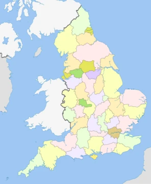
Leicestershire is a ceremonial county in the East Midlands of England. It is bordered by Derbyshire, Nottinghamshire and Lincolnshire to the north, Rutland to the east, Northamptonshire to the south-east, Warwickshire to the south-west, and Staffordshire to the west. The city of Leicester is the largest settlement.
- type
- Ceremonial county
- area
- 2,156 km² (832 sq mi)
- population_2024
- 1,133,921
- largest_settlement
- Leicester
- highest_point
- Bardon Hill, 278 m (912 ft)
- known_for
- Battle of Bosworth Field, fox hunting, Stilton cheese, Melton Mowbray pork pies, engineering
Lore & Background
The Domesday Book (1086) records four wapentakes in the territory of Leicestershire: Guthlaxton, Framland, Goscote and Gartree. These later became hundreds, with the division of Goscote into West Goscote and East Goscote, and the addition of Sparkenhoe hundred. The first recorded use of the county name occurs in 1087. Leicestershire's external boundaries have changed little since the Domesday Survey. The Measham-Donisthorpe exclave of Derbyshire has been exchanged for the Netherseal area, and the urban expansion of Market Harborough has caused Little Bowden, previously in Northamptonshire to be annexed. Until 1969, the county's legal name was 'Leicester' rather than 'Leicestershire', although the latter form was in common usage. In 1969 the government formally changed the county's name to 'Leicestershire' at the county council's request. In 1974, the Local Government Act 1972 abolished the county borough status of Leicester city and the county status of neighbouring Rutland, converting both to administrative districts of Leicestershire. These actions were reversed on 1 April 1997, when Rutland and the City of Leicester became unitary authorities. Rutland became a distinct Ceremonial County once again, although it continues to be policed by Leicestershire Constabulary. The symbol of the county council, of the Leicestershire County Cricket Club and of Leicester City FC is a fox. Tradition regards Leicestershire as the birthplace of fox hunting as it is known today. Hugo Meynell (1735-1808), who lived in Quorn, has a reputation as the 'father of modern fox-hunting'. Melton Mowbray and Market Harborough have associations with fox hunting, as has neighbouring Rutland. The flag of Leicestershire features a fox under an heraldic cinquefoil — both symbols often associated with Leicestershire. The flag design, made official in July 2021, was the last one registered for an historic county of England.
Reader's Guide
Leicestershire is generally a lowland county, characterised by small, rolling hills. It is bisected by the River Soar, which rises near the Warwickshire border south of Hinckley and flows north through Leicester and Loughborough before reaching the Trent at the county boundary. To the west of the river is Charnwood Forest, an upland area which contains Bardon Hill, which at 278 m is the county's highest point. The geographical centre of England is in Leicestershire, near Fenny Drayton in the southwest of the county. In 2013, the Ordnance Survey calculated that the point was on land at Lindley Hall Farm. An alternative point at Meriden, around 10 mi to the southwest, had been considered the traditional centre for more than 500 years. A large part of the north-west of the county, around Coalville, forms part of the new National Forest area extending into Derbyshire and Staffordshire. The highest point of the county is Bardon Hill at 278 m, which is also a Marilyn; with other hilly/upland areas of around 150 – 200 m and above in nearby Charnwood Forest and also to the east of the county around Launde Abbey. The lowest point, at an altitude of about 20 m, is located at the county's northernmost tip close to Bottesford where the River Devon flowing through the Vale of Belvoir leaves Leicestershire and enters Nottinghamshire. The population of Leicestershire (excluding Leicester Unitary Authority) is 609,578 people (2001 census). The county covers an area of 2084 km2. Its largest population centre is the city of Leicester, followed by the town of Loughborough. Other large towns include Ashby-de-la-Zouch, Coalville, Hinckley, Lutterworth, Market Harborough, Melton Mowbray, Oadby, Shepshed and Wigston. Some of the larger villages are: Burbage, Birstall, Broughton Astley, Castle Donington, Kibworth Beauchamp (along with Kibworth Harcourt), Great Glen, Ibstock, Countesthorpe and Kegworth. One of the most rapidly expanding villages is Anstey.
Did You Know?
- Leicestershire is the birthplace of fox hunting as it is known today, with Hugo Meynell (1735-1808) of Quorn regarded as the 'father of modern fox-hunting'.
- The geographical centre of England is in Leicestershire, near Fenny Drayton, calculated by the Ordnance Survey in 2013.
- The flag of Leicestershire, featuring a fox under a heraldic cinquefoil, was made official in July 2021 and was the last flag registered for an historic county of England.
- Leicestershire's external boundaries have changed little since the Domesday Survey, with only minor exchanges like the Measham-Donisthorpe exclave for the Netherseal area and the annexation of Little Bowden.
More in English Counties 1-24
Spotted an error? Know more?
This is a living reference — every entry is fact-audited, and reader corrections feed straight into our audit queue. Suggest an edit · See this site's audit record