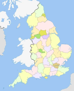
West Sussex
A ceremonial county in South East England, home to the South Downs and the second-busiest UK airport.
West Sussex is a ceremonial county in South East England. It is bordered by Surrey to the north, East Sussex to the east, the English Channel to the south, and Hampshire to the west. The largest settlement is Crawley. The county has a land area of and an estimated population of in . The largest settlements are on the coast, and include the towns of Bognor Regis, Littlehampton, and Worthing; the last two are part of the Brighton and Hove built-up area, which extends into East Sussex. The interior of the county is generally rural, and contains the towns of Crawley and Horsham in the north-east and the city of Chichester in the south-west. For local government purposes West Sussex is a non-metropolitan county with seven districts. West Sussex and East Sussex were historically a single county, Sussex.
- area
- 1,991 square kilometres (769 sq mi)
- population_2024
- 915,037
- largest_settlement
- Crawley
- county_town
- Chichester
- highest_point
- Blackdown
- sunniest_county
- United Kingdom (1902 hours per year average to 2011)
Lore & Background
The name Sussex, derived from the Old English 'Sūþseaxe' ('South Saxons'), dates from the Saxon period between AD 477 to 1066, and the history of human habitation in Sussex goes back to the Old Stone Age. The oldest hominin remains known in Britain were found at Eartham Pit, Boxgrove. Prehistoric monuments include the Devil's Jumps, a group of Bronze Age burial mounds, and the Iron Age Cissbury Ring and Chanctonbury Ring hill forts on the South Downs. The Roman period saw the building of Fishbourne Roman Palace and rural villas such as Bignor Roman Villa together with a network of roads including Stane Street, the Chichester to Silchester Way and the Sussex Greensand Way. The Romans used the Weald for iron production on an industrial scale. The foundation of the Kingdom of Sussex is recorded by the Anglo-Saxon Chronicle for the year AD 477; it says that Ælle arrived at a place called Cymenshore in three ships with his three sons and killed or put to flight the local inhabitants. The foundation story is regarded as somewhat of a myth by most historians, although the archaeology suggests that Saxons did start to settle in the area in the late 5th century. The Kingdom of Sussex was absorbed into Wessex as an earldom and became the county of Sussex. With its origins in the kingdom of Sussex, the later county of Sussex was traditionally divided into six units known as rapes. By the 16th century, the three western rapes were grouped together informally, having their own separate Quarter Sessions. These were governed by a separate county council from 1888, the county of Sussex being divided into the administrative counties of East and West Sussex. In 1974, West Sussex was made a single ceremonial county with the coming into force of the Local Government Act 1972. At the same time a large part of the eastern rape of Lewes (the Mid Sussex district which includes the towns of Haywards Heath, Burgess Hill and East Grinstead) was transferred into West Sussex. Until 1834, provision for the poor and destitute in West Sussex was made at parish level. From 1835 until 1948 eleven Poor Law Unions, each catering for several parishes, took on the job.
Reader's Guide
Most settlements in West Sussex are either along the south coast or in Mid Sussex, near the Brighton Main Line and M23/A23 corridor. The town of Crawley is the largest in the county with an estimated population of 106,600. The coastal settlement of Worthing closely follows with a population of 104,600. The seaside resort of Bognor Regis and the market town of Horsham are both large towns. Chichester, the county town, has a cathedral and city status, and is situated not far from the border with Hampshire. Other conurbations of a similar size are Burgess Hill, East Grinstead and Haywards Heath in the Mid Sussex district, Littlehampton in the Arun district, and Lancing, Southwick and Shoreham in the Adur district. Much of the coastal town population is part of the Brighton/Worthing/Littlehampton conurbation. Rustington and Southwater are the next largest settlements in the county. There are several more towns in West Sussex, including Arundel, Midhurst, Petworth, Selsey, Steyning, Henfield, Pulborough and Storrington. Other notable villages include Billingshurst, Copthorne, Crawley Down, Cuckfield, Hassocks, Hurstpierpoint and Lindfield. The South Downs are a defining feature of the county, crossing it from east to west and dividing the north and south. The downs are a chalk escarpment which falls away sharply into the Weald to the north and more gently toward the south, where there is a narrow strip of flat land between the hills and the coast. The coastal strip widens to the west, where it is punctuated by Chichester Harbour, a ria. West Sussex is bordered by Hampshire to the west, Surrey to the north and East Sussex to the east. The English Channel lies to the south. The area has been formed from Upper Jurassic and Lower Cretaceous rock strata, part of the Weald–Artois Anticline. The eastern part of this ridge, the Weald of Kent, Sussex and Surrey has been greatly eroded, with the chalk surface removed to expose older Lower Cretaceous rocks of the Wealden Group. In West Sussex the exposed rock becomes older towards the north of the county with Lower Greensand ridges along the border with Surrey including the highest point of the county at Blackdown. Erosion of softer sand and clay strata has hollowed out the basin of the Weald leaving a north facing scarp slope of the chalk which runs east and west across the whole county, broken only by the valleys of the R
Did You Know?
- West Sussex is the sunniest county in the United Kingdom, according to Met Office records.
- The oldest hominin remains known in Britain were found at Eartham Pit, Boxgrove in West Sussex.
- Gatwick Airport, located within the borders of Crawley, is the second largest airport in the United Kingdom.
- The county has a long history of human settlement dating back to the Lower Paleolithic era.
More in English Counties 1-24
Spotted an error? Know more?
This is a living reference — every entry is fact-audited, and reader corrections feed straight into our audit queue. Suggest an edit · See this site's audit record