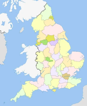
Suffolk
A county of ancient coasts, royal ship burials, and enduring rural character.
Suffolk is a ceremonial county in the East of England and East Anglia. It is bordered by Norfolk to the north, the North Sea to the east, Essex to the south, and Cambridgeshire to the west. Ipswich is the largest settlement. The county has an area of 3798 km2. For local government purposes Suffolk is a non-metropolitan county with five districts.
- area
- 3,798 km² (1,466 sq mi)
- population_2024_estimate
- 786,231
- largest_settlement
- Ipswich
- county_town
- Ipswich
- known_for
- Sutton Hoo ship burial, Hoxne Hoard, horse racing at Newmarket, container port at Felixstowe
Lore & Background
Artefacts dating to around 70,000 years ago found at Pakefield and Beeches Pit are among the earliest evidence of human activity in northern Europe. In the Neolithic period and Bronze Age burial mounds, hillforts and causewayed enclosures were built reflecting Suffolk's role in prehistoric trade and agriculture. At the start of the Roman period most of Suffolk was, along with Norfolk inhabited by the Iceni tribe. The Trinobantes inhabited parts of southern Suffolk, as well as Essex. The Iceni unsuccessfully revolted under Boudica in AD 60–61. Anglian settlement followed in the 5th and 6th centuries. The area was mostly or entirely governed by the Kingdom of East Anglia. Suffolk's most celebrated Anglo-Saxon site, Sutton Hoo was an elaborate royal ship burial – probably that of the East Anglian King Rædwald, whose son Sigeberht Christianised East Anglia. In the medieval period Suffolk became part of the Danelaw following Viking incursions. The county of Suffolk was formed in the 10th or 11th Century. Suffolk was reorganised under Norman feudalism after 1066, with castles at Framlingham, Clare, and Eye. The abbey at Bury St Edmunds became one of the wealthiest and most powerful religious institutions in medieval England. Later centuries saw Suffolk prosper from the cloth and wool trade, with towns such as Lavenham and Hadleigh flourishing in the 15th and 16th centuries. The county was also a site of Puritan and parliamentary strength during the English Civil War.
Reader's Guide
Ipswich is in the south of the county, and its other principal towns include Lowestoft in the north-east, Haverhill in the south-west, and Bury St Edmunds in the west. The Suffolk coastline, which includes parts of the Suffolk & Essex Coast & Heaths National Landscape, is a complex habitat, formed by London Clay and crag underlain by chalk and therefore susceptible to erosion. It contains several deep estuaries, including those of the rivers Blyth, Deben, Orwell, Stour, and Alde/Ore; the latter is 25.5 km long and separated from the North Sea by Orford Ness, a large spit. Large parts of the coast are backed by heath and wetland habitats, such as Sandlings. The northeast of the county contains part of the Broads, a network of rivers and lakes which is a national park. Inland, the landscape is flat and gently undulating, and contains part of Thetford Forest on the Norfolk border and Dedham Vale National Landscape on the Essex border. It is also known for its extensive farming and has largely arable land. Newmarket is known for horse racing, and Felixstowe is one of the largest container ports in Europe.
Did You Know?
- A survey in 2020 named Suffolk the third best place in the UK for aspiring archaeologists.
- The Hoxne Hoard, found near the village of Hoxne in 1992, is the largest assembly of late Roman silver and gold discovered in Britain.
- In 2020, archaeologists discovered a 7th-century Anglo-Saxon cemetery with 17 cremations and 191 burials in Oulton, near Lowestoft.
More in English Counties 1-24
Spotted an error? Know more?
This is a living reference — every entry is fact-audited, and reader corrections feed straight into our audit queue. Suggest an edit · See this site's audit record