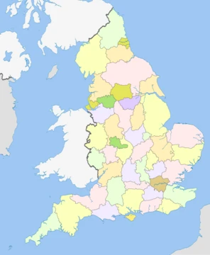
Bedfordshire
A ceremonial county in the East of England, home to Luton and the Chiltern Hills.
Bedfordshire (; abbreviated Beds) is a ceremonial county in the East of England. It is bordered by Northamptonshire to the north, Cambridgeshire to the north-east, Hertfordshire to the south-east and south, and Buckinghamshire to the west. The largest settlement is Luton. The county has an area of 1235 km2 and had an estimated population of in . Luton is in the south of the county, and Dunstable neighbours it to the west. Leighton Buzzard is in the south-west, and Bedford in the centre-north. For local government purposes Bedfordshire comprises three unitary authority areas: Bedford, Central Bedfordshire, and Luton.
- Area
- 1,235 km2 (477 sq mi)
- Population (2024 est.)
- 749,943
- Largest settlement
- Luton
- Highest point
- 243 m (797 ft) on Dunstable Downs
- County town
- Bedford
- First recorded name
- Bedanfordscir (1011)
Quick Facts
- Official Name
- Bedfordshire
- Locator Map
- Bedfordshire UK locator map 2010.svg
- Region
- East
- Established Date
- Ancient
- Mps
- 7 MPs
- Police
- Bedfordshire Police
- Largest Town
- Luton
- Lord Lieutenant Office
- Lord Lieutenant of Bedfordshire
- Lord Lieutenant Name
- Susan Lousada
- High Sheriff Office
- High Sheriff of Bedfordshire
- Ethnicity
- 72.0% White · 16.6% Asian · 5.6% Black · 3.8% mixed · 1.9% other
- Ethnicity Year
- 2021
Facts from the source article.
Lore & Background
The first recorded use of the name in 1011 was 'Bedanfordscir', meaning the shire or county of Bedford, which itself means 'Beda's ford' (river crossing). Bedfordshire was historically divided into nine hundreds: Barford, Biggleswade, Clifton, Flitt, Manshead, Redbornestoke, Stodden, Willey, Wixamtree, along with the liberty and the ancient borough of Bedford. There have been several changes to the county boundary; for example, in 1897 Kensworth and part of Caddington were transferred from Hertfordshire to Bedfordshire.
Reader's Guide
The centre of Bedfordshire is a gently undulating clay plateau, out of which rises a ridge of greensand that runs south-west to north-east and which has a distinct north-facing escarpment. The south of the county, around Luton, contains part of the chalk Chiltern Hills, and the north of the county part of a limestone ridge that runs between Milton Keynes and Northampton. The county's highest point is at 243 m on the Dunstable Downs, which are part of the Chilterns. The River Great Ouse flows through Bedfordshire, entering upstream of Harrold in the north-east and flowing in a circuitous but broadly southerly route to Bedford before turning north-east to exit the county upstream of St Neots in Cambridgeshire.
Did You Know?
- The county's highest point is at 243 m on the Dunstable Downs.
- The River Great Ouse enters Bedfordshire upstream of Harrold in the north-east.
- The River Great Ouse exits Bedfordshire upstream of St Neots in Cambridgeshire.
- The 'Bedfordshire clanger' is a local dish with meat in one end and fruit preserve in the other.
More in English Counties 1-24
Spotted an error? Know more?
This is a living reference — every entry is fact-audited, and reader corrections feed straight into our audit queue. Suggest an edit · See this site's audit record