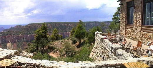
Grand Canyon Village Historic District
Historic planned village on the Grand Canyon's South Rim.
Last updated
Where it is
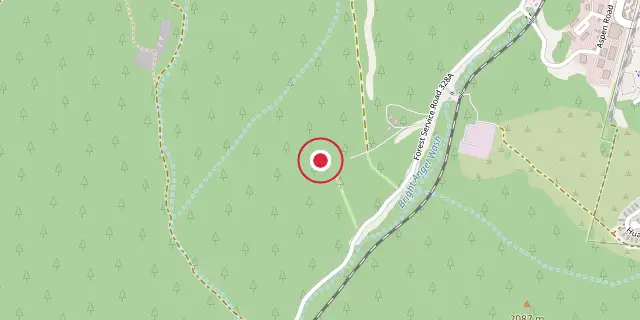
Coordinates: 36°02′56″N 112°09′25″W (36.0490, -112.1570) · Open in OpenStreetMap
Coordinates and connected clubs: the infobox of Wikipedia: Grand Canyon Village, Arizona (CC BY-SA 4.0). Map: drawn by Codexery from OpenStreetMap tiles.
Grand Canyon Village Historic District is a National Historic Landmark District encompassing the historic core of Grand Canyon Village on the South Rim of the Grand Canyon in Arizona. It was designated for its outstanding implementation of town design, which integrates with the canyon landscape and incorporates National Park Service Rustic elements as well as idiosyncratic concessioner structures.
Design and history
The village was planned by the National Park Service as a comprehensive tourism development on the South Rim and is the largest extant example of Park Service town planning in the national park system. Initial development centered on the El Tovar Hotel, opened in 1905 by the Atchison, Topeka and Santa Fe Railway, and the Bright Angel Lodge, both operated by the Fred Harvey Company. A new train depot was built next to the hotel in 1909. Nearly all early development was undertaken by concessioners.
In 1910, while the Grand Canyon was still a national monument, Secretary of the Interior Richard A. Ballinger suggested a plan be established before further development. Mark Daniels, general superintendent of the parks from 1914, called for comprehensive planning for water, sewer, power, and telephone systems. A 1924 master plan by landscape architect Daniel Ray Hull established a village square at the intersection of the railroad and east road below the El Tovar, where the first park administration building was placed.
Hull used the local topography of Bright Angel Wash valley, placing residential neighborhoods on two small hills divided by a branch of the drainage, away from the main south entrance road, and keeping hotel development near the Bright Angel Camp and El Tovar. Another plaza was intended where the new south entrance road approached the rim, surrounded by an administration building, a post office, and a proposed museum, but over time it became a parking area.
Park Service housing was arranged so that automobile access was to the rear and house fronts oriented to a central communal space, one of the earliest uses of this arrangement in a planned community, predating its use at Radburn, New Jersey by Clarence Stein and Henry Wright. Fred Harvey Company housing was arranged in a traditional street-facing layout with a parallel system of alleys for garage access.
Geography and transportation
The community spans 13.4 square miles of land, sitting 180 miles north of Phoenix and 168 miles from Las Vegas. Groome Transportation runs scheduled trips to Flagstaff.
Trans-Canyon Shuttle offers seasonal routes to the North Rim and Marble Canyon, while National Park Express provides a daily shuttle from Page. The Grand Canyon Railway links the Grand Canyon Depot to Williams, Arizona. Free shuttle buses operate on the South Rim through the National Park Service.
Demographics
At the 2020 census, the population was 1,784, with a median age of 38.9 years. 11.9% of residents were under 18 and 6.8% were 65 or older. For every 100 females there were 115.2 males.
0.0% lived in urban areas and 100.0% in rural areas. There were 659 households, of which 19.4% had children under 18; 32.2% were married-couple households, 36.1% had a male householder with no spouse or partner, and 26.1% had a female householder with no spouse or partner. 50.3% of households were individuals, and 6.4% had someone living alone aged 65 or older.
There were 898 housing units, with 26.6% vacant; the homeowner vacancy rate was 0.0% and the rental vacancy rate was 3.3%. In 2000, the population was 1,460, with 651 households and 345 families. The racial makeup was 73.7% White, 1.6% Black or African American, 18.8% Native American, 0.9% Asian, 0.3% Pacific Islander, 1.9% from other races, and 2.9% from two or more races; 10.2% were Hispanic or Latino. Of 651 households, 24.9% had children under 18, 42.1% were married couples, 6.0% had a female householder with no husband, and 46.9% were non-families; 31.6% were individuals and 0.9% had someone living alone aged 65 or older.
The average household size was 2.18 and average family size 2.84. The age distribution was 20.5% under 18, 8.4% 18–24, 41.2% 25–44, 27.7% 45–64, and 2.2% 65 or older; median age was 37. For every 100 females there were 114.7 males. Median household income was $42,083, median family income $53,676; males had a median income of $28,750 versus $23,565 for females.
Per capita income was $19,923. 1.7% of families and 4.8% of the population were below the poverty line, including 4.9% of those under 18 and none aged 65 or older.
More in Buildings and Structures in Grand Canyon National Park
Sources
Compiled from Wikipedia and the sources listed below. Text from Wikipedia is available under CC BY-SA 4.0; this entry is adapted from it.
- Wikipedia: Grand Canyon Village, Arizona (CC BY-SA 4.0).
Spotted an error? Know more?
Reader corrections go straight into our review queue. Suggest an edit · How this site is sourced