
Fortifications of Derbent
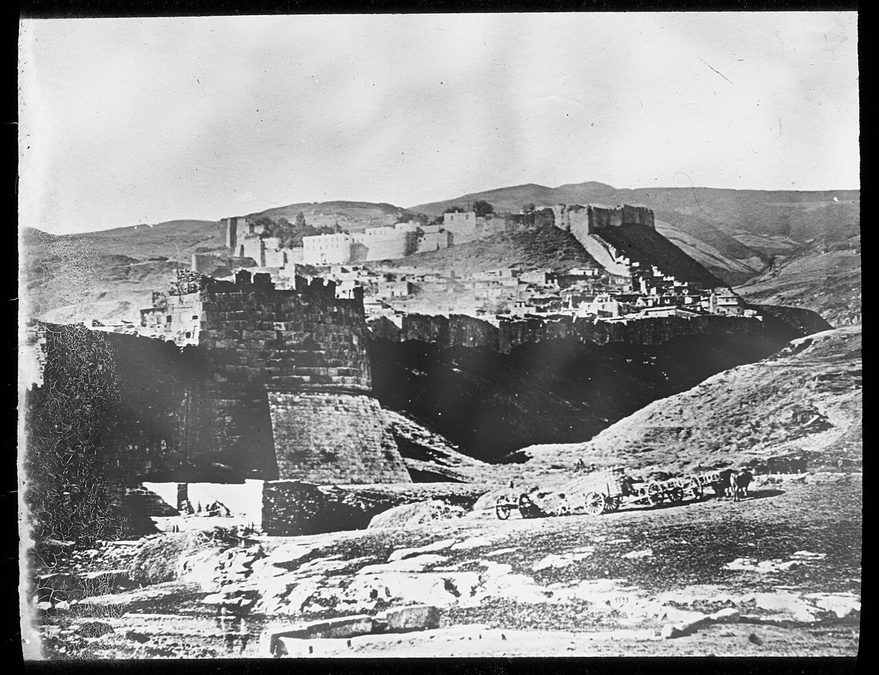
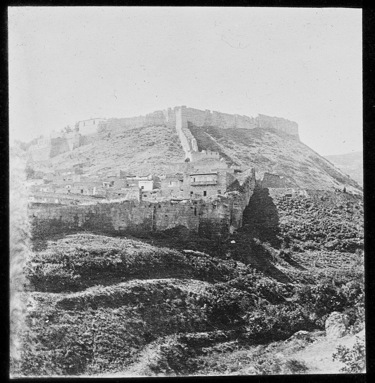
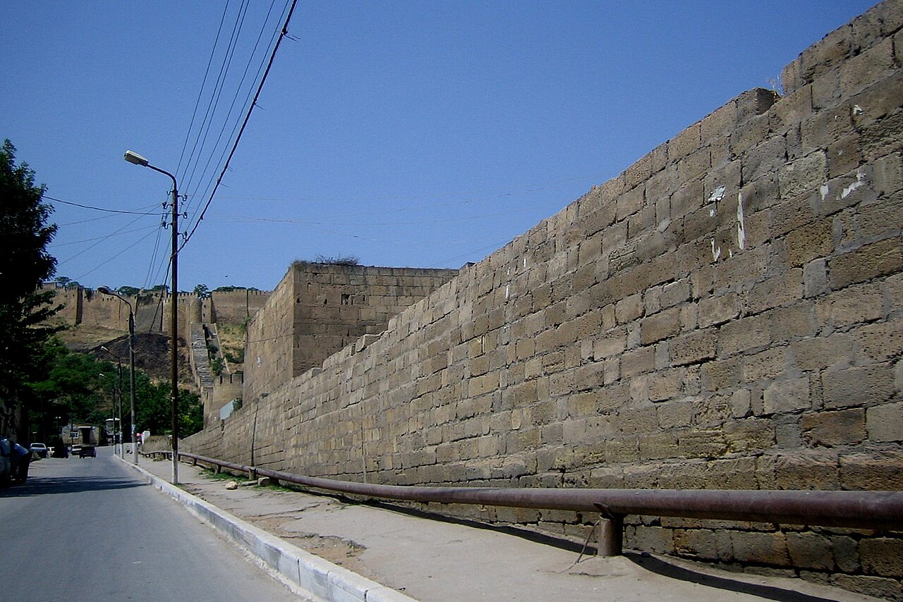
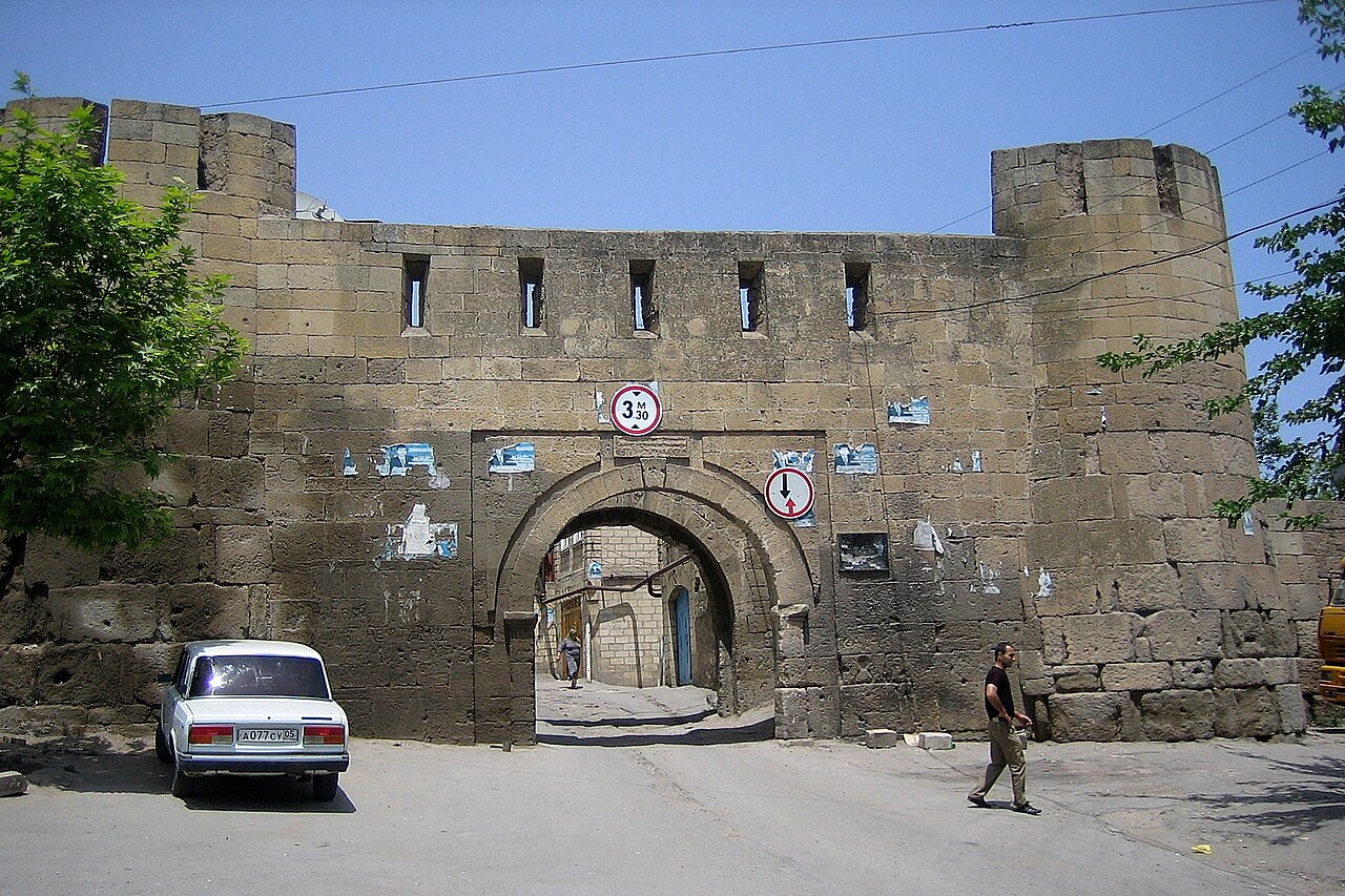
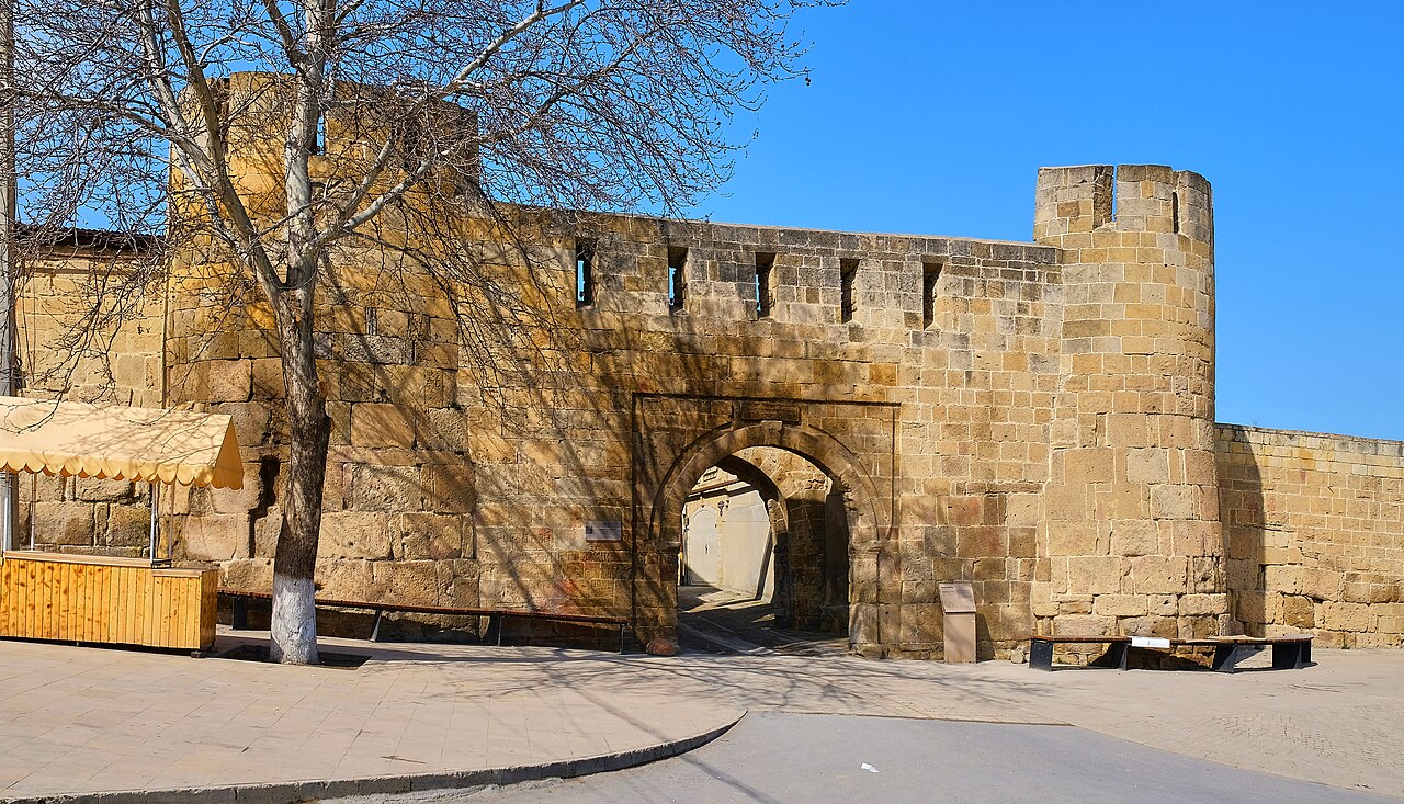
Sasanian-era fortifications blocking the Caspian Gates.

Vyacheslav Bukharov · CC BY-SA 4.0
The Fortifications of Derbent (Darband) are a fortified defense line in the eastern Caucasus, with origins dating to the Persian Sasanian Empire. Built to protect the Caspian Gates against nomadic incursions from the Pontic–Caspian steppe, the complex includes the citadel of Naryn-Kala, twin long walls to the Caspian Sea, and the mountain wall of Dagh-Bary. The fortifications were made a UNESCO World Heritage Site in 2003.
Quick Facts
- Criteria
- Cultural: iii, iv
- Year
- 2003
- Area
- 9.7 ha
- Buffer Zone
- 2 ha
- Location
- Russia
Facts from the source article.
Lore & Background
The first parts of the fortifications were built in the 6th century during the reign of Persian Emperor Khosrow I, though some historical writers attribute construction to his father Kavad I or grandfather Peroz. Historian Kosumova argues that construction began under Khosrow I, citing an inscription mentioning an amargar of Ādurbādagān dated to 568. The adobe fortifications built under Yazdegerd II were later replaced with stone. The complex comprises three elements: the citadel of Naryn-Kala, twin long walls connecting it to the Caspian Sea, and the mountain wall of Dagh-Bary running to the Caucasus foothills. The wall stretched 40 kilometers, with a height up to 20 meters and thickness of about 10 feet, and included thirty north-looking towers.
Reader's Guide
The Fortifications of Derbent represent a peak of Sasanian military architecture, designed to permanently block nomadic incursions from the Pontic–Caspian steppe. The construction was a massive undertaking, with some historians noting it required 2 million cubic meters of masonry and took considerable time. The Iran-Byzantine peace treaty of 561 provided funding, with Byzantium paying 30,000 solids annually for 50 years, much of which was invested in the Caucasian gates. The fortifications were maintained by later Arab, Turkish, and Persian regimes. In 2022, the documentary 'Derbent: What Persia Left Behind' explored the site's history. The citadel remains a popular tourist attraction in Derbent and Dagestan.
Strategic Crossroads of the Ancient World
The Derbent region sat at a critical chokepoint between the Caspian Sea and the eastern slopes of the Caucasus Mountains, a corridor that separated the settled agricultural civilizations to the south from the nomadic horsemen of the Pontic–Caspian steppe to the north. Archaeological traces reveal that a fortified community first took root on the Derbent hill as early as the late eighth century BCE, likely as a defensive response to Scythian incursions. That early settlement occupied roughly four to five hectares on the hill's more sheltered northeastern face, with walls standing about two meters high and up to seven meters thick. Over the following two centuries, the protected area grew to encompass the hill's full fifteen-hectare surface. The repeated cycles of destruction and reconstruction visible in the archaeological record underscore how contested this narrow passage was. By the first century BCE, Derbent had been absorbed into the kingdom of Caucasian Albania as its northernmost outpost, and for three centuries it enjoyed relative prosperity before renewed Alan and Hun raids in the fourth century refocused its identity as a frontier bulwark.
The Sasanian Masterwork
The most ambitious phase of Derbent's defensive architecture unfolded during the sixth century under the Sasanian Persian Empire. While earlier adobe fortifications had been erected under Yazdegerd II, it was Khosrow I Anushirvan who directed the transformation of these structures into a far more durable and expansive stone complex. Ancient sources describe him as having raised a wall of rock and lead stretching from the sea to the mountain peaks, with iron gates hung at the entrance. The project was staggered over a considerable period; historian Kudeyavtsev argued that the roughly two million cubic meters of masonry could not have been laid in a single short campaign, and the turbulent political and military conditions of the era further prolonged the work. An inscription referencing a high-ranking financial official whose title was introduced in the early years of Khosrow I's reign has been dated to 568 CE, marking the completion of an initial construction phase. Although some medieval writers attributed the work to Khosrow's father Kavad I or grandfather Peroz, the epigraphic evidence strongly supports Khosrow I as the principal patron. The fortress was regarded in its time as the pinnacle of military architecture.
Anatomy of the Defense Line
The completed fortification complex was organized around three interlocking components that together sealed the entire Caspian Gates corridor. At its heart stood Naryn-Kala, the citadel perched on the Derbent hill, which served as the command and garrison center. Extending eastward from the citadel, twin long walls ran down to the Caspian coastline, while to the west the so-called mountain wall of Dagh-Bary climbed from the city toward the Caucasus foothills. In total, the barrier stretched approximately forty kilometers from sea to mountain, rising to heights of up to twenty meters and maintaining a thickness of roughly three meters. Thirty north-facing watchtowers were spaced along the length to provide overlapping fields of fire and early warning. The result was a continuous physical barrier that effectively closed the only viable passage across the Caucasus in this sector, forcing any steppe raiding force to confront a fortified front rather than simply riding through open terrain. The system proved effective against a wide range of adversaries, including Byzantine-aligned groups such as the Savirs, Abkhaz, Banjar, Balanjar, and Alan peoples who repeatedly tested the Sasanian frontier in the late sixth and early seventh centuries.
Layers of History and Enduring Legacy
The walls of Derbent have accumulated a palimpsest of inscriptions and modifications spanning more than a millennium. Middle Persian Pahlavi texts carved into the citadel and the northern and southern city walls record the Sasanian laborers who raised the stone, while worker signatures scratched into the masonry offer a rare glimpse of the individual hands behind the construction. After the Arab conquest of Persia, Arabic inscriptions were added to the same surfaces, and subsequent Turkish and Persian regimes continued to maintain and adapt the defenses. The Armenian chronicler Movses Kalankatuaci noted in the early seventh century that the Persian kings had spent enormous sums on the Derbent walls, to the point of financially draining the treasury. Despite this staggering cost, the complex endured as a living military asset through successive political transformations. In 2003, the accumulated weight of its architectural achievement and its role as a cultural crossroads earned the Fortifications of Derbent designation as a UNESCO World Heritage Site, recognizing a structure that had guarded the boundary between steppe and settlement for well over a thousand years.
Gallery
Frequently Asked Questions
What are the Fortifications of Derbent?
They are a massive defensive line in the eastern Caucasus designed to seal off the narrow 'Caspian Gates' corridor between the mountains and the Caspian Sea. Originally raised under the Persian Sasanian Empire, the complex was meant to stop nomadic groups pushing south from the Pontic-Caspian steppe.
Where exactly are the Fortifications of Derbent located?
They sit in the city of Derbent in the Republic of Dagestan, Russia, guarding the tight coastal strip known as the Caspian Gates. This stretch is one of the few viable eastern passages through the entire Caucasus mountain range.
When were the Fortifications of Derbent built and how massive are they?
Major construction took place in the 6th century CE under the Sasanian king Khosrow I, though earlier defensive works at the site predate that era. The walls reached heights of up to 20 meters and were roughly three meters thick.
What structures make up the Fortifications of Derbent complex?
The site includes the Naryn-Kala citadel, two long walls stretching to the Caspian Sea, and the mountain-side wall called Dagh-Bary. Together these elements form a continuous barrier that seals the entire Caspian Gates corridor from one side to the other.
Why did UNESCO designate the Fortifications of Derbent a World Heritage Site?
It was inscribed in 2003 as an outstanding example of military architecture and frontier defense in the region. The complex demonstrates how a single fortified line could control one of the most strategically vital mountain passes in the Caucasus for well over a millennium.
More in World Heritage Sites in Russia 1-24
Spotted an error? Know more?
Reader corrections go straight into our review queue. Suggest an edit · How this site is sourced