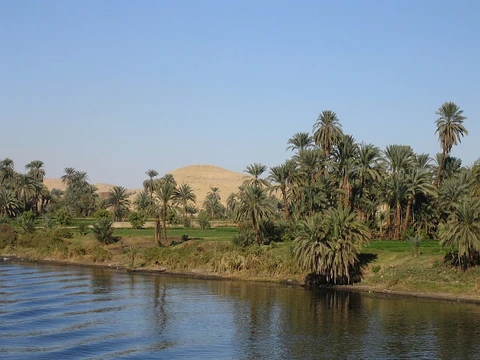
Zambezi
Fourth-longest African river, largest east-flowing into the Indian Ocean.

The Zambezi River—also known as the Zambeze or Zambesi—ranks as Africa’s fourth-longest river, the continent’s longest river that flows east, and the largest African river to drain into the Indian Ocean. Its drainage basin spans 1,390,000 square kilometers (540,000 square miles), a little less than half the size of the Nile’s. Stretching 2,574 kilometers (1,599 miles), the river begins in Zambia, then passes through eastern Angola, runs along the northeastern edge of Namibia and the northern border of Botswana, continues along the Zambia-Zimbabwe border, and finally crosses Mozambique before reaching the Indian Ocean. The Zambezi is best known for Victoria Falls, but it also features Chavuma Falls and Ngonye Falls. Two major hydroelectric dams harness its power: Kariba Dam, which supplies electricity to Zambia and Zimbabwe, and Cahora Bassa Dam in Mozambique, which powers Mozambique and South Africa. Two smaller power stations in Zambia operate at Victoria Falls and Zengamina.
The river’s source lies in a black, marshy dambo within dense, rolling miombo woodland, about 50 kilometers (31 miles) north of Mwinilunga and 20 kilometers (12 miles) south of Ikelenge, in the Ikelenge District of Zambia’s North-Western Province, at roughly 1,524 meters (5,000 feet) above sea level. This source area is a national monument, forest reserve, and important bird area. East of the source, the watershed between the Congo and Zambezi basins forms a distinct belt of high ground running nearly east-west, dropping steeply to the north and south. This ridge clearly separates the Lualaba (the upper Congo’s main branch) from the Zambezi, though near the source the divide is less defined, and the two river systems do not connect. The region drained by the Zambezi is a vast, uneven plateau 900–1,200 meters (3,000–3,900 feet) high, composed of metamorphic rock in the interior and fringed by igneous rock at Victoria Falls. At Chupanga on the lower Zambezi, thin layers of grey and yellow sandstone, with occasional limestone bands, appear on the riverbed during the dry season, continuing beyond Tete, where they are linked to extensive coal seams. Coal also occurs just below Victoria Falls, and gold-bearing rocks are found in several places.
In its upper course, the Zambezi flows southwest into Angola for about 240 kilometers (150 miles), where it is joined by sizable tributaries like the Luena and Chifumage, which come from highlands to the northwest. The river then turns south and develops a floodplain that varies greatly in width between the dry and rainy seasons. It enters dense evergreen Cryptosepalum dry forest, while Western Zambezian grasslands appear on its western side. When it re-enters Zambia, the river is nearly 400 meters (1,300 feet) wide in the rainy season and flows swiftly, with rapids ending at Chavuma Falls, where it passes through a rocky fissure. From its source at 1,500 meters (4,900 feet) to Chavuma Falls at 1,100 meters (3,600 feet), the river drops about 400 meters (1,300 feet) over roughly 400 kilometers (250 miles). From there to Victoria Falls, the basin’s level is very uniform, dropping only another 180 meters (590 feet) across about 800 kilometers (500 miles). The first major tributary to join the Zambezi is the Kabompo River in Zambia’s North-Western Province. The savanna here gives way to a wide floodplain dotted with Borassus fan palms. Farther south, the Lungwebungu River meets the Zambezi, marking the start of the Barotse Floodplain—the upper Zambezi’s most notable feature—though this northern part does not flood as heavily and includes islands of higher ground. About 30 kilometers below the Lungwebungu confluence, the land becomes very flat, and the typical Barotse Floodplain landscape emerges, with floodwaters spreading up to 25 kilometers wide in the rainy season. For over 200 kilometers downstream, the annual flood cycle shapes the natural environment and human life, society, and culture. About 80 kilometers further down, the Luanginga River—which, with its tributaries, drains a large area to the west—joins the Zambezi. Just upstream on the east, overflow from the Luampa/Luena system feeds the main river during the rainy season. Shortly after the Luanginga confluence lies Lealui, one of the capitals of the Lozi people, who inhabit Zambia’s Barotseland region in Western Province. The Lozi chief maintains one compound at Lealui and another at Limulunga, which sits on high ground and serves as the capital during the rainy season. The annual move from Lealui to Limulunga is a major event, celebrated as the Kuomboka, one of Zambia’s best-known festivals. After Lealui, the river turns south-southeast. From the east, it receives many small streams, but for 240 kilometers on the west, no major tributaries join. Before this stretch, Ngonye Falls and subsequent rapids block navigation. South of Ngonye Falls, the river briefly borders Namibia’s Caprivi Strip. Below the junction of the Cuando River and the Zambezi, the river bends almost due east. Here it is broad, shallow, and slow-moving, but as it flows east toward the edge of the great central African plateau, it reaches a chasm where Victoria Falls plunge.
Victoria Falls marks the boundary between the upper and middle Zambezi. Below the falls, the river continues due east for about 200 kilometers (120 miles), cutting through vertical basalt walls 20 to 60 meters (66 to 197 feet) apart, set in hills 200 to 250 meters (660 to 820 feet) high. The river flows swiftly through Batoka Gorge, its current constantly interrupted by reefs. This stretch is considered one of the world’s most spectacular whitewater runs, a major challenge for kayakers and rafters. Beyond the gorge, a succession of features follows.
- Countries
- Zambia, Angola, Namibia, Botswana, Zimbabwe, Mozambique
- Major falls
- Victoria Falls, Chavuma Falls, Ngonye Falls
- Major dams
- Kariba Dam, Cahora Bassa Dam
Lore & Background
The area around the source is a national monument, forest reserve, and important bird area. It re-enters Zambia, dropping about 400 m in elevation from its source to Chavuma Falls, and then flows through a wide floodplain studded with Borassus fan palms, eventually reaching the Barotse Floodplain, a notable feature of the upper Zambezi. The Victoria Falls mark the boundary between the upper and middle Zambezi. Below the falls, the river cuts through perpendicular walls of basalt in the Batoka Gorge, described as one of the world's most spectacular whitewater trips. The lower Zambezi, from Cahora Bassa to the Indian Ocean, is navigable for 650 km, though shallow in many places during the dry season. The river splits into a delta near the ocean, with primary distributaries including Kongone, Luabo, Timbwe, and the Chinde mouth.
Reader's Guide
The Zambezi River is significant as a major waterway in southern Africa, providing hydroelectric power through the Kariba Dam (serving Zambia and Zimbabwe) and the Cahora Bassa Dam (serving Mozambique and South Africa), as well as smaller power stations at Victoria Falls and Zengamina in Zambia. The river's annual flood cycle dominates the natural environment and human life along the Barotse Floodplain, influencing the culture of the Lozi people, whose annual move from Lealui to Limulunga is celebrated as the Kuomboka festival. The construction of the Kariba and Cahora Bassa dams has controlled seasonal variations in flow, reducing the delta's width by about half and altering the delivery of nutrient-rich fresh water to coastal wetlands. The Zambezi's Victoria Falls is its most noted feature, and the river's rapids and gorges offer significant challenges for kayakers and rafters.
Did You Know?
- The Zambezi is the longest east-flowing river in Africa and the largest flowing into the Indian Ocean from Africa.
- The river rises in a black, marshy dambo in dense miombo woodland in the Ikelenge District of North-Western Province, Zambia.
- The delta of the Zambezi is today about half as broad as it was before the construction of the Kariba and Cahora Bassa dams.
Frequently Asked Questions
Who is Zambezi?
Zambezi is a major African river that ranks as the continent's fourth-longest waterway. It holds the distinction of being the longest river in Africa that flows eastward, and it is the biggest African river that delivers its waters to the Indian Ocean.
What is Zambezi's route across the continent?
The river begins its journey in Zambia before threading through eastern Angola, skirting the northeastern edge of Namibia, and tracing the northern boundary of Botswana. It then runs along the shared border of Zambia and Zimbabwe before finally reaching Mozambique.
What are Zambezi's most notable features?
Victoria Falls is by far the river's most famous landmark, though Chavuma Falls and Ngonye Falls are also significant drops along its course. Two major dams—Kariba and Cahora Bassa—regulate flows at key points downstream.
How does Zambezi's story end?
After passing through six countries, the river empties into the Indian Ocean within Mozambique's territory. That estuary marks the final chapter of a journey that began in the highlands of Zambia.
Why is Zambezi important to the region?
Spanning six nations—Zambia, Angola, Namibia, Botswana, Zimbabwe, and Mozambique—it serves as a vital waterway and natural border for all of them. Its status as Africa's largest east-flowing river and its dramatic waterfalls make it both an ecological and a cultural cornerstone.
More in Rivers Of The World 1-20
Spotted an error? Know more?
This is a living reference — every entry is fact-audited, and reader corrections feed straight into our audit queue. Suggest an edit · See this site's audit record