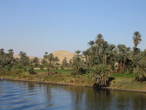
Orange River
Longest river in South Africa, vital for irrigation and hydroelectric power.

via Wikipedia: Orange River · see source
The Orange River, known in Afrikaans and Dutch as the Oranjerivier, flows through Southern Africa and holds the title of South Africa’s longest river, stretching 2,432 kilometers (1,511 miles). Its journey begins in the Drakensberg mountains of Lesotho, then heads westward across South Africa before emptying into the Atlantic Ocean. Along the way, it marks international boundaries between South Africa and Lesotho, as well as between South Africa and Namibia, and also traces several provincial borders within South Africa. With the exception of Upington, the river avoids any major urban centers. Economically, the Orange River is vital to South Africa, supplying water for irrigation and generating hydroelectric power. Its name honors the Dutch House of Orange, given by explorer Robert Jacob Gordon. Other names include !Garib in Khoekhoegowab, Gariep River in Afrikaans, Groote River, Senqu River in Lesotho (derived from ǂNū, meaning "Black"), and iGqili in isiXhosa.
The river’s source sits in the Drakensberg mountains along the Lesotho-South Africa border, roughly 193 kilometers (120 miles) west of the Indian Ocean, at an elevation exceeding 3,000 meters (9,800 feet). Within Lesotho, the upper stretch is called the Senqu, and parts of it freeze in winter due to the high altitude, leading to downstream droughts that primarily impact goat and cattle farming. Flowing westward through South Africa, the Orange forms the southwestern boundary of the Free State province. Along this section, it first fills the Gariep Dam, then the Vanderkloof Dam. From the Lesotho border to below Vanderkloof, the river cuts a deep channel, but further west the terrain flattens, making the water suitable for extensive irrigation. At the Free State’s western edge, southwest of Kimberley, the Orange meets its main tributary, the Vaal River, which defines much of the province’s northern border. From there, the river continues west through the arid landscapes of the southern Kalahari and Namaqualand in the Northern Cape, reaching Namibia at 20°E longitude. For the next 550 kilometers (340 miles), it serves as the international border between the Northern Cape and Namibia’s ǁKaras Region. Crossing points include roads at Vioolsdrif/Noordoewer and Alexander Bay/Orangemund, plus a ferry at Sendlingsdrif.
Over its final 800 kilometers (500 miles), the Orange receives several intermittent streams, like the Fish River, and numerous large wadis, though the Namib Desert borders its north bank here, so these tributaries add negligible water under normal conditions. In this stretch, the riverbed is again deeply incised, and the Augrabies Falls drop 56 meters (184 feet) over 18 kilometers (11 miles). The river reaches the Atlantic Ocean between Oranjemund in Namibia and Alexander Bay in South Africa, roughly halfway between Walvis Bay and Cape Town. The mouth is a biodiverse wetland, hosting 57 bird species, with between 20,653 and 26,653 individual birds recorded in 1985. It is a recognized Ramsar site, one of the few perennial wetlands on the semi-arid South-West African coast. About 33 kilometers (21 miles) from the sea, rapids and sandbars block navigation, making the river largely impassable for long stretches. Its total length remains 2,432 kilometers (1,511 miles).
Rainfall varies dramatically along the river’s course: at the source, it averages about 2,000 millimeters (79 inches) per year, but drops to less than 50 millimeters (2.0 inches) annually at the mouth. Evaporation rates increase westward. During the wet summer season, the Orange turns into a brown torrent, carrying heavy sediment that poses long-term risks to engineering projects. The entire catchment, including the Vaal, covers 973,000 square kilometers (376,000 square miles)—roughly 77% of South Africa’s land area. However, about 366,000 square kilometers (141,000 square miles) (38%) lie outside the country, in Lesotho, Botswana, and Namibia.
Key tributaries include the Vaal River (1,458 km or 906 mi), the Caledon River (642 km or 399 mi), and the Khubelu River (144 km or 89 mi). The upper Orange is fed by numerous streams from the highlands of Lesotho and South Africa, such as the Little Caledon, Kraai, Kornetspruit, and Senqunyane rivers, many draining the Maloti Mountains. These upper tributaries supply most of the annual discharge, as the highest rainfall occurs in Lesotho’s mountainous catchments, with snow and seasonal rain boosting flow during the austral summer. Several of these tributaries are regulated by reservoirs tied to the Lesotho Highlands Water Project, which sends water to South Africa and generates hydroelectric power for Lesotho. Dams on the river system include Armenia, Egmont, Gariep, Newberry, Vanderkloof, Welbedacht, Knellport, Kalkfontein, Teirpoort, Mohale, Katse, and Rustfontein.
Historically, some of the earliest precolonial inhabitants named the river ǂNūǃarib, referencing its dark color.
- length
- 2,432 km (1,511 mi)
- source
- Drakensberg mountains, Lesotho
- mouth
- Atlantic Ocean between Oranjemund (Namibia) and Alexander Bay (South Africa)
- basin_area
- 973,000 km² (376,000 sq mi)
- named_after
- House of Orange (Dutch ruling family)
- other_names
- Gariep River, Senqu River, iGqili, !Garib
Lore & Background
The Orange rises in the Drakensberg mountains along the border between South Africa and Lesotho, about 193 km (120 mi) west of the Indian Ocean and at an altitude of over 3,000 m (9,800 ft). The extremity of the Orange River inside Lesotho is known as the Senqu. Parts of the Senqu River freeze in winter because of the high altitude, creating droughts downstream that mainly affect goat and cattle production. The river then runs westward through South Africa, forming the south-western boundary of the Free State province. In this section, the river flows first into the Gariep Dam and later into the Vanderkloof Dam. At the western point of the Free State, southwest of Kimberley, the Orange meets with its main tributary, the Vaal River. From here, the river flows further westward through the arid wilderness of the southern Kalahari region and Namaqualand in the Northern Cape province to meet with Namibia at 20°E longitude. From here, it flows westward for 550 km (340 mi), forming the international border between the province and Namibia's ǁKaras Region. The river can be crossed at Vioolsdrif / Noordoewer, Alexander Bay / Orangemund border crossing by road and the Sendlingsdrif border crossing by ferry. In the last 800 km (500 mi) of its course, the Orange receives many intermittent streams (such as the Fish River). The Augrabies Falls are located on this section, where the river descends 56 m (184 ft) in a course of 18 km (11 mi). The Orange empties into the Atlantic Ocean between the small towns of Oranjemund (meaning "Orange mouth") in Namibia and Alexander Bay in South Africa. It is a recognised Ramsar site. Some 33 km (21 mi) from its mouth, it is obstructed by rapids and sand bars and is generally not navigable for long stretches.
Reader's Guide
As the primary source of water for the majority of South Africa, the Orange River plays a crucial role in supporting agriculture, industry, and mining. Two large water schemes have been created: the Orange River Project and the Lesotho Highlands Water Project. Historically, the river played an important role in the South African diamond rush, with the first diamonds in the country being discovered in alluvial deposits on the Orange. Today, commercial diamond mines operate along the final stretch of the Orange River and around its mouth. Because of the lack of dangerous animals and high water levels during summer, the river is used for recreational canoeing and rafting. Orange River rafting has become very popular, with many companies using their camps along the river from which to operate. The most popular trips are four-day and six-day river trips that take place either along the gorge below the Augrabies Falls or along the Richtersveld area. The river was named the Orange River in honour of the Dutch ruling family, the House of Orange, by the Dutch explorer Robert Jacob Gordon. Other names include !Garib, rendered in Afrikaans as Gariep River, Groote River, or Senqu River (used in Lesotho). It is known in the isiXhosa as iGqili. Since the end of apartheid, the name "Gariep" has had greater favor in official correspondence in South Africa.
Did You Know?
- The Orange River is the longest river in South Africa, with a total length of 2,432 km (1,511 mi).
- Parts of the Senqu River (the Orange's extremity inside Lesotho) freeze in winter because of the high altitude, causing droughts downstream that affect goat and cattle production.
- The Augrabies Falls on the Orange River descend 56 m (184 ft) in a course of 18 km (11 mi).
- The river was named the Orange River in honour of the Dutch ruling family, the House of Orange, by the Dutch explorer Robert Jacob Gordon in 1779.
Frequently Asked Questions
What is the Orange River?
It is the longest river in South Africa, running 2,432 km from the Drakensberg highlands in Lesotho westward to the Atlantic Ocean. Along stretches of its course it doubles as a natural border between South Africa and both Lesotho and Namibia.
How long is the Orange River and how big is its basin?
The river measures roughly 2,432 km (1,511 mi) from source to mouth. Its drainage basin spans about 973,000 km², making it one of the largest river systems in southern Africa.
Where does the Orange River start and where does it empty?
It rises in the Drakensberg mountains of Lesotho and flows generally westward across South Africa before reaching the Atlantic Ocean between Oranjemund (Namibia) and Alexander Bay (South Africa).
Why is it called the Orange River?
The name traces back to the Dutch House of Orange, the royal family that ruled the Netherlands during the colonial era in the region. Indigenous and Afrikaans communities also know it by names such as Gariep, Senqu, iGqili, and !Garib.
Why is the Orange River important to the region?
It supplies water for large-scale irrigation and hydroelectric power generation, making it a backbone of the South African economy. Its basin also sustains ecosystems and communities across Lesotho, South Africa, and Namibia.
More in Rivers Of The World 1-20
Spotted an error? Know more?
This is a living reference — every entry is fact-audited, and reader corrections feed straight into our audit queue. Suggest an edit · See this site's audit record