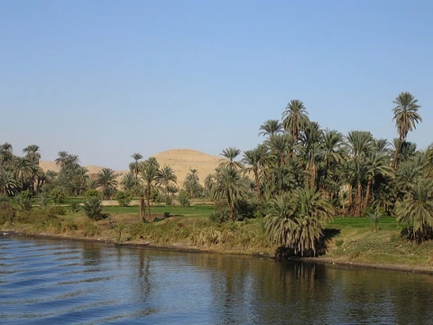
Limpopo River
By drainage basin area, second largest African river draining to the Indian Ocean.

via Wikipedia: List of river systems by length · see source
The Limpopo River rises in South Africa and flows in a great arc, first zigzagging north and then northeast, before turning east and finally southeast through Mozambique to the Indian Ocean. It is formed at the confluence of the Marico and Crocodile Rivers. The river is approximately 1,750 kilometers long and drains an area of 415,000 square kilometers. Its mean discharge at the mouth ranges from 170 to 313 cubic meters per second, making it the second largest African river flowing into the Indian Ocean, after the Zambezi. The river serves as a border for about 640 kilometers, separating South Africa from Botswana and Zimbabwe. The waters move sluggishly and carry considerable silt, a character captured by Rudyard Kipling’s description of the “great grey-green, greasy Limpopo River.” Rainfall is seasonal and unreliable; in dry years, the upper parts may flow for only 40 days or less. The upper basin in the Kalahari Desert is arid, but conditions become less dry downstream. The lower reaches drain fertile lowlands that support a denser population, with about 14 million people living in the basin. Major tributaries include the Olifants River, which contributes around 1,233 million cubic meters of water annually, as well as the Notwane, Shashe, Mzingwane, Crocodile, Mwenezi, and Luvuvhu Rivers. The river is navigable from the Olifants confluence to the sea, though a sandbar blocks large ships except at high tide. The first European to sight the river was Vasco da Gama, who anchored off its mouth in 1498. St Vincent Whitshed Erskine explored the lower course in 1868–69, and Captain J F Elton traveled down the middle course in 1870. The Venda people call it the Vhembe, a name adopted by the South African government for a district municipality. Over geological time, the drainage area has decreased: until the Late Pliocene or Pleistocene, the upper Zambezi River flowed into the Limpopo, but earth movements lifted the land north of the present river, diverting those waters to the Zambezi.
- countries
- South Africa, Botswana, Zimbabwe, Mozambique
Verified Timeline
Lore & Background
The Limpopo River rises in South Africa and flows in a great arc, first zigzagging north and north-east, then turning east and finally south-east. The river's name becomes the Limpopo at the confluence of the Marico and Crocodile Rivers. Its waters flow sluggishly with considerable silt content, and rainfall is seasonal and unreliable—in dry years, the upper parts flow for 40 days or less. The river has been called the Vhembe by local Venda communities, a name adopted by the South African government for its District Municipality in the north. The drainage area of the Limpopo has decreased over geological time. Up to Late Pliocene or Pleistocene times, the upper course of the Zambezi River drained into the Limpopo. The change of the drainage divide resulted from epeirogenic movement that uplifted the surface north of the present-day Limpopo, diverting waters into the Zambezi.
Reader's Guide
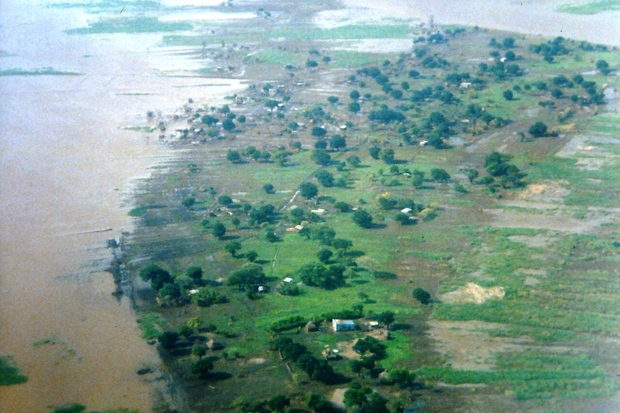
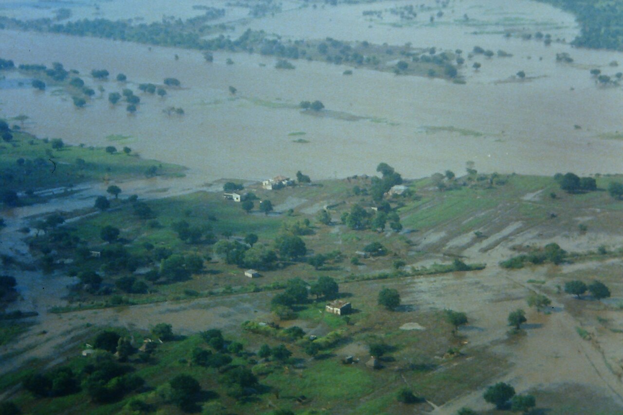
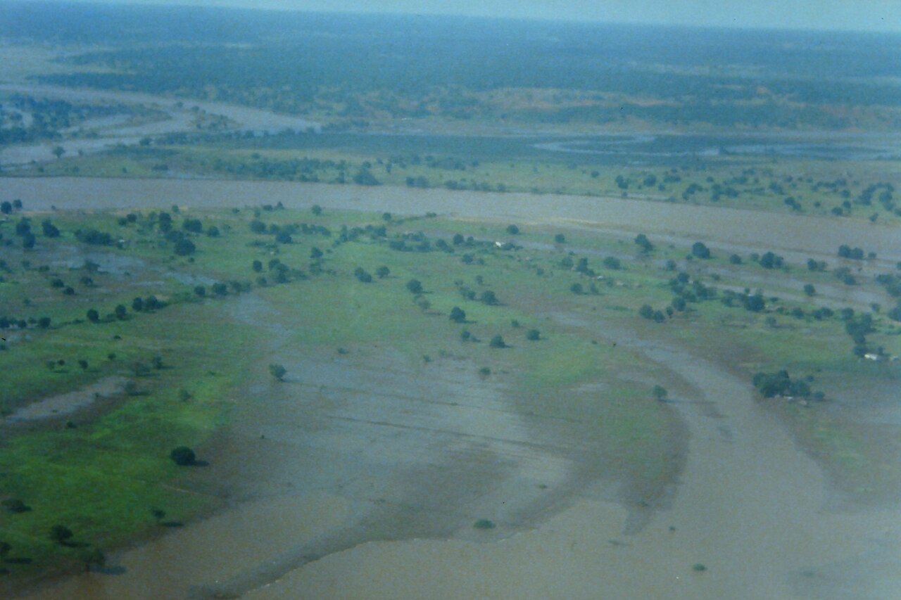
The Limpopo River is the second largest African river flowing into the Indian Ocean, after the Zambezi. Its waters are characteristically sluggish and carry a heavy load of silt, a quality famously captured in Rudyard Kipling’s description of the “great grey-green, greasy Limpopo River.” Rainfall in the basin is seasonal and unreliable; in dry years, the upper reaches may flow for only 40 days or less. The upper drainage area lies in the arid Kalahari Desert, while the middle reaches drain the Waterberg Massif, a biome of semi-deciduous forest with low human population. The fertile lowlands support a denser population, with about 14 million people living in the entire basin. Flooding occasionally affects the lower reaches during the rainy season, as seen in the catastrophic 2000 Mozambique flood caused by heavy rains from a cyclone. The river hosts a notable concentration of hippopotamuses between the Mokolo and Mogalakwena Rivers. A Zambezi shark, which tolerates fresh water, was caught hundreds of kilometres upriver at the confluence with the Luvuvhu River in July 1950. In 2013, approximately 15,000 Nile crocodiles were accidentally released into the river from a nearby crocodile farm. Mining is extensive in the basin, with about 1,900 active mines and roughly 1,700 abandoned ones. The river’s geological history includes a major shift: until the Late Pliocene or Pleistocene, the upper Zambezi drained into the Limpopo, but epeirogenic uplift north of the present Limpopo diverted those waters into the Zambezi.
Did You Know?
- The Limpopo River's name becomes the Limpopo at the confluence of the Marico and Crocodile Rivers.
- In dry years, the upper parts of the Limpopo flow for 40 days or less.
- The river has been called the Vhembe by local Venda communities, a name adopted by the South African government for its District Municipality in the north.
- Up to Late Pliocene or Pleistocene times, the upper course of the Zambezi River drained into the Limpopo.
- The change of the drainage divide resulted from epeirogenic movement that uplifted the surface north of the present-day Limpopo, diverting waters into the Zambezi.
The Elusive Metric: Measuring a Great River
The precise length of any major river system remains one of geography's stubborn puzzles. For a river belonging to the category of systems exceeding one thousand kilometres, the act of measurement is far from straightforward. Where exactly does the source begin? Which tributary claims the title of longest headwater? And at the mouth, where does the river end and the estuary or delta begin? These questions are compounded by what geographers call the coastline paradox—the idea that the scale at which you measure changes the result. Seasonal flooding, erosion cycles, and the presence of lakes or reservoirs along the course all introduce further ambiguity. Even when a river flows through multiple channels or anabranches, the choice of whether to trace the centreline or the bank edge shifts the final figure. In short, the true length of a great river is not a single fixed number but a range of reasonable estimates, each dependent on the assumptions a surveyor brings to the task.
Among the Giants: Context of Major River Systems
Rivers that stretch beyond the one-thousand-kilometre mark form a select group, and their rankings are far from settled. The most famous dispute—whether the Nile or the Amazon holds the title of longest—illustrates how easily a river's standing can shift depending on methodological choices. In 2007 and 2008, researchers argued the Amazon surpassed the Nile by including the adjacent Pará estuary and the longest connecting tidal canal in the tally. A 2009 peer-reviewed article in the International Journal of Digital Earth countered that the Nile retains the lead. For other major rivers, different reference works simply disagree on the figure, sometimes by hundreds of kilometres. When the spread between sources is wide, encyclopaedias list every value rather than forcing a single number; when the spread is modest, an average is offered. The result is that the rank of any given river in the global hierarchy is always provisional, contingent on which measurement convention a particular source happens to adopt.
Rivers That Were and Rivers That Might Have Been
The landscape of the world's great rivers is a palimpsest of geological epochs. Before the Andes thrust upward, the Amazon basin drained westward into the Pacific rather than eastward to the Atlantic. The Congo basin, ringed by high terrain except for a narrow exit valley past Kinshasa, appears to have been rejuvenated when much of its lower course was stripped away during the breakup of Gondwanaland. Some geologists speculate that, before that continental rift, the Congo's waters may have flowed into the Amazon, creating a combined system approaching ten thousand kilometres. In Europe, the last glacial maximum left much of the southern North Sea as dry land—Doggerland—where the Thames, Meuse, Scheldt, and Rhine likely converged into a single outflow. Palaeogeographers call this the Loubourg or Lobourg system, and its length could have ranged from roughly fourteen hundred to sixteen hundred and fifty kilometres depending on whether the combined waters turned southwest toward the English Channel or north toward the North Sea. These ghost rivers remind us that today's ranking of great rivers is only a snapshot of a constantly rearranging hydrological world.
Why No Single Number Suffices
Even with the most detailed modern maps, pinning down a river's length is fraught with ambiguity. A river may split into multiple channels or anabranches, and the measured distance changes depending on whether one traces the centre of the flow or follows the outer bank. Where the course crosses a lake or reservoir, the method of accounting for that stretch is not standardized. Dams, levees, and deliberate channelization alter the path over human timescales, while natural meander cutoffs can erase vast stretches in a single event. The Mississippi demonstrates this dramatically: its stretch between Cairo, Illinois, and New Orleans lost over three hundred and fifty kilometres of course to eighteen natural cutoffs occurring between 1766 and 1885. Erosion, flooding, and seasonal variation add further drift. Because no universally agreed standard governs how to handle these nuances, the length of any major river is best understood as an approximation that shifts with each new survey. Comparing one river's length to another's therefore always carries an irreducible margin of uncertainty, and the longest-river title remains, in a meaningful sense, perpetually under negotiation.
Gallery
Frequently Asked Questions
How does the Limpopo River's journey end?
After crossing four countries—South Africa, Botswana, Zimbabwe, and Mozambique—the river finally discharges into the Indian Ocean. One of its most notable tributaries, the Olifants (Elephant) River, feeds into the main stem while it is still within South African territory.
Why is the Limpopo River important to the region?
The river is a defining transboundary waterway that touches four nations, supporting ecosystems, agriculture, and communities across all of them. Its role as a long shared border for South Africa, Botswana, and Zimbabwe also makes it a key element of regional geography and water-resource management.
More in Rivers Of The World 1-20
Spotted an error? Know more?
This is a living reference — every entry is fact-audited, and reader corrections feed straight into our audit queue. Suggest an edit · See this site's audit record