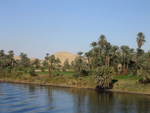
Yukon River
Major northwestern North American river and Klondike Gold Rush route.

via Wikipedia: Yukon River · see source
The Yukon River is a major waterway in northwestern North America. It begins in British Columbia, flows through Canada’s Yukon territory—which takes its name from the river—and continues through the U.S. state of Alaska for its lower half. Stretching 3,190 kilometers (1,980 miles), it empties into the Bering Sea at the Yukon–Kuskokwim Delta. Its average discharge ranges from 6,400 to 7,000 cubic meters per second (230,000–250,000 cubic feet per second). The river drains 854,700 square kilometers (330,000 square miles), with 323,800 square kilometers (125,000 square miles) in Canada—an area more than 25 percent larger than Texas or Alberta. As the longest river in both Alaska and Yukon, it served as a key transportation route during the Klondike Gold Rush from 1896 to 1903.
The name Yukon comes from the Gwichʼin phrase *chųų gąįį han*, meaning “white water river,” a reference to the pale color of glacial runoff. This phrase contracts to *Ųųg Han* (with nasalized vowels) or *Yuk Han* (without nasalization). In the 1840s, different Dene nations offered conflicting interpretations. In 1843, the Holikachuks told the Russian-American Company their name was *Yukkhana*, meaning “big river,” though this does not literally match a Holikachuk phrase for that meaning. Two years later, the Gwichʼins told the Hudson’s Bay Company their name was *Yukon*, meaning “white water river,” which does correspond to Gwichʼin words that shorten to *Yukon*. Because the Holikachuks traded regularly with both the Gwichʼins and the Yupʼiks, they likely borrowed the Gwichʼin contraction and conflated its meaning with the Yupʼik name *Kuig-pak* (“River-big”). Documentary evidence thus suggests the Holikachuks borrowed *Ųųg Han* from Gwichʼin and mistakenly assumed it meant the same as the Yupʼik term. The upper course of the Yukon, from Marsh Lake to the confluence of the Pelly River at Fort Selkirk, was formerly called the Lewes River.
Geologists, geographers, hydrologists, and ecologists agree the headwaters lie in the glaciated Coast Mountains of British Columbia, but the exact source is debated. The U.S. Geological Survey generally accepts the Llewellyn Glacier at the southern end of Atlin Lake as the source. Others point to Lake Lindeman at the northern end of the Chilkoot Trail. Atlin Lake flows into Tagish Lake via the Atlin River, and Lake Lindeman flows into Bennett Lake, which also reaches Tagish Lake. Tagish Lake then flows into Marsh Lake via the Tagish River. The Yukon River proper begins at the northern end of Marsh Lake, just south of Whitehorse. Some argue the true source is Teslin Lake and the Teslin River, which contributes a larger flow when it meets the Yukon at Hootalinqua. North of Whitehorse, the river widens into Lake Laberge, immortalized by Robert W. Service’s poem “The Cremation of Sam McGee.” Other large lakes in the system include Kusawa Lake (feeding the Takhini River) and Kluane Lake (feeding the Kluane and then White River).
The river passes through Whitehorse, Carmacks (just before Five Finger Rapids), and Dawson City in Yukon, then crosses into Alaska, flowing past Eagle, Circle, Fort Yukon, Stevens Village, Rampart, Tanana, Ruby, Galena, Nulato, Grayling, Holy Cross, Russian Mission, Marshall, Pilot Station, St. Marys (accessible from the Yukon at Pitkas Point), and Mountain Village. Beyond Mountain Village, the main channel splits into many branches across the delta. Communities after the “head of passes”—as the division is locally known—include Nunum Iqua, Alakanuk, Emmonak, and Kotlik. Emmonak, the largest delta community with about 760 people in the 2000 census, has a gravel airstrip that serves as the regional hub.
Navigational hazards on the river include Five Finger Rapids and Rink Rapids, both downstream from Carmacks. Despite its length, only four vehicle-carrying bridges span the river.
A portion of the river in Yukon—the “Thirty Mile” section from Lake Laberge to the Teslin River—is a national heritage river and part of the Klondike Gold Rush International Historical Park. Paddle-wheel riverboats operated on the Yukon until the 1950s, when the Klondike Highway was completed. After the United States purchased Alaska in 1867, the Alaska Commercial Company took over the Russian-American Company’s assets and built several posts along the river.
The Yukon has a recent history of pollution from military sites, dumps, wastewater, and other sources. However, the Environmental Protection Agency does not list it among impaired watersheds, and U.S. Geological Survey data show relatively good levels of turbidity, metals, and dissolved oxygen. The Yukon and Mackenzie rivers carry much higher suspended sediment concentrations than major Siberian Arctic rivers. The Yukon River Inter-Tribal Watershed Council, a cooperative of 70 First Nations and tribes in Alaska and Canada, aims to make the river and its tributaries safe to drink from again by supplementing and scrutinizing government data.
- length
- 3,190 km (1,980 mi)
- average_flow
- 6,400–7,000 m³/s (230,000–250,000 ft³/s)
- drainage_area
- 854,700 km² (330,000 mi²)
- source
- Llewellyn Glacier at Atlin Lake, British Columbia (generally accepted)
- mouth
- Bering Sea at Yukon–Kuskokwim Delta
- longest_river_in
- Alaska and Yukon
Verified Timeline
Lore & Background
The name Yukon, or ųųg han, is a contraction of the words in the phrase Gwichʼin: chųų gąįį han, which means 'white water river' and refers to 'the pale colour' of glacial runoff in the Yukon River. In the 1840s, the Holikachuks told the Russian-American Company that their name for the river was Yukkhana and that this name meant 'big river.' However, Yukkhana does not literally correspond to a Holikachuk phrase that means big river. Two years later, the Gwich'ins told the Hudson's Bay Company that their name for the river was Yukon and that the name meant 'white water river.' The documentary evidence suggests that the Holikachuks had borrowed the contraction Ųųg Han from Gwich'in, and erroneously assumed that this contraction had the same literal meaning as the corresponding Yup'ik name Kuig-pak ['River-big']. The Lewes River is the former name of the upper course of the Yukon, from Marsh Lake to the confluence of the Pelly River at Fort Selkirk. The river passes through the communities of Whitehorse, Carmacks, and Dawson City in Yukon, and crossing Alaska into Eagle, Circle, Fort Yukon, Stevens Village, Rampart, Tanana, Ruby, Galena, Nulato, Grayling, Holy Cross, Russian Mission, Marshall, Pilot Station, St. Marys, and Mountain Village. After Mountain Village, the main Yukon channel frays into many channels, sprawling across the delta. Navigational obstacles on the Yukon River are the Five Finger Rapids and Rink Rapids downstream from Carmacks. Despite its length, there are only four vehicle-carrying bridges across the river. A car ferry crosses the river at Dawson City in the summer; it is replaced by an ice bridge over the frozen river during the winter.
Reader's Guide
The Yukon River was one of the principal means of transportation during the 1896–1903 Klondike Gold Rush. A portion of the river in Yukon—'The Thirty Mile' section, from Lake Laberge to the Teslin River—is a national heritage river and a unit of Klondike Gold Rush International Historical Park. Paddle-wheel riverboats continued to ply the river until the 1950s, when the Klondike Highway was completed. After the purchase of Alaska by the United States in 1867, the Alaska Commercial Company acquired the assets of the Russian-American Company and constructed several posts at various locations on the Yukon River. The Yukon River is home to one of the longest salmon runs in the world. Each year Chinook, coho, and chum salmon return to their terminal streams in Alaska, the Yukon Territory, and British Columbia. The Chinook, which arrive at the mouth of the Yukon River in early June, have the longest journey – as many as 2,000 miles against the current, with an estimated 35–50% bound for Canada. The villages along the Yukon have historically relied on and continue to rely on salmon for their cultural, subsistence, and commercial needs. The Yukon River Inter-Tribal Watershed Council, a cooperative effort of 70 First Nations and tribes in Alaska and Canada, has the goal of making the river and its tributaries safe to drink from again by supplementing and scrutinizing government data. The river flows into several parklands and refuges including Innoko National Wildlife Refuge, Nowitna National Wildlife Refuge, Yukon-Charley Rivers National Preserve, Yukon Delta National Wildlife Refuge, and Yukon Flats National Wildlife Refuge.
Did You Know?
- The total drainage area of the Yukon River is more than 25% larger than Texas or Alberta.
- The name Yukon derives from the Gwich'in phrase chųų gąįį han, meaning 'white water river,' referring to the pale color of glacial runoff.
- The Thirty Mile section of the river, from Lake Laberge to the Teslin River, is a national heritage river and a unit of Klondike Gold Rush International Historical Park.
- Despite its length, there are only four vehicle-carrying bridges across the entire Yukon River.
- In the summer of 2023, the U.S. Fish and Wildlife Service counted 58,500 Chinook salmon, the second lowest season on record.
Frequently Asked Questions
Who is Yukon River?
The Yukon River is a major watercourse of northwestern North America, stretching 3,190 km (1,980 mi) from British Columbia through Canada's Yukon territory and into Alaska. It holds the title of longest river in both Alaska and the Yukon.
What are Yukon River's powers/role?
The river moves an average of 6,400–7,000 m³/s of water and drains a basin of 854,700 km², making it one of the continent's largest river systems. It functions as a vital transportation corridor and ecological backbone for the vast northwestern landscape.
How does Yukon River's story end?
The Yukon River's journey concludes where it empties into the Bering Sea at the Yukon–Kuskokwim Delta in western Alaska. That delta marks the final chapter of its roughly 2,000-mile path from a glacial source in the Canadian Rockies.
Why is Yukon River important?
The river gave its name to Canada's Yukon territory and served as the primary route during the Klondike Gold Rush of the 1890s. Its drainage basin is more than 25% larger than Texas, making it a defining geographic feature of the continent.
Where does Yukon River begin?
The generally accepted source is Llewellyn Glacier at Atlin Lake in British Columbia, Canada. From that starting point the watercourse heads northward through the Yukon before turning west into Alaska.
More in Rivers Of The World 1-20
Spotted an error? Know more?
This is a living reference — every entry is fact-audited, and reader corrections feed straight into our audit queue. Suggest an edit · See this site's audit record