Bryce Canyon National Park
A high-elevation park of hoodoos and natural amphitheaters in Utah.
Last updated
Where it is
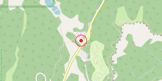
Coordinates: 37°38′24″N 112°10′12″W (37.6400, -112.1700) · Open in OpenStreetMap
Coordinates and connected clubs: the infobox of Wikipedia: Bryce Canyon National Park (CC BY-SA 4.0). Map: drawn by Codexery from OpenStreetMap tiles.
Bryce Canyon National Park is a protected area in southwestern Utah, known for its distinctive geological formations called hoodoos. Despite its name, the park does not contain a canyon but rather a series of giant natural amphitheaters along the eastern side of the Paunsaugunt Plateau. The park's red, orange, and white rock colors and high elevation make it a notable landscape within the Colorado Plateau region.
History
Little is known about early human habitation in the area, though archaeological surveys of the Paunsaugunt Plateau indicate people have lived there for at least 10,000 years. Basketmaker Anasazi artifacts thousands of years old were found south of the park, and other artifacts from the Pueblo-period Anasazi and the Fremont culture date up to the mid-12th century. The Paiute Native Americans moved into the area around the time the other cultures left, hunting and gathering most of their food while supplementing with cultivated plants.
The Paiute developed a mythology surrounding the hoodoos, believing they were the Legend People turned to stone by the trickster Coyote due to their bad deeds; one older Paiute said his culture called the hoodoos Anka-ku-was-a-wits, Paiute for "red painted faces." European Americans first explored the area in the late 18th and early 19th centuries, with Mormon scouts visiting in the 1850s to assess its potential for agriculture, grazing, and settlement.
The first major scientific expedition was led by U.S. Army Major John Wesley Powell in 1872, whose mapmakers used many Paiute place names. Small groups of Mormon pioneers attempted to settle east of Bryce Canyon along the Paria River, and the Kanarra Cattle Company began grazing cattle there in 1873. The Church of Jesus Christ of Latter-day Saints sent Scottish immigrant Ebenezer Bryce and his wife Mary to settle land in the Paria Valley; they lived right below Bryce Amphitheater, and Bryce built a road to the plateau and a canal for irrigation. Other settlers began calling the canyon at the road's end "Bryce's Canyon," and the name stuck.
Geography
The park covers 35835 acres in southwestern Utah at an altitude of 8000 to 9000 ft, lying within the Colorado Plateau geographic province. It straddles the southeastern edge of the Paunsaugunt Plateau west of the Paunsaugunt Faults; Paunsaugunt is Paiute for "home of the beaver." Visitors look over the plateau's edge toward a valley containing the fault and the Paria River (Paria is Paiute for "muddy or elk water"), with the Kaiparowits Plateau on the opposite side.
Bryce Canyon was not formed by erosion from a central stream, so it is technically not a canyon; instead, headward erosion excavated large amphitheater-shaped features in Cenozoic-aged rocks, producing colorful pinnacles called hoodoos up to 200 ft high. A series of amphitheaters extends more than 20 mi north-to-south, the largest being Bryce Amphitheater at 12 mi long, 3 mi wide, and 800 ft deep. Rainbow Point, the highest part at 9105 ft, sits at the end of the 18 mi scenic drive, while Yellow Creek at the park's northeast exit is the lowest point at 6620 ft.
Ecology
More than 1000 plant species live in the park, which spans three life zones depending on elevation. The highest areas support Douglas fir, blue spruce, and quaking aspen, with mule deer, elk, grouse, squirrels, and chipmunks present. Mid elevations are dominated by Ponderosa pine forests, along with greenleaf manzanita and Rocky Mountain juniper. The lowest elevations are arid and contain Colorado pinyon and Utah juniper trees; pinyon jays and Clark's nutcrackers consume pinyon seeds and help the trees reproduce.
The park hosts 59 mammal species, more than 45 species of butterflies and moths, over 100 species of birds, and many insects. Larger mammals include deer, antelope, elk, and mountain lions, while ringtails also occur. Birds include peregrine falcons, ospreys, jays, and hummingbirds. Eleven reptile species and four amphibian species have been found, including the Great Basin rattlesnake, short-horned lizard, side-blotched lizard, striped whipsnake, and tiger salamander.
Three wildlife species listed under the Endangered Species Act inhabit the park: the Utah prairie dog (a threatened species reintroduced here, with its largest protected population in the park), the California condor, and the southwestern willow flycatcher. Cryptobiotic soil—black, lumpy, slow-growing colonies of lichens, algae, fungi, and cyanobacteria—slows erosion, adds nitrogen, and helps retain moisture.
Activities
The park offers eight marked and maintained day hikes. Easy to moderate hikes include Mossy Cave (one hour), Rim Trail (5–6 hours), Bristlecone Loop (one hour), and Queens Garden (1–2 hours). Moderate hikes are Navajo Loop (1–2 hours) and Tower Bridge (2–3 hours). Strenuous hikes include Fairyland Loop (4–5 hours) and Peekaboo Loop (3–4 hours).
Several trails intersect, allowing hikers to arrange longer routes. Two trails are designated for overnight trips: the 9 mi Riggs Spring Loop Trail and the 23 mi Under-the-Rim Trail. On clear days, Navajo Mountain and the Kaibab Plateau can be seen 90 mi away in Arizona from Yovimpa and Rainbow points, and the Black Mesas of eastern Arizona and western New Mexico are visible 160 mi away. The park has a 7.4 magnitude night sky, one of the darkest in North America, allowing patrons to see approximately 7,500 stars.
Park rangers host public stargazing events and evening programs on astronomy, nocturnal animals, and night sky protection. The Bryce Canyon Astronomy Festival, typically held in June, attracts thousands of visitors; Asteroid 49272 was named after the national park in honor of this festival. Two campgrounds are available: North Campground (Loop A open year-round) and Sunset Campground (open late spring to early autumn).
Did You Know?
- The plant hardiness zone at the visitor center is 5b, with an average annual extreme minimum air temperature of -10.0 °F.
- The record high temperature in the park was 98 °F in July 2002, and the record low was -28 °F in December 1972.
- The Laramide orogeny, starting about 70 million to 50 million years ago, helped build the Rocky Mountains and closed the Cretaceous Seaway.
Frequently Asked Questions
Where is Bryce Canyon National Park?
Bryce Canyon National Park is located in Garfield County and Kane County, Utah, United States.
When was Bryce Canyon National Park founded?
Bryce Canyon National Park was founded on 25 February 1928.
More in Religious Places of the Indigenous Peoples of North America
Sources
Compiled from Wikipedia and the sources listed below. Text from Wikipedia is available under CC BY-SA 4.0; this entry is adapted from it.
- Wikipedia: Bryce Canyon National Park (CC BY-SA 4.0).
- Word definitions: the Codexery glossary, each quoted from its Wikipedia article.
Spotted an error? Know more?
Reader corrections go straight into our review queue. Suggest an edit · How this site is sourced