Blanca Peak
Sacred mountain of the Navajo and highest peak of the Sangre de Cristo Range.
Last updated
Where it is
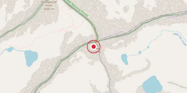
Coordinates: 37°34′37″N 105°29′10″W (37.5770, -105.4860) · Open in OpenStreetMap
Coordinates and connected clubs: the infobox of Wikipedia: Blanca Peak (CC BY-SA 4.0). Map: drawn by Codexery from OpenStreetMap tiles.
Blanca Peak, known to the Navajo as Sis Naajinį́, is the highest summit of the Sierra Blanca Massif and the Sangre de Cristo Range in Colorado. It is the fourth highest peak in the Rocky Mountains and the highest point in the entire Rio Grande drainage basin. The mountain is also the highest summit in both Alamosa and Costilla counties.
History
The Navajo people know Blanca Peak as the Sacred Mountain of the East, or Tsisnaasjiní, the Dawn or White Shell Mountain. It marks the eastern boundary of the Dinetah, the traditional Navajo homeland, and is associated with the color white, covered in daylight and fastened to the ground with lightning. The mountain is gendered male. When the Wheeler Survey made the first recorded ascent on August 14, 1874, they found evidence of a stone structure possibly built by Ute Indians or wandering Spaniards.
Geography
Blanca Peak lies at the southern end of the Sangre de Cristo Range, about 20 miles east-northeast of Alamosa. Great Sand Dunes National Park and Preserve is approximately 15 miles to the north-northwest. The peak rises nearly 7000 feet above the San Luis Valley in only 6 miles, giving it great local relief. It is separated from higher peaks in the Sawatch Range by Poncha Pass at 9019 feet.
Three major creeks originate from Blanca Peak: Holbrook Creek on the west, the Huerfano River on the north, and Blanca Creek draining the south slopes. Holbrook Creek flows from a basin containing Crater Lake, Blue Lakes, and Como Lake. A class 2 route to the summit begins at Como Lake, which is accessed by an extremely challenging four-wheel drive road rated as the most difficult in Colorado. Most vehicles stop between 8000 and 10000 feet on this road.
The Huerfano River side offers a less challenging four-wheel drive road that provides access to technical climbing on the North Face. Little Ute Creek descends from the Winchell Lakes on the southeast side, but private property prevents access from that direction.
Three other fourteeners are nearby: Mount Lindsey to the east, Ellingwood Point to the north, and Little Bear Peak to the southwest. Ellingwood Point is connected to Blanca by a short high ridge and is often climbed together with it. The ridge connecting Little Bear to Blanca is a technical traverse recommended only for experienced parties.
Did You Know?
- The granite of the Blanca massif is pre-Cambrian, dated at approximately 1.8 billion years old.
- Two glaciers, North and South Blanca Glaciers, once existed below the steep North Face but became extinct sometime after 1903.
- The Blanca Peak Tripoint of Alamosa, Costilla, and Huerfano counties is located about 251 feet northeast by north of the summit and is the highest point in Huerfano County.
More in Religious Places of the Indigenous Peoples of North America
Sources
Compiled from Wikipedia and the sources listed below. Text from Wikipedia is available under CC BY-SA 4.0; this entry is adapted from it.
- Wikipedia: Blanca Peak (CC BY-SA 4.0).
Spotted an error? Know more?
Reader corrections go straight into our review queue. Suggest an edit · How this site is sourced