Saitama Prefecture
Inland prefecture of Japan, suburban hub north of Tokyo.

Suikotei · via Wikipedia: Saitama Prefecture · CC BY-SA 4.0
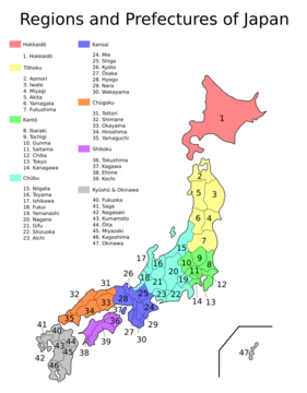
Saitama Prefecture is an inland prefecture of Japan located in the Kantō region of Honshu. It borders Tokyo to the south and several other prefectures, and its capital and largest city is Saitama City. Historically part of Musashi Province, the area was known as a fertile agricultural region that supplied food for the Kantō region, and its modern development as a residential and commercial suburb of Tokyo has driven rapid population growth since 1960.
Quick Facts
- Native Name
- ja · 埼玉県
- Settlement Type
- Prefecture
- Blank Emblem Type
- Symbol
Facts from the source article.
Lore & Background
The area that became Saitama Prefecture was part of Musashi Province under the Ritsuryō system. In 708, copper deposits were reported in the Chichibu District. During the Edo period, the region contained shogunate domains and fiefdoms such as Kawagoe, Oshi, and Iwatsuki. After the Meiji Restoration, various short-lived prefectures—including Ōmiya (later Urawa) and Iruma—were consolidated, and by 1876 the prefecture reached its present extent, except for minor later transfers to Tokyo. The prefectural capital was originally Urawa Town, which became a city in 1934; in 2001, Urawa merged with Ōmiya and Yono to form Saitama City, the prefecture's first designated major city (2003).
Reader's Guide
Saitama Prefecture's significance lies in its transformation from an agricultural breadbasket for the Kantō region into a densely populated suburban extension of Tokyo. Its population nearly tripled after 1960 as metropolitan rail lines connected its cities to central Tokyo, making it a key residential and commercial zone. The prefecture's geography spans from the mountainous west—including Mount Sanpō, the highest peak, and part of Chichibu Tama Kai National Park—to the eastern lowlands and plateaus of the Kantō Plain. Ōmiya Station in Saitama City serves as a major railway hub for Shinkansen and conventional lines. The prefecture's modern boundaries were shaped by the Meiji-era consolidation of former domains and prefectures, and its administrative history reflects the broader reorganization of Japan's provincial system. Today, Saitama remains an integral part of the Greater Tokyo Area, balancing its historical rural heritage with contemporary urban growth.
Did You Know?
- Saitama Prefecture's population has nearly tripled since 1960.
- The prefecture's highest mountain is Mount Sanpō (2,483 m) on the border with Nagano.
- Saitama City was created in 2001 by merging Urawa, Ōmiya, and Yono.
More in Prefectures Of Japan 1-24
Spotted an error? Know more?
Reader corrections go straight into our review queue. Suggest an edit · How this site is sourced