Ōita Prefecture
Japan's prefecture with the most hot springs and abundant natural resources.

663highland · via Wikipedia: Ōita Prefecture · CC BY 2.5
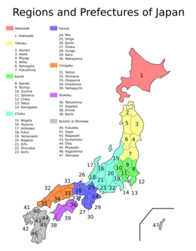
Ōita Prefecture is a prefecture of Japan located on the island of Kyūshū, bordered by Fukuoka, Kumamoto, and Miyazaki prefectures. It is known for having more hot springs than any other Japanese prefecture, making it a popular tourist destination for onsen and ryokan, particularly in and around the city of Beppu.
- Capital
- Ōita
- Population
- 1,081,646 (as of 1 February 2025)
- Area
- 6,340 km²
- Location
- Northeast Kyūshū, Japan
- Known for
- Largest number of hot springs in Japan; top producer of kabosu limes, dried shiitake mushrooms, saffron, galingale, and madake bamboo
Lore & Background
Around the 6th century, Kyushu consisted of four regions, including Toyo Province, which was later divided into Bungo and Buzen provinces. After the Meiji Restoration, districts from these provinces were combined to form Ōita Prefecture. The name Ōita is documented in the early 8th-century Chronicles of Bungo, where Emperor Keikō, upon visiting Toyo-no-Kuni, exclaimed 'This is a vast land, indeed. It shall be known as Okita-Kuni!'—meaning 'Land of the Great Fields'—which later came to be written as 'Ōita'. Present-day interpretations based on topography suggest the name derives from 'Okita' meaning 'many fields' due to the complex terrain.
In the Edo period (1603–1867), the town of Hita served as the government seat for the entire domain of Kyushu, directly controlled by the shōgun. The region became known for the money-lending industry based out of Hita, known as Hita-kin, developed by merchants in Hita's Mameda and Kuma districts working with the national government.
The prefecture's geography is shaped by volcanic belts, including the Kirishima Range, contributing to its numerous hot springs. Mountain ranges such as Mount Kujū, Mount Yufu, and Mount Tsurumi cover 70% of the land in forests. Major rivers include the Yamakuni, Yakkan, Ōita, Ōno, and Banjō rivers. The coastline features Beppu Bay and the Bungo Channel, with a 759 km coastline that includes shoals in the north and a jagged rias coastline in the south.
Reader's Guide
Ōita Prefecture holds significance as a major tourist destination in Japan, primarily due to its unparalleled number of hot springs, especially in Beppu. Its natural parks, including Aso Kujū and Setonaikai National Parks, along with several quasi-national and prefectural parks, cover 28% of the land area, preserving diverse landscapes from volcanic highlands to limestone caves.
Economically, Ōita is Japan's leading producer of several agricultural and specialty products: kabosu limes, dried shiitake mushrooms, saffron (producing 80% of Japan's total in the Taketa area), galingale (used for Ryukyu-style tatami mats), and madake bamboo (making up 60% of Japan's cultivated bamboo). These products, along with fishery and manufactured goods, form the backbone of the prefecture's industrial activity.
Culturally, Ōita is home to Usa Jingū, the head shrine of more than 40,000 Hachiman shrines, and the ichinomiya shrines Sasamuta-jinja and Yusuhara Hachiman-gū. The prefecture underwent significant municipal mergers from 2005 to 2006, reducing the number of municipalities from 58 to 18, making it the prefecture with the fewest towns and villages in Japan. Its legacy as the 'Land of Abundance' (Toyo-no-Kuni) endures through its rich natural resources and thermal waters.
Did You Know?
- Usa Jingū in Ōita is the head shrine of more than 40,000 Hachiman shrines across Japan.
- Ōita is Japan's top producer of kabosu limes, dried shiitake mushrooms, saffron, galingale, and madake bamboo.
- The name Ōita may derive from 'Okita', meaning 'many fields', due to the prefecture's complex terrain.
More in Prefectures Of Japan 1-24
Spotted an error? Know more?
Reader corrections go straight into our review queue. Suggest an edit · How this site is sourced