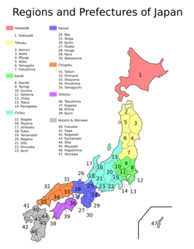
Aichi Prefecture
Aichi Prefecture is Japan's industrial heartland and home to Toyota.

AichiWikiFixer · CC BY-SA 4.0
Aichi Prefecture, located on the Pacific coast of central Honshū, is a major economic and industrial hub of Japan. Its capital, Nagoya, is the country’s fourth-largest city and forms the core of the Chūkyō metropolitan area, the third-largest metropolitan region in Japan and one of the largest in the world. The prefecture is bordered by Mie, Gifu, Nagano, and Shizuoka prefectures, and its geography includes the Nōbi Plain and the Ise and Mikawa Bays. The highest point is Mount Chausuyama. Historically, the area comprised the two provinces of Owari and Mikawa, which were unified after the Meiji Restoration. Nagoya Prefecture was renamed Aichi in 1872 and merged with Nukata Prefecture later that year. The prefecture is world-renowned as the home of the Toyota Motor Corporation, and its economy is exceptionally strong: it holds the second-largest gross domestic product in Japan, leads the nation in the shipment value of manufactured goods, and ranks highly in commerce and agriculture. Key industries include automotive, aerospace, ceramics, and steel manufacturing. Major cities beyond Nagoya include Toyota, Okazaki, and Ichinomiya. The prefecture hosted the Expo 2005 World Exposition in Seto and Nagakute. Notable attractions include the Higashiyama Zoo and Botanical Gardens, Chubu Centrair International Airport, and Legoland Japan Resort. Approximately 23% of its land is designated as natural parks, including several quasi-national parks. The name “Aichi” derives from the historical Ayuchi tidal flats, referenced in an ancient poem.
Lore & Background
Originally divided into the provinces of Owari and Mikawa, Aichi Prefecture was formed after the Meiji Restoration, with its government located in Nagoya, the old capital of Owari. The name Aichi derives from the ancient Ayuchi tidal flats, referenced in a poem from the *Man'yōshū*. The prefecture is situated near the center of Honshu, facing Ise and Mikawa Bays to the south, and borders Mie, Gifu, Nagano, and Shizuoka prefectures. It forms a major part of the Nōbi Plain, with its highest point at Chausuyama. The western area is dominated by Nagoya, Japan’s fourth-largest city, while the eastern part contains major industrial centers. Aichi is home to the Toyota Motor Corporation and has a robust economy, with the second-largest gross domestic product in Japan and the highest shipment value of manufactured goods. Its industries include automotive, aerospace, ceramics, and steel. The prefecture also has significant agricultural output. About 23% of its land is designated as natural parks, including quasi-national parks and prefectural parks. The Expo 2005 World Exposition was held in Seto and Nagakute. Notable locations include the Higashiyama Zoo and Botanical Gardens, Chubu Centrair International Airport, and Legoland Japan Resort.
Reader's Guide
Its industrial structure is well-balanced, with high rankings in agriculture, commerce, and manufacturing. The prefecture hosts major companies such as Toyota Motor Corporation and operates plants or branch offices of Fuji Heavy Industries, Mitsubishi Motors, Pfizer, Sony, Suzuki, Bodycote, and Volkswagen Group. Aichi is also notable for its cultural sites, including the Meiji Mura open-air architectural museum, Nagoya Castle, and the Higashiyama Zoo and Botanical Gardens. Its transportation infrastructure includes Chubu Centrair International Airport, the Tokaido Shinkansen, and multiple rail and port facilities.
Did You Know?
- The name Aichi comes from the ancient Ayuchi tidal flats mentioned in a poem in the Man'yōshū.
Geographic Character & Natural Terrain
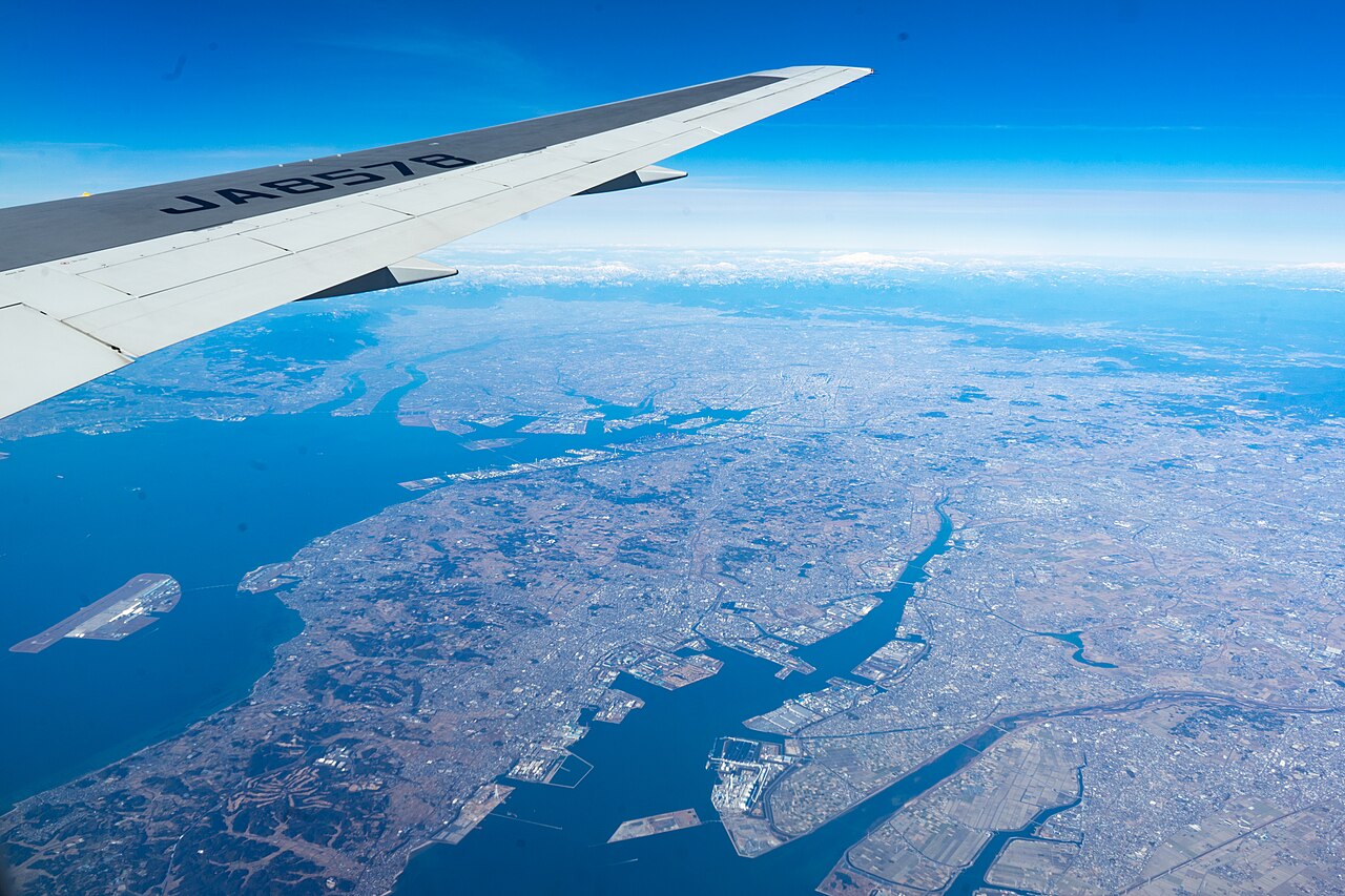
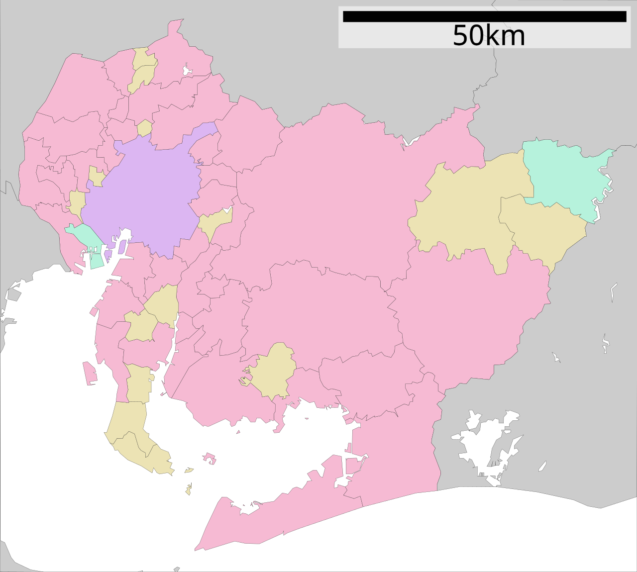
Aichi Prefecture sits near the center of Honshu, stretching 106 km east to west and 94 km south to north. Its southern coastline opens onto the Ise and Mikawa Bays, while its interior forms a major portion of the Nōbi Plain. The terrain ranges from the densely built western suburbs around Nagoya to the less crowded eastern stretches that still host significant industrial centers. The highest point, Chausuyama, rises to 1,415 meters above sea level, a stark contrast to the flat coastal lowlands that define much of the prefecture. Despite its urban reputation, roughly 23% of the prefecture's land is set aside as Natural Parks, including the Aichi Kōgen, Hida-Kisogawa, Mikawa Wan, and Tenryū-Okumikawa Quasi-National Parks, plus seven additional Prefectural Natural Parks. The prefecture covers about 5,173 square kilometres, roughly 1.36% of Japan's total land area, and is bordered by Mie to the west, Gifu and Nagano to the north, and Shizuoka to the east.
Economic Engine of Japan
Aichi's industrial might places it among the most economically significant prefectures in the country. Its gross domestic product ranks second in Japan, while the shipment value of manufactured goods sits at number one nationally. Annual product sales hold the third position, and agricultural output ranks eighth, reflecting a remarkably balanced industrial structure. The prefecture is the home base of Toyota Motor Corporation and hosts operations from companies including Fuji Heavy Industries, Mitsubishi Motors, Pfizer, Sony, Suzuki, Bodycote, and Volkswagen Group. Key sectors span aerospace, automotive manufacturing, ceramics, and steel and alloy production. The Mikawa Port serves primarily as an automobile and car parts export hub, while Nagoya Port functions as an international container gateway with ferry connections to Sendai and Tomakomai in Hokkaido. This combination of manufacturing depth and export infrastructure makes Aichi a central node in Japan's industrial economy.
Historical Formation & the Name Aichi
Before the Meiji Restoration, the territory now known as Aichi was split between two provinces: Owari and Mikawa. Following the abolition of the han system in 1871, Owari (excluding the Chita Peninsula) became Nagoya Prefecture, while Mikawa merged with the Chita Peninsula to form Nukata Prefecture. In April 1872, Nagoya Prefecture was renamed Aichi, and on 27 November of that year it was united with Nukata to create the modern prefecture. The name itself traces back to the Man'yōshū, where a poem by Takechi Kurohito references Ayuchi flats and the cry of a crane over the tidal marsh. That original Ayuchi-gata has largely vanished, with the Fujimae tidal flat remaining as a protected remnant. The prefectural government office in Nagoya, the old capital of Owari, has anchored administration since the 1871 reorganization, and the Aichi Prefectural Police have maintained law enforcement continuity from that same year.
Metropolitan Core & Transport Infrastructure
Nagoya, Japan's fourth-largest city, serves as both the capital of Aichi and the anchor of the Chūkyō metropolitan area, the third-largest urban region in Japan and one of the largest globally. The prefecture's population of over 7.4 million people is concentrated heavily in the western portion around Nagoya and its suburbs, while the eastern half, though less dense, still contains major industrial centers. Aichi's transport network is extensive: the Tokaido Shinkansen and multiple JR Central lines cross the prefecture, while Meitetsu operates a web of private railways including the Nagoya, Inuyama, Komaki, Centrair, Tokoname, Seto, Toyokawa, Gamagori, Toyota, Chita, Mikawa, Bisai, Chikko, and Tsushima lines. The Nagoya Municipal Subway adds five urban lines, and Kintetsu runs the Nagoya and Aonami lines. Air access is provided by Chubu Centrair International Airport and Nagoya Airfield, while the Linimo people-mover and Nagoya Guideway Bus offer additional transit options.
Gallery
More in Prefectures Of Japan 1-24
Spotted an error? Know more?
This is a living reference — every entry is fact-audited, and reader corrections feed straight into our audit queue. Suggest an edit · See this site's audit record