
Fort Donelson National Battlefield
Site of key Union victories opening the Tennessee and Cumberland Rivers.
Last updated
Where it is
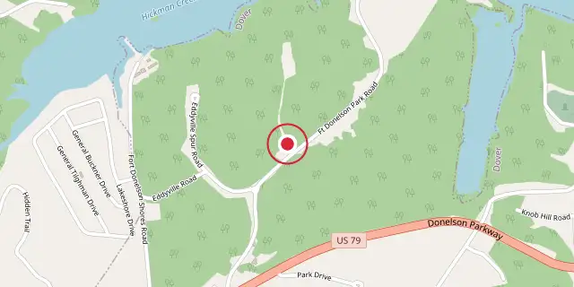
Coordinates: 36°29′13″N 87°51′40″W (36.4870, -87.8610) · Open in OpenStreetMap
Coordinates and connected clubs: the infobox of Wikipedia: Fort Donelson National Battlefield (CC BY-SA 4.0). Map: drawn by Codexery from OpenStreetMap tiles.
Fort Donelson National Battlefield includes Fort Donelson and Fort Heiman, key sites from the Civil War campaign where Union forces under Grant and Foote captured three Confederate forts. These February 1862 victories, the Union's first major successes, led to the seizure of Nashville and gave the North control over much of Tennessee.
History
The most vulnerable area in the Confederate defensive line in the Western Theater was Kentucky, whose neutrality prevented the Confederacy from building defensive works there. The Tennessee and Cumberland Rivers offered potential invasion routes into the South. In May 1861, engineers Adna Anderson and William F. Foster surveyed sites along the Cumberland River near the Kentucky border.
Anderson laid out the water battery of Fort Donelson on the west bank, 12 miles from the Kentucky line. The fort was named for Confederate General Daniel S. Donelson, who with Colonel Bushrod Johnson approved the site. Construction began using labor from the nearby Cumberland Iron Works.
Administrative history of the park
Originally designated a national military park in March 1928, this site was later placed under National Park Service control in August 1933. It earned a spot on the National Register of Historic Places in October 1966 and was reclassified as a national battlefield in August 1985. A 2004 law expanded its authorized boundary from 551.69 to 2,000 acres. In October 2006, Calloway County transferred the Fort Heiman site, which had been listed on the National Register since December 1976, to the Park Service.
Park today
The park preserves much of the original battle site, including river batteries and eroded fort remains, though the area of the Confederate attack on February 15, 1862, is largely in private hands with residential development. The Cumberland River was dammed in the 1960s, creating Lake Barkley, which covers an area similar to the river at flood stage during the battle. The Civil War Trust and partners have acquired and preserved 368 acres of the battlefield, most conveyed to the NPS.
Did You Know?
- Fort Donelson National Cemetery contains 670 Union dead, reinterred in 1867.
- The cemetery is 15.34 acres in Stewart County and is unavailable for additional burials.
More in National Battlefields and Military Parks of the United States
Sources
Compiled from Wikipedia and the sources listed below. Text from Wikipedia is available under CC BY-SA 4.0; this entry is adapted from it.
- Wikipedia: Fort Donelson National Battlefield (CC BY-SA 4.0).
Spotted an error? Know more?
Reader corrections go straight into our review queue. Suggest an edit · How this site is sourced