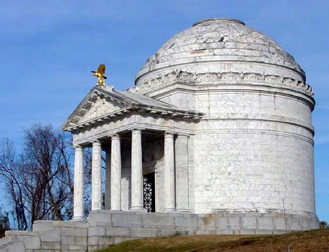
Monocacy National Battlefield
Site of the 1864 battle that saved Washington.
Last updated
Where it is
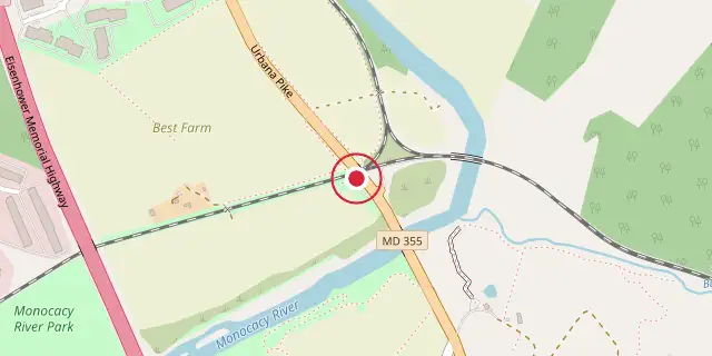
Coordinates: 39°22′16″N 77°23′31″W (39.3710, -77.3920) · Open in OpenStreetMap
Coordinates and connected clubs: the infobox of Wikipedia: Monocacy National Battlefield (CC BY-SA 4.0). Map: drawn by Codexery from OpenStreetMap tiles.
Monocacy National Battlefield is a unit of the National Park Service that preserves the site of the Battle of Monocacy, fought on July 9, 1864, during the American Civil War. The engagement, sometimes called 'The Battle That Saved Washington,' was one of the last Confederate operations on Union soil. The opposing commanders were General Jubal Early for the Confederacy and General Lew Wallace for the Union. The battlefield straddles the Monocacy River southeast of Frederick, Maryland.
History
For more than a century after the Civil War, most of the Monocacy battlefield remained in private ownership. In 1928, Glenn Worthington, who owned a large portion of the northern segment, petitioned Congress to create a National Military Park at Monocacy. Although a bill passed in 1934, nearly fifty years passed before Congress appropriated funds for land acquisition. In the late 1970s, 1587 acres were acquired and turned over to the National Park Service.
The historic Thomas Farm, site of intense fighting, was acquired in 2001. Preservation efforts suffered setbacks in the 1960s and 1980s when Interstate 270 was built and later widened, cutting through part of the battlefield. Early commemorative markers were placed by veterans organizations, including those for the 14th New Jersey (1907), 87th Pennsylvania Infantry, and Vermont units. Later additions include the Confederate Monument and the Maryland Centennial Monument near the Best farm, where Union soldiers discovered Robert E. Lee's lost Special Order 191 during the 1862 Maryland Campaign.
The visitor center, relocated from Gambrill Mill to a new facility west of the Monocacy River, offers an electric map orientation program, interactive computer program, interpretive displays, and artifacts. A self-guided four-mile auto tour and a half-mile loop walking trail begin at the visitor center. The National Park Service has established a General Management Plan to further interpret the area and acquire additional land if funding permits. In 2013, Preservation Maryland listed Monocacy National Battlefield as a threatened historic property.
Location
Monocacy National Battlefield lies on present-day Maryland Route 355 (Urbana Pike) a few miles southeast of Frederick, Maryland. Interstate 70 runs westward to Antietam National Battlefield, while U.S. Route 15 leads north to Gettysburg Battlefield and south to Ball's Bluff battlefield. The park is 50 miles west of Baltimore and 44 miles northwest of Washington D.C.
Frequently Asked Questions
Where is Monocacy National Battlefield?
Monocacy National Battlefield is located in Frederick County, Maryland, USA.
When was Monocacy National Battlefield founded?
Monocacy National Battlefield was founded on June 21, 1934.
More in National Battlefields and Military Parks of the United States
Sources
Compiled from Wikipedia and the sources listed below. Text from Wikipedia is available under CC BY-SA 4.0; this entry is adapted from it.
- Wikipedia: Monocacy National Battlefield (CC BY-SA 4.0).
Spotted an error? Know more?
Reader corrections go straight into our review queue. Suggest an edit · How this site is sourced