Kings Mountain National Military Park
Site of a pivotal Revolutionary War battle.
Last updated
Where it is
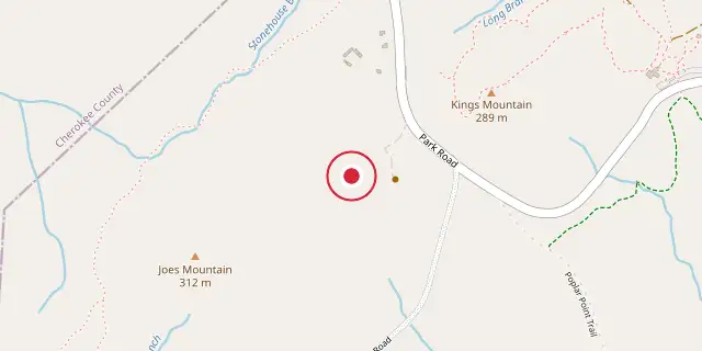
Coordinates: 35°08′17″N 81°23′20″W (35.1380, -81.3890) · Open in OpenStreetMap
Coordinates and connected clubs: the infobox of Wikipedia: Kings Mountain National Military Park (CC BY-SA 4.0). Map: drawn by Codexery from OpenStreetMap tiles.
This national military park, located near Blacksburg, South Carolina, straddles the border with North Carolina. It honors the Battle of Kings Mountain, where American Patriots defeated American Loyalists in a crucial Revolutionary War Southern Campaign fight. Thomas Jefferson called that victory "The turn of the tide of success."
Battle of Kings Mountain
For most of the Revolutionary War, the fighting stayed in the North. But after a failed campaign there, British General Clinton shifted his focus to the South, expecting loyalist support to make conquest easy. He first captured Charleston after a two-month siege. Leaving General Cornwallis in charge of the Southern Campaign, Clinton went back to New York, ordering Cornwallis to secure South Carolina, then push into North Carolina and Virginia.
Following Charleston’s fall, Colonel Abraham Buford, whose 400 Virginians had arrived too late to help, tried to retreat to Virginia. In late May, Colonel Tarleton’s men caught up with him, sparking the Battle of Waxhaws.
Buford sent a surrender offer, but Tarleton ignored it. His troops killed 113 of Buford’s men, wounded about 50 so severely they couldn’t be moved, took another 50 prisoner, and let about 200 escape. This brutal encounter fueled armed resistance across the South, especially in the Carolinas.
Establishment
Kings Mountain National Military Park was created by Congress on March 3, 1931 to honor the Battle of Kings Mountain. It marks the end of the Overmountain Victory National Historic Trail, which follows the Patriot army’s path from across the Appalachian Mountains to the fight. The park sits next to Kings Mountain State Park, where visitors can camp, picnic, and explore a living history farm. It lies about 30 miles south of Charlotte, North Carolina, and roughly 60 miles north of Greenville, South Carolina.
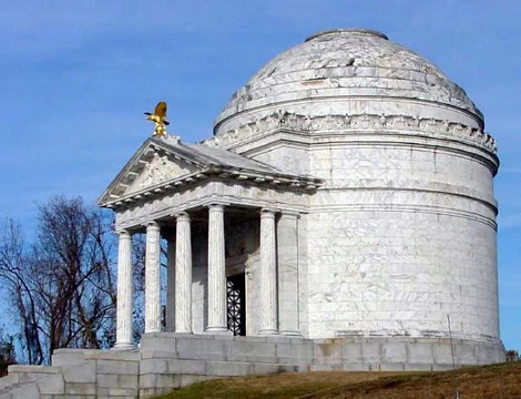
From I-85 North, the mountain is visible for many miles. A 1.5-mile paved trail starts at the visitor center, winds around the mountain’s base along the Patriot lines, and climbs to the crest where the Loyalists stood. Along the way, it passes several monuments—the oldest from 1815—and Patrick Ferguson’s grave, giving a clear feel for the battlefield. The trail has some moderately steep sections, but as part of the NPS Centennial Initiative, it will be rebuilt to remove those steeper parts, making it fully accessible.
On the battle’s 150th anniversary, President Herbert Hoover gave a speech calling the site “a place of inspiring memories.” A year later, the Daughters of the American Revolution placed a monument near where Hoover stood. It reads: “ON THIS SITE / PRESIDENT HOOVER / ADDRESSED AN AUDIENCE OF 75,000 / AT THE CELEBRATION OF THE / SESQUI CENTENNIAL / OF THE BATTLE OF KINGS MOUNTAIN,” followed by the date. That monument is a stop on the historic loop trail.
Did You Know?
- The Battle of Kings Mountain was fought on October 7, 1780.
- The victory destroyed the left wing of Lord Cornwallis' army, effectively ending Loyalist ascendance in the Carolinas.
Frequently Asked Questions
Where is Kings Mountain National Military Park?
Kings Mountain National Military Park is located in York; Cherokee counties, South Carolina.
When was Kings Mountain National Military Park founded?
Kings Mountain National Military Park was founded on August 10, 1933.
More in National Battlefields and Military Parks of the United States
Sources
Compiled from Wikipedia and the sources listed below. Text from Wikipedia is available under CC BY-SA 4.0; this entry is adapted from it.
- Wikipedia: Kings Mountain National Military Park (CC BY-SA 4.0).
Spotted an error? Know more?
Reader corrections go straight into our review queue. Suggest an edit · How this site is sourced