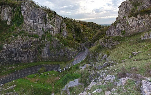
Glenwood Canyon
Scenic canyon on the Upper Colorado River in western Colorado.
Last updated
Glenwood Canyon is a rugged, scenic gorge in western Colorado, stretching 12.5 miles (20 km) along the Colorado River. Its walls rise as high as 1,300 feet (400 m) above the river, making it the largest canyon of its kind on the Upper Colorado. The canyon runs from near Dotsero, where the Colorado meets the Eagle River, downstream in a west-southwest direction to just east of Glenwood Springs at the mouth of the Roaring Fork. Most of the canyon lies in Garfield County, while its upper portion near Dotsero is in Eagle County.
Geology
Geologically, the canyon was carved relatively recently during the Pleistocene epoch, as the Colorado River rapidly cut through layers of sedimentary rock. The upper canyon walls consist of sandstone from the Pennsylvanian and Mississippian periods, with the Mississippian layer, part of the Leadville Formation, prominent along the upper rim. Lower sections of the walls are made of Cambrian rock.
Railroads
Historically, the canyon has served as a vital transportation corridor. In the late 19th century, it provided the route for the Denver and Rio Grande Western Railroad, a line now part of the Union Pacific system and its Central Corridor between Denver and Grand Junction. In 1906, the Taylor State Road, a gravel route and the first automobile road through the Colorado Rockies, was built through the canyon. The canyon was also a famed scenic highlight for the California Zephyr passenger train; a monument to the dome car design originally stood there but was moved to the Colorado Railroad Museum in Golden during the 1990s to make way for Interstate 70 construction.
Interstate 70
Today, the canyon carries both Interstate 70 and the Union Pacific line. I-70 is widely regarded as one of the most scenic stretches of the U.S. Interstate Highway System. Foot access is available at four rest areas along the freeway, including the Hanging Lake Rest Area (exit 125), where the highway is concealed within the Hanging Lake Tunnel. The freeway is prone to rockslides, with notable closures occurring in February 2016 and July 2021.
Last updated 2026-10-05 from the source article.
Quick Facts
- Major routes
- Interstate 70 and Union Pacific's Central Corridor
- Notable feature
- Hanging Lake Tunnel and four rest areas along I-70
Facts from the source article.
More in Caves & Gorges
Related in Caves & Gorges
Links follow this subject's own source article.
Sources
Compiled from Wikipedia and the sources listed below. Text from Wikipedia is available under CC BY-SA 4.0; this entry is adapted from it.
- Wikipedia: Glenwood Canyon (CC BY-SA 4.0).
- Word definitions: the , each quoted from its Wikipedia article.
Spotted an error? Know more?
Reader corrections go straight into our review queue. Suggest an edit · How this site is sourced