
Aqueduct of Padre Tembleque
A 16th-century Mexican aqueduct named after Friar Francisco de Tembleque.

Necropxia · CC BY-SA 4.0
The Aqueduct of Padre Tembleque, also known as the Tembleque Aqueduct, is a historic hydraulic system in Mexico. It was built between the towns of Zempoala, Hidalgo, and Otumba in the State of Mexico, and takes its name from the Spanish friar Francisco de Tembleque.
- Location
- Between Zempoala, Hidalgo, and Otumba, State of Mexico
- Construction period
- 1553 to 1570
- Length
- 45 kilometers (28 miles)
- Source
- Tecajete volcano east of Zempoala
- Terminus
- Otumba
- Tallest arch height
- 38.75 meters (127.1 feet)
- Unesco inscription
- 5 July 2015
Lore & Background
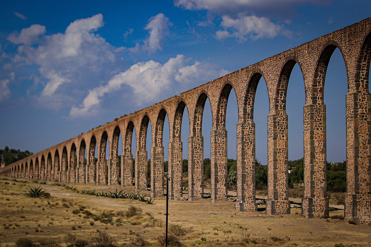
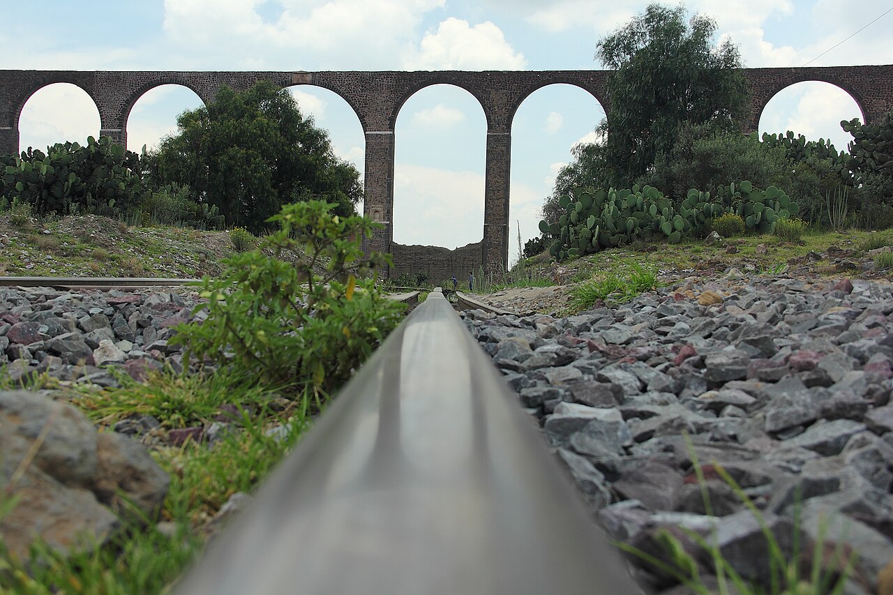
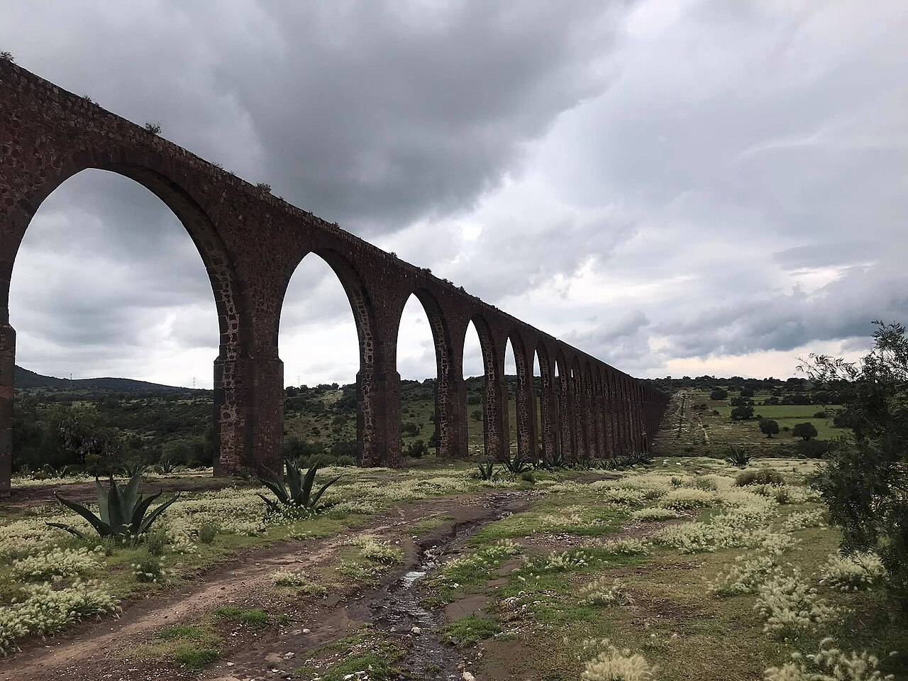
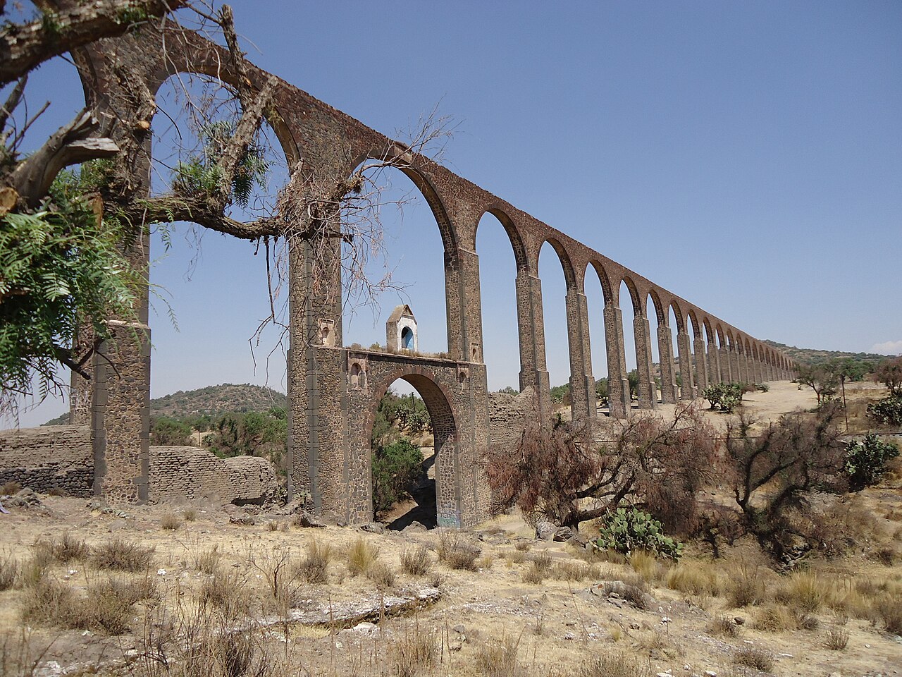
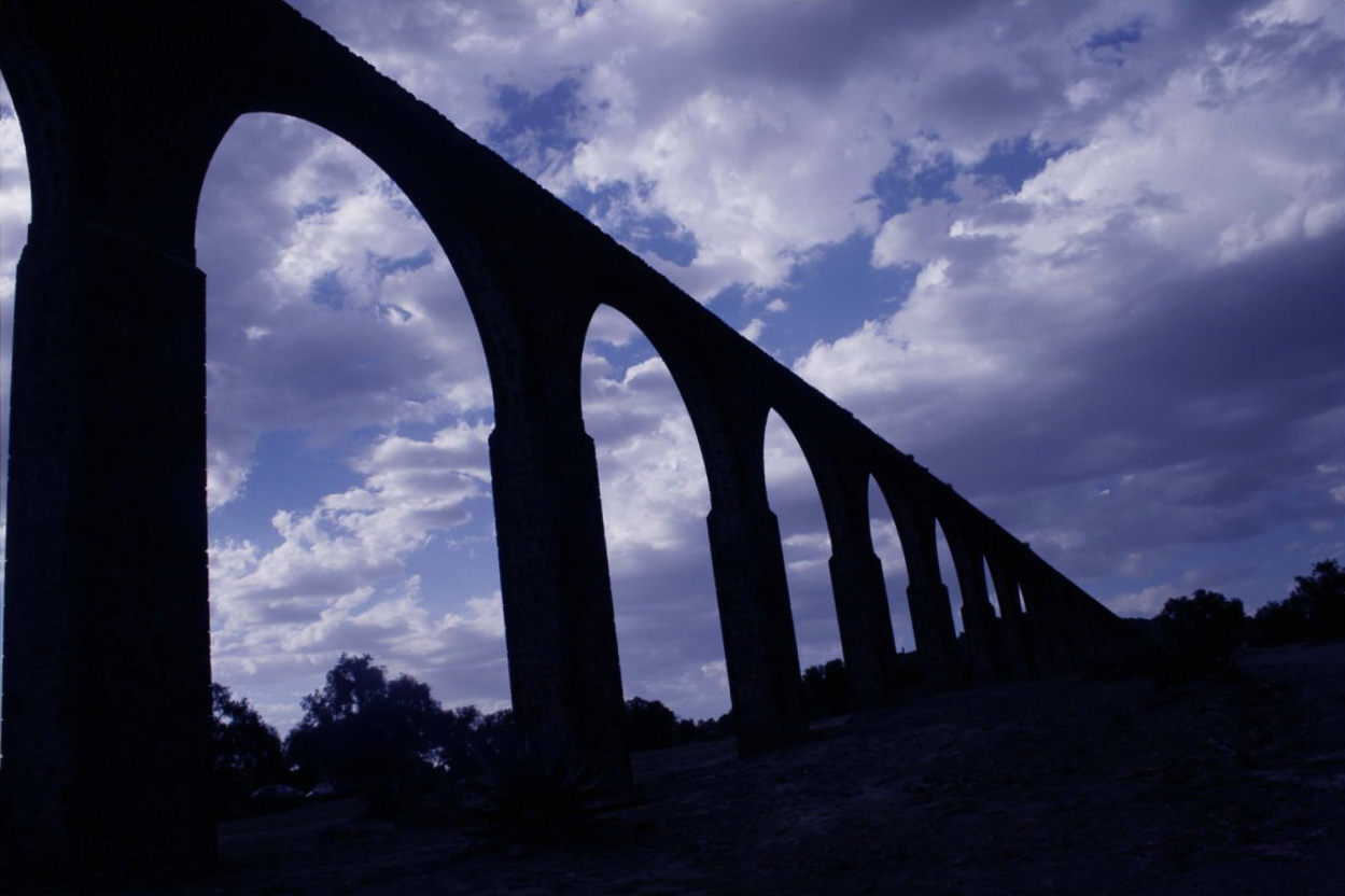
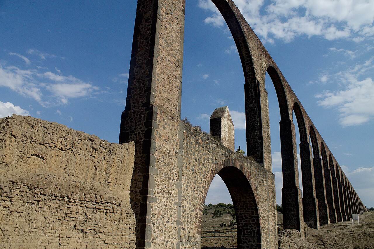
The aqueduct was originally constructed between 1553 and 1570, stretching 45 kilometers from the Tecajete volcano east of Zempoala to Otumba. It passed mostly at ground level, but also went underground and over ravines and valleys. Three arcades were built along its route: the first has 46 arches, the second has 13 arches, and the third has 67 arches. The highest valley spanned is Papalote ravine, crossed by the 67-arch Main Arcade, whose tallest arch stands 38.75 meters high.
Reader's Guide
The Aqueduct of Padre Tembleque is significant as a major hydraulic engineering work from the 16th century in Mexico. It demonstrates the adaptation of European water conveyance techniques to the local landscape, spanning 45 kilometers with a combination of ground-level channels, underground sections, and arcades over ravines. Its inclusion on the UNESCO World Heritage List in 2015 recognizes its cultural and historical value. The structure is named after the Spanish friar Francisco de Tembleque, reflecting the religious and colonial context of its construction. The aqueduct's three arcades, particularly the 67-arch Main Arcade over Papalote ravine, highlight the scale and ambition of the project. It remains a testament to pre-industrial infrastructure and the blending of indigenous and European knowledge.
Did You Know?
- The aqueduct was built between 1553 and 1570.
- It stretches 45 kilometers from Tecajete volcano to Otumba.
- The tallest arch is 38.75 meters high, part of the 67-arch Main Arcade over Papalote ravine.
- It was inscribed as a UNESCO World Heritage Site on 5 July 2015.
Origins & the Friar's Enduring Name
The Aqueduct of Padre Tembleque takes its name from a Spanish friar, Francisco de Tembleque, whose association with the project gave this remarkable hydraulic structure its enduring identity. Built over a period spanning roughly 1553 to 1570, the aqueduct represents a significant chapter in sixteenth-century Mexican engineering. Situated in the region between the town of Zempoala in the state of Hidalgo and Otumba in the State of Mexico, the structure was designed to carry water across a considerable distance. The fact that construction stretched across approximately seventeen years speaks to the scale and ambition of the undertaking. As a Mexican aqueduct, it stands as a testament to the engineering capabilities of its era. The naming after a religious figure underscores the intertwined relationship between faith and public works during this period, and the friar's name has remained attached to the structure for nearly five centuries.
Engineering Scale & the Three Arcades
Stretching a remarkable 45 kilometres, the aqueduct represents a feat of hydraulic engineering that demanded careful negotiation of diverse terrain. Rather than following a single uniform path, the structure adapted to the landscape: it ran at ground level for much of its length, descended underground in certain stretches, and rose dramatically above ravines and valleys where the topography required it. Three distinct arcades punctuate the route, each a study in graduated ambition. The first arcade features 46 arches, the second a more modest 13, and the third—the most spectacular—comprises 67 arches. This final structure, commonly called the Main Arcade, spans the Papalote ravine, the highest valley the aqueduct crosses. Its tallest arch soars to 38.75 metres, a height that would have been staggering for its era and remains a striking visual landmark in the Mexican landscape.
Geographic Setting & the Cross-State Route
The aqueduct's route traces a path through the varied landscape of central Mexico, connecting two distinct administrative regions. It originates at the Tecajete volcano, positioned just to the east of Zempoala in the state of Hidalgo, and travels 45 kilometres before reaching its endpoint at Otumba in the State of Mexico. This cross-state journey means the structure passes through a range of geological and topographical conditions, from volcanic foothills to deep ravines and open valleys. The route was not a simple straight line; the aqueduct had to negotiate the natural contours of the land, sometimes hugging the ground, sometimes disappearing beneath it, and at other times soaring above dramatic drops in elevation. The Papalote ravine represents the most extreme challenge along this corridor, requiring the construction of the aqueduct's most ambitious architectural element. The choice of Zempoala and Otumba as the bookends of this waterway reflects the practical needs of communities separated by difficult terrain.
World Heritage Recognition & Global Standing
The international recognition of the Aqueduct of Padre Tembleque unfolded over more than a decade, reflecting the gradual process by which cultural heritage sites gain global standing. The site was first added to the UNESCO World Heritage Tentative List on 20 November 2001, classified under the Cultural category. This tentative listing served as an acknowledgment of the aqueduct's outstanding universal value while the formal nomination process continued. Nearly fourteen years later, on 5 July 2015, the aqueduct achieved full inscription on the World Heritage Site list, cementing its status as a site of international significance. This recognition places the Tembleque Aqueduct among Mexico's most celebrated cultural landmarks and highlights the enduring importance of sixteenth-century hydraulic engineering. The journey from tentative listing to full inscription underscores the sustained scholarly and institutional effort required to document, preserve, and advocate for a structure's heritage value on the world stage.
Gallery
Frequently Asked Questions
What is the Aqueduct of Padre Tembleque?
It is a 16th-century hydraulic engineering structure in central Mexico that channels water from the slopes of the Tecajete volcano down to the town of Otumba. Spanning roughly 45 kilometers, it is one of the longest and oldest functioning aqueducts on the continent and holds UNESCO World Heritage status.
Where exactly is the Tembleque Aqueduct located?
The structure stretches between the town of Zempoala in the state of Hidalgo and Otumba in the State of Mexico. Its water source sits on the eastern flank of the Tecajete volcano near Zempoala, and the channel terminates in Otumba.
Who was Padre Tembleque and why does the aqueduct bear his name?
Francisco de Tembleque was a Spanish friar who spearheaded the project to bring much-needed water to the Otumba region in the mid-1500s. The completed system was popularly named after him in recognition of his role as its driving force.
When was the Aqueduct of Padre Tembleque built?
Construction took place between 1553 and 1570, a span of roughly seventeen years. It was one of the earliest large-scale hydraulic works carried out in colonial New Spain.
What is the most impressive architectural feature of the aqueduct?
Its tallest arch rises to 38.75 meters (about 127 feet) above the ground, making it a striking landmark in the valley. The entire 45-kilometer channel is supported by a series of arches of varying heights that follow the terrain between Zempoala and Otumba.
More in World Heritage Sites in Mexico 1-24
Spotted an error? Know more?
Reader corrections go straight into our review queue. Suggest an edit · How this site is sourced