Norwegian Sea
Marginal sea northwest of Norway, ice-free year-round.

Wikipedia / Wikimedia Commons
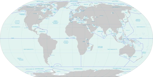
The Norwegian Sea sits northwest of Norway, a marginal sea that can be classified as part of either the Atlantic or Arctic Ocean. It lies between the North Sea and the Greenland Sea, with the Barents Sea to its northeast. A submarine ridge running from Iceland to the Faroe Islands cuts it off from the Atlantic in the southwest, while the Jan Mayen Ridge separates it from the Greenland Sea to the north. Unlike most seas, the Norwegian Sea’s floor is largely not continental shelf, giving it an average depth of about two kilometres (1.2 miles). Beneath that bottom, commercial exploration has found rich oil and natural gas deposits in areas where the water is up to roughly one kilometre (0.6 miles) deep. Fish like cod travel from the North Atlantic or Barents Sea to spawn in the coastal zones, which are abundant with marine life. The warm North Atlantic Current keeps water temperatures relatively stable and high, so the sea stays ice-free all year—unlike Arctic seas. Recent studies suggest that the Norwegian Sea’s large water volume and heat-absorbing capacity matter more for Norway’s mild winters than the Gulf Stream and its branches do.
**Extent**
The International Hydrographic Organization sets the Norwegian Sea’s boundaries as follows: - On the northeast: A line from the southernmost point of West Spitzbergen to North Cape of Bjørnøya (Bear Island), then through that island to Cape Bull, and onward to North Cape, Norway (25°45'E). - On the southeast: The west coast of Norway from North Cape to Cape Stadt (62°10′N 5°00′E). - On the south: From a point on Norway’s west coast at latitude 61°00' N, east along that parallel to longitude 0°53' W, then a line to the northeast tip of Fuglö (62°21′N 6°15′W), and finally to the east point of Gerpir (65°05′N 13°30′W) in Iceland. - On the west: The southeastern limit of the Greenland Sea—a line from the southernmost point of West Spitzbergen to the northern point of Jan Mayen Island, down the island’s west coast to its southern extreme, then a line to the eastern extreme of Gerpir in Iceland.
**Formation and geography**
The Norwegian Sea formed about 250 million years ago when the Eurasian Plate (carrying Norway) and the North American Plate (carrying Greenland) began drifting apart. What was then a narrow shelf sea between Norway and Greenland widened and deepened. The present continental slope marks the old border between those landmasses from that time. In the north, this slope extends east from Svalbard; in the southwest, it runs between Britain and the Faroes. These slopes host rich fishing grounds and many coral reefs. After the continents separated, settling of the shelf triggered landslides, including the Storegga Slide roughly 8,000 years ago, which caused a major tsunami. The last ice age shaped the coasts. Glaciers several kilometres high pushed inland, carving fjords, scraping crust into the sea, and extending the continental slopes—especially off Norway’s coast near Helgeland and north to the Lofoten Islands. The Norwegian continental shelf is 40 to 200 kilometres (25 to 124 miles) wide and differs in shape from the shelves in the North Sea and Barents Sea. It has many trenches and irregular peaks, usually less than 100 metres (328 feet) high but sometimes reaching 400 metres (1,312 feet). These features are covered with gravel, sand, and mud, and fish use the trenches as spawning grounds. Farther out, two deep basins are separated by a low ridge (its deepest point at 3,000 metres, or 9,843 feet) between the Vøring Plateau and Jan Mayen island. The southern basin is larger and deeper, with wide areas between 3,500 and 4,000 metres (11,483 to 13,123 feet). The northern basin is shallower—3,200 to 3,300 metres (10,499 to 10,827 feet)—but has many individual spots down to 3,500 metres (11,483 feet). Submarine thresholds and continental slopes mark these basins’ borders with nearby seas. To the south lies the European continental shelf and the North Sea; to the east, the Eurasian continental shelf and the Barents Sea. To the west, the Scotland-Greenland Ridge (averaging only 500 metres, or 1,640 feet, deep, with a few spots at 850 metres, or 2,789 feet) separates the Norwegian Sea from the North Atlantic. To the north, the Jan Mayen Ridge and Mohns Ridge lie at about 2,000 metres (6,562 feet), with some trenches reaching roughly 2,600 metres (8,530 feet).
**Hydrology**
Four major water masses from the Atlantic and Arctic oceans meet in the Norwegian Sea, and their currents are crucial for global climate. The warm, salty North Atlantic Current flows in from the Atlantic, while the colder, less saline Norwegian Current comes from the North Sea. The East Iceland Current carries cold water south from the Norwegian Sea toward Iceland, then east along the Arctic Circle in the middle water layer. Deep water enters from the Greenland Sea. Tides are semi-diurnal—rising twice daily to about 3.3 metres (11 feet).
**Surface currents**
The upper water layers’ hydrology is mostly driven by the flow from the North Atlantic. This current moves at about 10 Sv (1 Sv = 1 million m³/s) and reaches a maximum depth of 700 metres (2,297 feet) near the Lofoten Islands, though it is usually within 500 metres (1,640 feet). Part of it passes through the Faroe-Shetland Channel, with a relatively high salinity of 35.3‰. This current originates in the...
- average_depth
- about 2 kilometres (1.2 miles)
- deepest_point
- 3,000 metres (9,843 feet) between Vøring Plateau and Jan Mayen island
- southern_basin_max_depth
- between 3,500 and 4,000 metres (11,483 and 13,123 feet)
- northern_basin_max_depth
- 3,200 to 3,300 metres (10,499 to 10,827 feet)
- tidal_height
- about 3.3 metres (11 ft), semi-diurnal
- surface_current_speed
- up to 10 Sv (1 Sv = million m³/s)
- warm_current_temperature_range
- about 9.5 °C (49.1 °F) at Faroe-Shetland Channel to about 5 °C (41 °F) at Svalba
Lore & Background
The Norwegian Sea was formed about 250 million years ago, when the Eurasian Plate of Norway and the North American Plate, including Greenland, started to move apart. The existing narrow shelf sea between Norway and Greenland began to widen and deepen. The present continental slope in the Norwegian Sea marks the border between Norway and Greenland as it stood approximately 250 million years ago. In the north it extends east from Svalbard and on the southwest between Britain and the Faroes. This continental slope contains rich fishing grounds and numerous coral reefs. Settling of the shelf after the separation of the continents has resulted in landslides, such as the Storegga Slide about 8,000 years ago that induced a major tsunami. The coasts of the Norwegian Sea were shaped during the last ice age. Large glaciers several kilometres high pushed into the land, forming fjords, removing the crust into the sea, and thereby extending the continental slopes. This is particularly clear off the Norwegian coast along Helgeland and north to the Lofoten Islands. The Norwegian continental shelf is between 40 and 200 kilometres (25 and 124 miles) wide, and has a different shape from the shelves in the North Sea and Barents Sea. It contains numerous trenches and irregular peaks, which usually have an amplitude of less than 100 metres (328 feet), but can reach up to 400 metres (1,312 feet). They are covered with a mixture of gravel, sand, and mud, and the trenches are used by fish as spawning grounds. Deeper into the sea, there are two deep basins separated by a low ridge — its deepest point at 3,000 metres (9,843 feet) — between the Vøring Plateau and Jan Mayen island. The southern basin is larger and deeper, with large areas between 3,500 and 4,000 metres (11,483 and 13,123 feet) deep. The northern basin is shallower at 3,200 to 3,300 metres (10,499 to 10,827 feet), but contains many individual sites going down to 3,500 metres (11,483 feet). Submarine thresholds and continental slopes mark the borders of these basins with the adjacent seas. To the south lies the European continental shelf and the North Sea, to the east is the Eurasian continental shelf with the Barents Sea. To the west, the Scotland-Greenland Ridge separates the Norwegian Sea from the North Atlantic. This ridge is on average only 500 metres (1,640 feet) deep, only in a few places reaching the depth of 850 metres (2,789 feet). To the north lie the Jan Mayen Ridge and Mohns Ridge, which lie at a depth of 2,000 metres (6,562 feet), with some trenches reaching depths of about 2,600 metres (8,530 feet).
Reader's Guide
Four major water masses originating in the Atlantic and Arctic oceans meet in the Norwegian Sea, and the associated currents are of fundamental importance for the global climate. The warm, salty North Atlantic Current flows in from the Atlantic Ocean, and the colder and less saline Norwegian Current originates in the North Sea. The so-called East Iceland Current transports cold water south from the Norwegian Sea toward Iceland and then east, along the Arctic Circle; this current occurs in the middle water layer. Deep water flows into the Norwegian Sea from the Greenland Sea. The tides in the sea are semi-diurnal; that is, they rise twice a day, to a height of about 3.3 metres (11 ft). The hydrology of the upper water layers is largely determined by the flow from the North Atlantic. It reaches a speed of 10 Sv (1 Sv = million m3/s) and its maximum depth is 700 metres (2,297 feet) at the Lofoten Islands, but normally it is within 500 metres (1,640 feet). Part of it comes through the Faroe-Shetland Channel and has a comparatively high salinity of 35.3‰ (parts per thousand). This current originates in the North Atlantic Current and passes along the European continental slope; increased evaporation due to the warm European climate results in the elevated salinity. Another part passes through the Greenland-Scotland trench between the Faroe Islands and Iceland; this water has a mean salinity between 35 and 35.2‰. The flow shows strong seasonal variations and can be twice as high in winter as in summer. While at the Faroe-Shetland Channel it has a temperature of about 9.5 °C (49.1 °F), it cools to about 5 °C (41 °F) at Svalbard and releases this energy (about 250 terawatts) to the environment. The current flowing from the North Sea originates in the Baltic Sea and thus collects most of the drainage from northern Europe; this contribution is however relatively small. The temperature and salinity of this current show strong seasonal and annual fluctuations. Long-term measurements within the top 50 metres (164 feet) near the coast show a maximum temperature of 11.2 °C (52.2 °F) at the 63° N parallel in September and a minimum of 3.9 °C (39.0 °F) at the North Cape in March. The salinity varies between 34.3 and 34.6‰ and is lowest in spring owing to the inflow of melted snow from rivers. The largest rivers discharging into the sea are Namsen, Ranelva, and Vefsna. They are all relatively short, but have a high discharge rate owing to their steep, mountainous nature. A portion of the warm surface water flows directly, within the West Spitsbergen Current, from the Atlantic Ocean, off the Greenland Sea, to the Arctic Ocean. This current has a speed of 3–5 Sv and has a large impact on the climate. Other surface water (~1 Sv) flows along the Norwegian coast in the direction of the Barents Sea. This water may cool enough in the Norwegian Sea to submerge into the deeper layers; there it displaces water that flows back into the North Atlantic. Arctic water from the East Iceland Current is mostly found in the southwestern part of the sea, near Greenland. Its properties also show significant annual fluctuations, with long-term average temperature being below 3 °C (37 °F) and salinity between 34.7 and 34.9‰. The fraction of this water on the sea surface depends on the strength of the current, which in turn depends on the pressure difference between the Icelandic Low and Azores High: the larger the difference, the stronger the current. The Norwegian Sea is connected with the Greenland Sea and the Arctic Ocean by the 2,600-metre (8,530-foot) deep Fram Strait. The Norwegian Sea Deep Water (NSDW) occurs at depths exceeding 2,000 metres (6,562 feet); this homogeneous layer with a salinity of 34.91‰ experiences little exchange with the adjacent seas. Its temperature is below 0 °C (32 °F) and drops to −1 °C (30 °F) at the ocean floor. Compared with the deep waters of the surrounding seas, NSDW has more nutrients but less oxygen and is relatively old. The weak deep-water exchange with the Atlantic Ocean is due to the small depth of the relatively flat Greenland-Scotland Ridge between Scotland and Greenland, an offshoot of the Mid-Atlantic Ridge. Only four areas of the Greenland-Scotland Ridge are deeper than 500 metres (1,640 feet): the Faroe-Bank Channel (about 850 metres (2,789 feet)), some parts of the Iceland-Faroe Ridge (about 600 metres (1,969 feet)), the Wyville-Thomson Ridge (620 metres (2,034 feet)), and areas between Greenland and the Denmark Strait (850 metres (2,789 feet)) – this is much shallower than the Norwegian Sea. Cold deep water flows into the Atlantic through various channels: about 1.9 Sv through the Faroe Bank channel, 1.1 Sv through the Iceland-Faroe channel, and 0.1 Sv via the Wyville-Thomson Ridge. The turbulence that occurs when the deep water falls behind the Greenland-Scotland Ridge into the deep Atlantic basin mixes the adjacent water layers and forms the North Atlantic Deep Water, one of two major deep-sea currents providing the deep ocean with oxygen.
Did You Know?
- The Storegga Slide, about 8,000 years ago, induced a major tsunami in the Norwegian Sea.
- The Norwegian Sea is ice-free throughout the year due to the warm North Atlantic Current.
- The Norwegian Sea Deep Water (NSDW) has a temperature below 0 °C (32 °F) and drops to −1 °C (30 °F) at the ocean floor.
- The largest rivers discharging into the Norwegian Sea are Namsen, Ranelva, and Vefsna.
- The West Spitsbergen Current carries warm surface water from the Atlantic Ocean to the Arctic Ocean at a speed of 3–5 Sv.
More in Seas And Oceans 1-24
Related in Seas And Oceans
Links follow this subject's own source article.
Spotted an error? Know more?
This is a living reference — every entry is fact-audited, and reader corrections feed straight into our audit queue. Suggest an edit · See this site's audit record