Gulf of Alaska
Arm of the Pacific Ocean off southern Alaska, storm generator.

Wikipedia / Wikimedia Commons
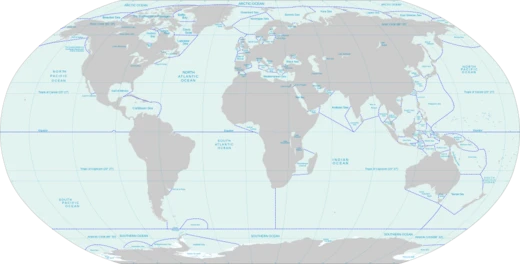
The Gulf of Alaska (Tlingit: Yéil T'ooch’) is an arm of the Pacific Ocean defined by the curve of the southern coast of Alaska, stretching from Kabuch Point on the Alaska Peninsula and Kodiak Island in the west to Cape Spencer in the east, where Glacier Bay is found and the Inside Passage begins. Its shoreline is a mix of forest, mountain, and numerous tidewater glaciers. The largest glaciers in Alaska, the Malaspina and Bering, spill directly onto the coastal line. The coast is heavily indented, featuring the two largest connected bodies of water: Cook Inlet and Prince William Sound, as well as Yakutat Bay. Lituya Bay, a fjord north of Cross Sound and south of Mount Fairweather, is the site of the largest recorded tsunami in history and serves as a sheltered anchorage for fishing boats. The Gulf is considered a Class I, productive ecosystem, generating more than 300 grams of carbon per square meter per year based on SeaWiFS data. Deep water corals, particularly *Primnoa pacifica*, are found here, leading to the area being designated a Habitat Area of Particular Concern. Due to the North Pacific Current, fed by the warm Kuroshio Current, the Gulf remains ice-free year-round. In 1977, the Gulf began an unexpected shift in its normal climate regime, resulting in a rise in mean sea surface temperature and an increased availability and variety of commercial fish species, a volatile change also observed in other North Pacific seas during the 1970s. Meteorologically, the Gulf is a great generator of storms that dump vast quantities of snow and ice on southern Alaska, creating some of the largest concentrations south of the Arctic Circle. Many of these storms move south along the coasts of British Columbia, Washington, Oregon, and as far as Southern California, particularly during El Niño events, supplying much of the seasonal rainfall and snowfall to the Pacific Northwest and Southwestern United States.
- ice_status
- Coastal areas and inlets can experience sea ice in winter, though the open gulf is moderated by the Alaska Current.
Quick Facts
- Location
- South shore of Alaska
- Part Of
- North Pacific Ocean
- Rivers
- Susitna River
- Oceans
- Pacific Ocean
- Countries
- United States
- Area
- 1533000 km2
- Islands
- Kodiak Archipelago, Montague Island, Middleton Island
- Settlements
- Valdez, Anchorage, Seward
Facts from the source article.
Lore & Background
The Gulf of Alaska is an arm of the Pacific Ocean defined by the curve of the southern coast of Alaska, stretching from the Alaska Peninsula and Kodiak Island in the west to Cape Spencer in the east, where Glacier Bay is found and the Inside Passage begins. Its shoreline is a combination of forest, mountain, and tidewater glaciers, including Alaska's largest glaciers, the Malaspina Glacier and Bering Glacier. The coast is heavily indented with Cook Inlet and Prince William Sound, the two largest connected bodies of water, and includes Yakutat Bay. Lituya Bay, a fjord north of Cross Sound and south of Mount Fairweather, is the site of the largest recorded tsunami in history and serves as a sheltered anchorage for fishing boats.
Reader's Guide
Due to the North Pacific Current, which is itself fed by the warm Kuroshio Current, the Gulf of Alaska remains ice-free throughout the year. The Gulf is a major storm generator, dumping vast quantities of snow and ice on southern Alaska, resulting in some of the largest concentrations of snow and ice south of the Arctic Circle. Many of these storms then move south along the coasts of British Columbia, Washington, Oregon, and as far as Southern California, particularly during El Niño events. Much of the seasonal rainfall and snowfall in the Pacific Northwest and Southwestern United States originates from this gulf. The Gulf of Alaska is considered a Class I, productive ecosystem, with more than 300 grams of carbon per square meter per year based on SeaWiFS data. Its waters host deep water corals, including *Primnoa pacifica*, which has led to the area being designated a Habitat Area of Particular Concern. The shoreline is a mix of forest, mountains, and numerous tidewater glaciers, with Alaska’s largest glaciers, the Malaspina and Bering Glaciers, spilling onto the coast. The coast is heavily indented by Cook Inlet, Prince William Sound, and Yakutat Bay. Lituya Bay, a fjord north of Cross Sound, is the site of the largest recorded tsunami in history and serves as a sheltered anchorage for fishing boats. In 1977, the Gulf began an unexpected shift in its climate regime, leading to a rise in mean sea surface temperature and an increased availability and variety of commercial fish species, a volatile change also observed in the 1970s in other North Pacific seas.
Did You Know?
- While the open gulf is moderated by the Alaska Current, coastal areas and inlets can experience sea ice in winter.
Frequently Asked Questions
Who is Gulf of Alaska?
Gulf of Alaska is a broad stretch of water hugging the southern coastline of Alaska, stretching from the Alaska Peninsula and Kodiak Island in the west to Cape Spencer in the east. It goes by the Tlingit name Yéil T'ooch' and is best understood as a defined arm branching off the larger Pacific Ocean.
What are Gulf of Alaska's powers or role?
The gulf functions as a major storm engine, regularly generating weather systems that sweep along the Pacific coast of North America. It also sustains a Class I productive marine ecosystem, making it one of the most biologically rich feeding areas in the northern Pacific.
How does Gulf of Alaska's story end?
Because the gulf is a permanent geographic feature rather than a narrative character, it has no true 'ending'; it simply cycles through seasons indefinitely. In winter, sheltered inlets and coastal areas can freeze, while the open gulf waters stay liquid thanks to the moderating influence of the Alaska Current.
Why is Gulf of Alaska important?
The gulf shapes weather patterns across western North America by acting as a persistent source of coastal storms. Its highly productive waters also anchor commercial fisheries and support diverse marine communities, giving it outsized ecological and economic significance for the region.
Where does Gulf of Alaska sit in the Seas And Oceans catalog?
Gulf of Alaska is listed as entry 1-24 in the Seas And Oceans lineup, classified as a Pacific Ocean arm rather than a fully enclosed sea. Its identity is defined entirely by the curved southern shoreline of Alaska, which sets it apart from the open ocean to the south.
More in Seas And Oceans 1-24
Spotted an error? Know more?
This is a living reference — every entry is fact-audited, and reader corrections feed straight into our audit queue. Suggest an edit · See this site's audit record