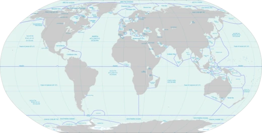
Gulf of Carpentaria
A shallow sea off northern Australia with submerged coral reefs.

Wikipedia / Wikimedia Commons
The Gulf of Carpentaria is a sea off the northern coast of Australia, enclosed on three sides by northern Australia and bounded on the north by the eastern Arafura Sea, which separates Australia and New Guinea. Its northern boundary is defined by a line from Slade Point, Queensland, to Cape Arnhem on the Gove Peninsula, Northern Territory. At its mouth, the Gulf is wide, and it extends further south, with a north–south length exceeding a significant distance. It covers a water area of about a certain size, with general depths between specific figures and a maximum depth recorded. The tidal range varies between set measurements. During the peak of the last ice age 18,000 years ago, when global sea levels were much lower, the Gulf and adjacent Sahul Shelf were dry land, with a large, shallow lake occupying the centre of the present-day Gulf. A submerged coral reef province, only recognized in 2004, exists within the Gulf.
The region was first visited by the Dutch explorer Willem Janszoon in 1605–06. Jan Carstenszoon named the gulf in 1623 after Pieter de Carpentier, then Governor-General of the Dutch East Indies. Abel Tasman explored the coast in 1644, and English navigator Matthew Flinders charted the area in 1802 and 1803. The first overland expedition to reach the Gulf was the Burke and Wills expedition, which arrived at the mouth of the Bynoe River in February 1861; both leaders died on the return journey. The land bordering the Gulf is generally flat and low-lying. To the west lie Arnhem Land and Groote Eylandt, the largest island in the Gulf. To the east is Cape York Peninsula and the Torres Strait, which connects the Gulf to the Coral Sea. The southern area, part of Queensland, is known as the Gulf Country, which supports the world’s largest intact savanna woodlands and native grasslands, dominated by Eucalyptus and Melaleuca species. The climate is hot and humid, with a dry season from April to November and a wet season from December to March, during which many low-lying areas flood. The Gulf is prone to tropical cyclones between November and April, averaging three per year, which transport sediments clockwise along the coast. In September and October, the Morning Glory cloud appears in the southern Gulf, best viewed from the Burketown area. The Gulf contains fringing reefs and isolated coral colonies, but no near-surface patch or barrier reefs exist
- location
- Northern coast of Australia
- maximum_depth
- 69 metres
- tidal_range
- Between two and three metres
Lore & Background
The Gulf of Carpentaria is a sea enclosed on three sides by northern Australia, bounded to the north by the Arafura Sea. Its northern boundary runs from Slade Point, Queensland, to Cape Arnhem on the Gove Peninsula. The gulf is wide at its mouth and narrower further south, with a north-south length exceeding a certain distance. It covers a water area of about a specific size, with general depths between set figures and a maximum depth. The tidal range falls within a given range. The surrounding land is flat and low-lying, with Arnhem Land and Groote Eylandt to the west and Cape York Peninsula to the east. The southern region, known as the Gulf Country, supports the world’s largest intact savanna woodlands and native grasslands, dominated by Eucalyptus and Melaleuca species. The climate is hot and humid, with a dry season from April to November and a wet season from December to March, when most rainfall occurs and low-lying areas flood. The gulf experiences an average of three tropical cyclones each year between November and April, which transport sediments clockwise along the coast. Unlike other parts of Australia, there are no mountains restricting rainfall, so the transition from coastal tropical growth to central Australian arid scrubs is gradual. In September and October, the Morning Glory cloud appears in the southern gulf, best viewed near Burketown. The gulf contains fringing reefs and isolated coral colonies, but no near-surface patch or barrier reefs exist today. However, a submerged coral reef province covering at least a certain area was discovered in 2004 in the southern gulf, with upper surfaces at a mean depth of a specific figure, undetected by satellites or aerial photographs. These reefs point to an earlier, late Quaternary phase of framework reef growth under cooler, lower sea-level conditions. The gulf and adjacent Sahul Shelf were dry land at the peak of the last ice age, when a large, shallow lake occupied the center of what is now the gulf.
Reader's Guide
The Gulf of Carpentaria is significant for its unique geography, climate, and ecological features. It supports the world's largest intact savanna woodlands, known as the Carpentaria tropical savanna, dominated by Eucalyptus and Melaleuca species. The Gulf experiences a hot and humid climate with two seasons: a dry season from April to November and a wet season from December to March, during which many low-lying areas flood. It is prone to tropical cyclones between November and April, averaging three cyclones per year. The Gulf also supports commercial shrimp operations, zinc, lead, and silver mining, and a cattle industry.
Did You Know?
- The Morning Glory cloud appears in the Southern Gulf in September and October, best viewed from the Burketown area.
More in Seas And Oceans 1-24
Spotted an error? Know more?
This is a living reference — every entry is fact-audited, and reader corrections feed straight into our audit queue. Suggest an edit · See this site's audit record