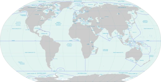
Gulf of Guinea
Northeastern tropical Atlantic gulf with Null Island and major rivers.

Wikipedia / Wikimedia Commons
The Gulf of Guinea is the northeasternmost part of the tropical Atlantic Ocean, extending from Cape Lopez in Gabon north and west to Cape Palmas in Liberia. It contains Null Island, the point where the Equator and Prime Meridian intersect at zero degrees latitude and longitude. The gulf’s coastline includes the Bight of Benin and the Bight of Bonny, and major rivers such as the Niger and the Volta drain into its waters. The name "Guinea" is thought to derive from a local regional name, though its exact origin is disputed; historically, the term referred to the south coast of West Africa (Upper Guinea) and the west coast of Southern Africa (Lower Guinea), and today appears in the names of three African nations and one in Melanesia. The International Hydrographic Organization defines the gulf’s southwest limit as a line from Cap Lopez to Ilhéu das Rôlas and onward to Cape Palmas. The gulf contains several islands, including a volcanic chain along the Cameroon line, such as Annobón, Bioko, Corisco, Elobey Grande, Elobey Chico, Bobowasi Island, and the nation of São Tomé and Príncipe, which consists of two extinct volcanic islands. Maritime security in the gulf involves 18 sovereign states and is addressed by ECOWAS, ECCAS, and the Gulf of Guinea Commission. Since 2000, a 60% population increase has driven food shortages, leading to crimes like hijacking, kidnapping, and robbery. Maritime insecurity includes piracy, illegal fishing, drug trafficking, and oil-bunkering—the latter prevalent in Nigerian waters. Kidnapping for ransom is a major issue; between 2018 and 2019, crew kidnappings rose by 50%, accounting for 90% of global sea kidnappings. Despite a decline in reported piracy since the early 2020s, kidnappings and armed robberies persisted into 2025 and 2026, with pirates increasingly targeting high-value individuals using fast boats at night.
- Location
- Northeastern tropical Atlantic Ocean
- Coordinates
- From Cape Lopez (0°37′S 8°43′E) to Cape Palmas (4°22′N 7°44′W)
- Major rivers
- Niger and Volta
- Notable feature
- Null Island (0°N, 0°E)
- Number of coastal states
- 18
- Major islands
- Bioko, São Tomé, Príncipe, Annobón, Corisco
Lore & Background
The name 'Guinea' is thought to have originated from a local name for an area in the region, though specifics are disputed. One theory suggests it derives from the Berber word 'aguinaou' meaning Negro, referencing the Bab Aguinaou gate in Marrakech. Another holds it is a corrupt form of Ghana or Jenne. The gulf's coastline includes the Bight of Benin and the Bight of Bonny. Among the many rivers draining into it are the Niger and the Volta. The International Hydrographic Organization defines the southwest extent from Cap Lopez northwestward to Ilhéu Gago Coutinho and then to Cape Palmas. Maritime security in the Gulf of Guinea involves 18 sovereign states and multiple institutional mandates, including ECOWAS, ECCAS, and the Gulf of Guinea Commission.
Reader's Guide
The Gulf of Guinea holds significant geographical and historical importance as the northeasternmost part of the tropical Atlantic Ocean and the location of Null Island, the point where the Equator and Prime Meridian intersect. Ecologically and economically, the gulf receives waters from major rivers like the Niger and Volta, and its islands—including Bioko, São Tomé, and Príncipe—are part of the Cameroon line of volcanoes. The region faces severe maritime security challenges, including piracy, kidnapping for ransom, illegal fishing, and drug trafficking. Illegal, unreported, and unregulated (IUU) fishing has also become a severe problem, depleting fish stocks and threatening food security. The Gulf of Guinea Commission, along with ECOWAS and ECCAS, addresses these issues, but the region remains a hotspot for maritime crime.
Did You Know?
- Null Island, the intersection of the Equator and Prime Meridian, is located in the Gulf of Guinea.
- The name 'Guinea' may derive from the Berber word 'aguinaou' meaning Negro, referencing the Bab Aguinaou gate in Marrakech.
- The Gulf of Guinea contains islands forming part of the Cameroon line of volcanoes, including Bioko, São Tomé, and Príncipe.
Frequently Asked Questions
Who is Gulf of Guinea?
Gulf of Guinea is the northeasternmost arm of the tropical Atlantic Ocean, stretching from Cape Lopez in Gabon to Cape Palmas in Liberia. It is the Seas And Oceans 1-24 entry that anchors the 0°N, 0°E coordinate intersection and borders 18 sovereign states.
What are Gulf of Guinea's powers/role?
The gulf functions as the primary maritime corridor for 18 coastal nations, channeling oil, trade, and shipping traffic through the northeastern tropical Atlantic. It also receives the outflows of the Niger and Volta rivers, making it a key ecological and economic node for the region.
How does Gulf of Guinea's story end?
The gulf's defined extent concludes at Cape Palmas in Liberia, where the coastline transitions into the open Atlantic beyond the gulf's boundary. Past that cape, the waters are no longer classified as part of the Gulf of Guinea proper.
Why is Gulf of Guinea important?
It is the sole body of water on Earth that contains the intersection of the Equator and Prime Meridian, giving it a singular role in global cartography and navigation. It also underpins the economies of 18 nations and hosts major islands such as Bioko, São Tomé, and Príncipe.
What is Null Island and why does it belong to Gulf of Guinea?
Null Island is the theoretical point at 0°N, 0°E where the Equator and Prime Meridian cross, and it sits squarely within the gulf's waters. It has no land, no population, and no governing authority, yet it serves as the origin reference for the entire global coordinate system.
More in Seas And Oceans 1-24
Spotted an error? Know more?
This is a living reference — every entry is fact-audited, and reader corrections feed straight into our audit queue. Suggest an edit · See this site's audit record