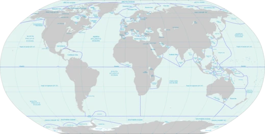
Mid-Atlantic Ridge
Divergent plate boundary forming the Atlantic Ocean floor.

Wikipedia / Wikimedia Commons
The Mid-Atlantic Ridge is a divergent, or constructive, plate boundary running along the Atlantic Ocean floor, forming part of the planet’s longest mountain chain. In the North Atlantic, it splits the North American Plate from the Eurasian Plate and the African Plate, with the Azores triple junction marking the division. In the South Atlantic, it separates the African and South American Plates. The ridge stretches from the Gakkel Ridge (Mid-Arctic Ridge) northeast of Greenland down to the Bouvet triple junction in the South Atlantic. While mostly submerged, parts rise above sea level, notably in Iceland. The ridge spreads at an average rate of roughly 2.5 centimeters per year.
The existence of a ridge under the northern Atlantic was first suggested in 1853 by Matthew Fontaine Maury, based on soundings from the USS Dolphin. The HMS Challenger expedition in 1872, led by Charles Wyville Thomson, confirmed the ridge and its southward extension while surveying a route for a transatlantic telegraph cable. Sonar verified the ridge in 1925, and the German Meteor expedition later traced it around Cape Agulhas into the Indian Ocean. In the 1950s, ocean floor mapping by Marie Tharp, Bruce Heezen, and Maurice Ewing revealed a strange pattern of valleys and ridges, with a seismically active central valley that was the epicenter of many earthquakes. Ewing, Heezen, and Tharp found that this ridge is part of a continuous 40,000-kilometer system of mid-ocean ridges spanning all the world’s oceans. This discovery led to the theory of seafloor spreading and the acceptance of Alfred Wegener’s continental drift, refined into plate tectonics. The ridge’s role in breaking up the supercontinent Pangaea, roughly 200 to 160 million years ago, is now understood through modern tectonic models involving subduction and mantle plumes, though this was once debated.
A deep rift valley runs along nearly the entire axis of the ridge, marking the boundary between tectonic plates. Here, magma from the mantle reaches the seafloor, erupting as lava and forming new crust. Near the equator, the Romanche Trench—a narrow submarine trench reaching 7,758 meters deep, one of the Atlantic’s deepest spots—divides the ridge into the North Atlantic and South Atlantic sections. This trench does not, however, separate the North and South American Plates or the Eurasian and African Plates.
Islands along or near the ridge, listed from north to south, include: Jan Mayen (Beerenberg, 2,277 meters, in the Arctic Ocean); Iceland (Hvannadalshnúkur, 2,109.6 meters, through which the ridge runs); the Azores (Ponta do Pico, 2,351 meters); Saint Peter and Paul Rocks (Southwest Rock, 22.5 meters); Ascension Island (The Peak, 859 meters); Saint Helena (Diana’s Peak, 818 meters); Tristan da Cunha (Queen Mary’s Peak, 2,062 meters); Gough Island (Edinburgh Peak, 909 meters); and Bouvet Island (Olavtoppen, 780 meters). Near southwest Iceland, the submerged section is called the Reykjanes Ridge. In Iceland, the ridge is known as the Neovolcanic Zone, and the Tjörnes fracture zone connects it to the Kolbeinsey Ridge in the north.
The ridge sits atop the Mid-Atlantic Rise, a linear bulge running the length of the Atlantic, thought to be caused by upward convection in the asthenosphere pushing the crust and lithosphere. This divergent boundary first formed in the Triassic period when three-armed grabens coalesced on Pangaea. Typically, only two arms of each graben become a divergent plate boundary; the failed arms, called aulacogens, later became major river valleys in the Americas and Africa, such as the Mississippi, Amazon, and Niger Rivers. The Fundy Basin on North America’s Atlantic coast is evidence of the ancestral ridge.
- type
- Mid-ocean ridge
- location
- Atlantic Ocean floor
- length
- Part of a 40,000 km continuous system of mid-ocean ridges
- spreading_rate
- About 2.5 cm per year
- deepest_point
- Romanche Trench, 7,758 m
- first_inferred
- 1853 by Matthew Fontaine Maury
- confirmed
- 1872 by HMS Challenger expedition
Verified Timeline
Lore & Background
A ridge under the northern Atlantic Ocean was first inferred by Matthew Fontaine Maury in 1853, based on soundings by the USS Dolphin. The existence of the ridge and its extension into the South Atlantic was confirmed during the expedition of HMS Challenger in 1872. A team of scientists on board, led by Charles Wyville Thomson, discovered a large rise in the middle of the Atlantic while investigating the future location for a transatlantic telegraph cable. The existence of such a ridge was confirmed by sonar in 1925 and was found to extend around Cape Agulhas into the Indian Ocean by the German Meteor expedition. In the 1950s, mapping of the Earth's ocean floors by Marie Tharp, Bruce Heezen, Maurice Ewing, and others revealed that the Mid-Atlantic Ridge had a strange bathymetry of valleys and ridges, with its central valley being seismologically active and the epicenter of many earthquakes. Ewing, Heezen and Tharp discovered that the ridge is part of a 40,000 km (25,000 mi) long essentially continuous system of mid-ocean ridges on the floors of all the Earth's oceans. The discovery of this worldwide ridge system led to the theory of seafloor spreading and general acceptance of Alfred Wegener's theory of continental drift and expansion in the modified form of plate tectonics. The ridge is a feature whose contribution to the breakup of the supercontinent of Pangaea, in the period from about 200 to 160 million years ago, is considered in the modelling of such breakup in modern tectonic theory, where subduction and mantle plumes mechanisms are hypothesised to be primary, although historically this was contentious.
Reader's Guide
The Mid-Atlantic Ridge includes a deep rift valley that runs along the axis of the ridge for nearly its entire length. This rift marks the actual boundary between adjacent tectonic plates, where magma from the mantle reaches the seafloor, erupting as lava and producing new crustal material for the plates. Near the equator, the Mid-Atlantic Ridge is divided into the North Atlantic Ridge and the South Atlantic Ridge by the Romanche Trench, a narrow submarine trench with a maximum depth of 7,758 m (25,453 ft), one of the deepest locations of the Atlantic Ocean. This trench, however, is not regarded as the boundary between the North and South American plates, nor the Eurasian and African plates. The islands on or near the Mid-Atlantic Ridge include Jan Mayen, Iceland (through which the ridge runs), the Azores, Saint Peter and Paul Rocks, Ascension Island, Saint Helena, Tristan da Cunha, Gough Island, and Bouvet Island. The submarine section of the Mid-Atlantic Ridge close to southwest Iceland is known as the Reykjanes Ridge. In northern Iceland the Tjörnes fracture zone connects Iceland to the Kolbeinsey Ridge. The ridge sits atop a geologic feature known as the Mid-Atlantic Rise, which is a progressive bulge that runs the length of the Atlantic Ocean, with the ridge resting on the highest point of this linear bulge. This divergent boundary first formed in the Triassic period, when a series of three-armed grabens coalesced on the supercontinent Pangaea to form the ridge. Usually, only two arms of any given three-armed graben become part of a divergent plate boundary. The failed arms are called aulacogens, and the aulacogens of the Mid-Atlantic Ridge eventually became many of the large river valleys seen along the Americas and Africa (including the Mississippi River, Amazon River and Niger River). The Fundy Basin on the Atlantic coast of North America between New Brunswick and Nova Scotia in Canada is evidence of the ancestral Mid-Atlantic Ridge.
Did You Know?
- The Mid-Atlantic Ridge has an average spreading rate of about 2.5 centimetres per year.
- The Romanche Trench near the equator reaches a maximum depth of 7,758 m, one of the deepest locations of the Atlantic Ocean.
- The ridge was first inferred by Matthew Fontaine Maury in 1853 based on soundings by the USS Dolphin.
- In the 1950s, mapping by Marie Tharp, Bruce Heezen, and Maurice Ewing revealed the ridge is part of a 40,000 km continuous system of mid-ocean ridges.
- The ridge runs through Iceland, where it is also known as the Neovolcanic Zone.
More in Seas And Oceans 1-24
Spotted an error? Know more?
This is a living reference — every entry is fact-audited, and reader corrections feed straight into our audit queue. Suggest an edit · See this site's audit record