Afro-Eurasia
Largest contiguous landmass, comprising Africa, Asia, and Europe.

Keepscases · CC BY-SA 3.0
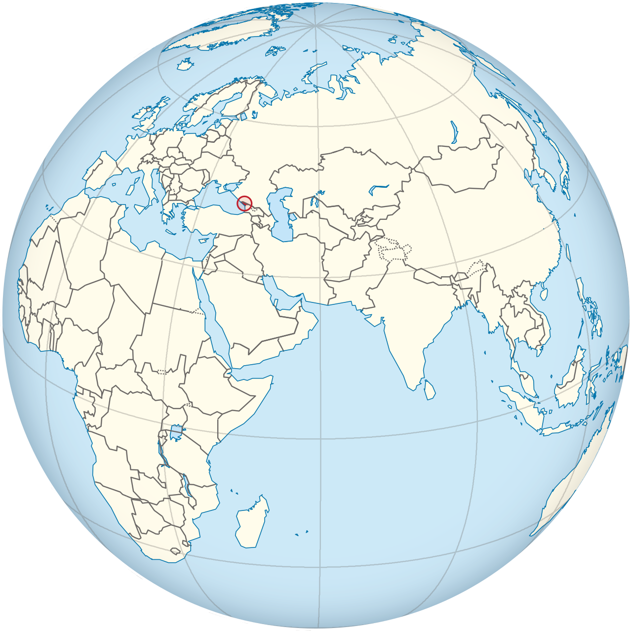
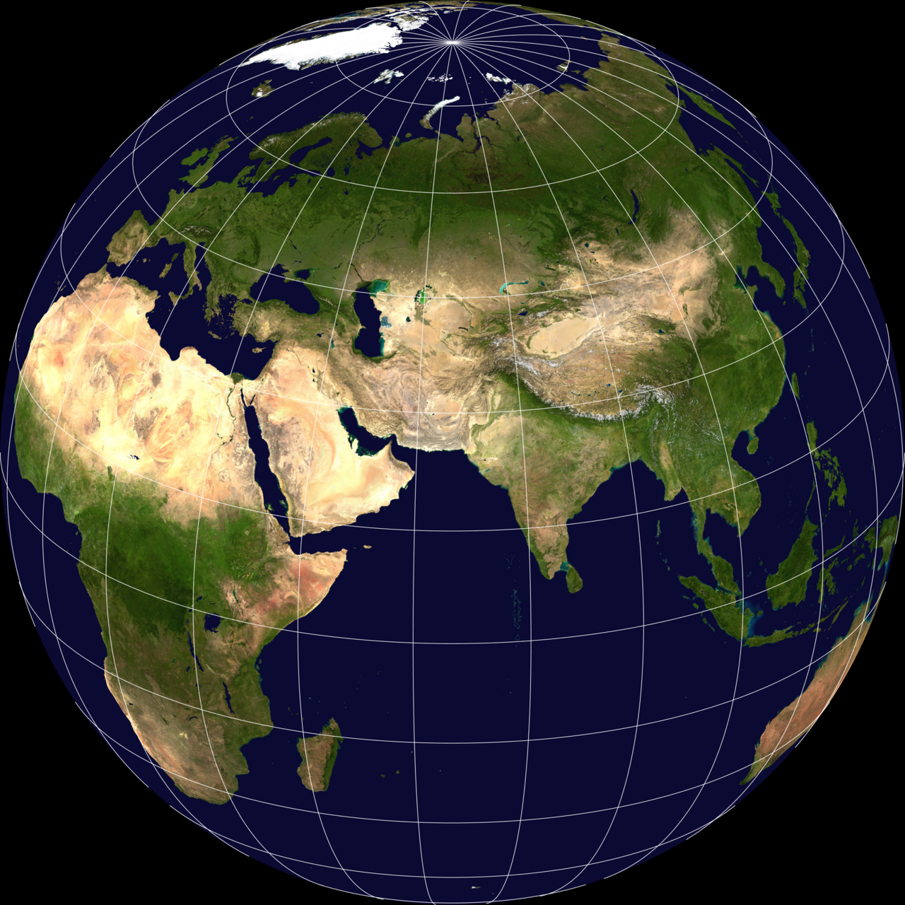
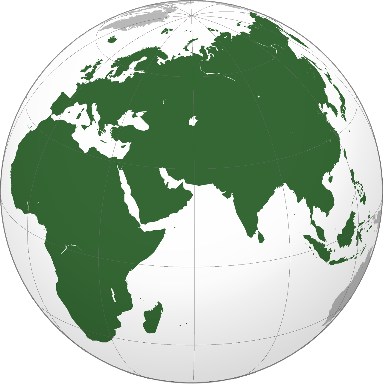
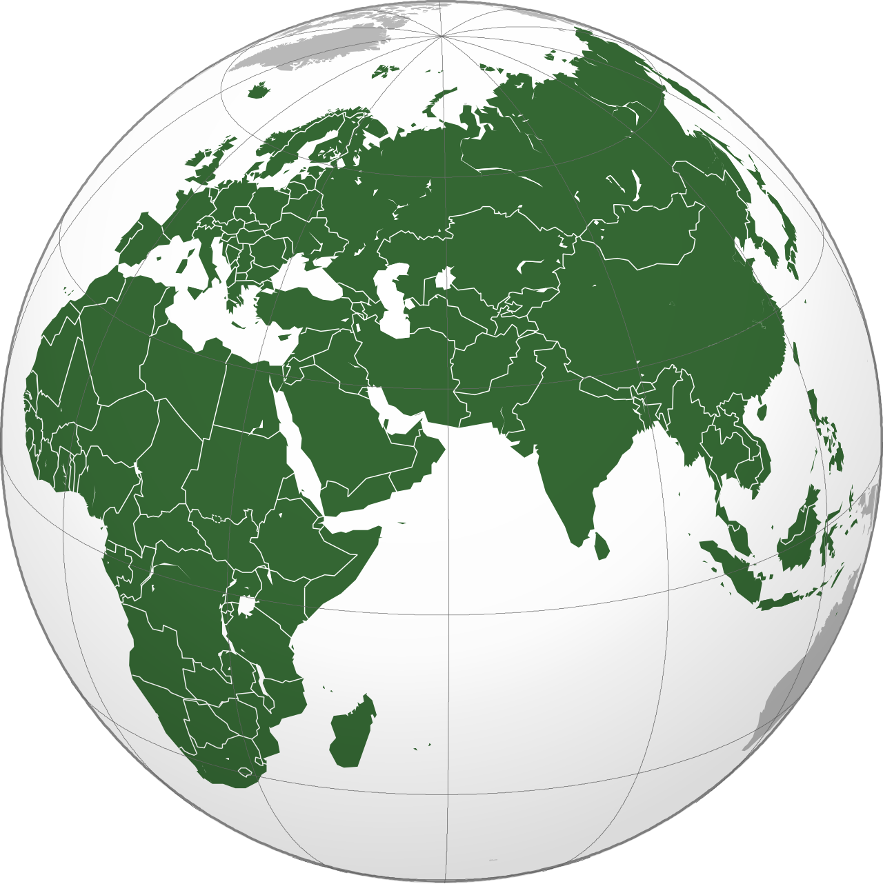
Afro-Eurasia (also called Afroeurasia or Eurafrasia) is a landmass sometimes referred to as a supercontinent, made up of Africa, Asia, and Europe. Its name is a blend of those three continents. It is also known as the "Old World," a term used to distinguish it from the "New World" of the Americas, and sometimes Oceania and Antarctica. Covering 85,135,000 square kilometers—57% of Earth's total land—it is home to about 6.7 billion people, or roughly 86% of the global population. Along with mainland Australia, it forms the vast majority of land in the Eastern Hemisphere. This contiguous landmass is the largest and most populous on the planet.
Several related terms exist. "Ecumene" comes from classical antiquity and referred to the world known to ancient Greek scholars, which included only Europe and parts of Africa and Asia. "Old World" emerged during the Age of Discovery, when European explorers contrasted their familiar lands with the newly encountered Americas; it remains common in biology. "World Island" was coined by geographer H.J. Mackinder in 1904 for geopolitical use, describing the large contiguous landmass while excluding islands like the British Isles, Japan, Madagascar, and the Malay Archipelago. "Afro-Eurasia," however, generally includes those islands when they are considered part of Africa, Asia, or Europe.
Geologically, Afro-Eurasia is not a true supercontinent but rather the largest current segment of the supercontinent cycle. Its oldest known part is the Kaapvaal craton, which, together with Madagascar, parts of India, and western Australia, formed the early supercontinent Vaalbara or Ur about 3 billion years ago. This region has been part of every supercontinent since. When Pangaea broke up around 200 million years ago, the North American and Eurasian plates formed Laurasia, while the African plate stayed in Gondwana. The Indian plate later split from Gondwana, collided with the Eurasian plate around 50 million years ago, creating southern Asia and beginning the uplift of the Himalayas. Around the same time, the Indian plate fused with the Australian plate. The Arabian plate separated from Africa about 30 million years ago and collided with the Iranian plate between 19 and 12 million years ago, forming the Alborz and Zagros mountain chains. Shortly after this initial connection of Afro-Eurasia, the Betic corridor along the Gibraltar Arc closed nearly 6 million years ago, linking northwest Africa and Iberia and causing the near-total drying of the Mediterranean Basin—the Messinian salinity crisis. Eurasia and Africa were separated again about 5.33 million years ago when the Zanclean Flood refilled the Mediterranean through the Strait of Gibraltar.
Today, the Eurasian and African plates dominate their respective continents. The Somali plate covers much of eastern Africa, creating the East African Rift. In the eastern Mediterranean, the Aegean Sea, Anatolian, and Arabian plates border the African plate, which includes the Sinai Peninsula, Gulf of Aqaba, and the coastal Levant via the Dead Sea transform. Eurasia also contains the Indian, Burma, Sunda, Yangtze, Amur, and Okhotsk plates, while the North American plate includes the Chukotka Autonomous Okrug in Russia’s Far East. By convention, Africa is connected to Eurasia only by a narrow land bridge (now split by the Suez Canal at the Isthmus of Suez) and remains separated from Europe by the straits of Gibraltar and Sicily.
Looking ahead, paleogeologist Ronald Blakey considers the next 15 to 100 million years of tectonic development fairly predictable. Africa will continue drifting northward, closing the Strait of Gibraltar and quickly evaporating the Mediterranean Sea. No supercontinent is expected to form within that timeframe, and the geologic record shows unexpected shifts that make further projections highly speculative. Three possible future supercontinents—Novopangaea, Amasia, and Pangaea Proxima—have been proposed. In the first two, the Pacific closes while Africa remains fused to Eurasia, but Eurasia splits as Africa and Europe spin westward. In the last, the trio spins eastward together as the Atlantic closes, creating land borders with the Americas.
Extreme points of Afro-Eurasia are as follows. On the mainland: the easternmost point by longitude is the 180th meridian in Russia; on a continuous eastbound path, it is Cape Dezhnev, Russia. The northernmost point is Cape Chelyuskin, Russia; the southernmost is Cape Agulhas, South Africa; the westernmost is Pointe des Almadies, Senegal. Including islands: the easternmost point is Big Diomede, Russia (the 180th meridian passes through Asia, so this point lies in the Western Hemisphere and is Asia’s easternmost on a continuous path). The northernmost is Cape Fligeli on Rudolf Island, Franz Josef Land, Russia. The southernmost remains Cape Agulhas, South Africa; if the Prince Edward Islands are included in Africa, then Marion Island at 46°54'S is the southernmost. The westernmost is Santo Antão, Cape Verde. The highest elevation is Mount Everest on the China–Nepal border, at 8,848.86 meters above sea level. The lowest point on land is the shore of the Dead Sea, between Israel, the West Bank, and Jordan, at 430.5 meters below sea level.
Last updated 2026-09-29 from the source article.
Quick Facts
- Area
- 85,135,000 km2
- Population
- 6.7 billion (2019)
- Density
- 78.7/km; 2 (204.2/sq mi)
- Demonym
- Afro-Eurasian
- Afroeurasian
- Eurafrasian
- Countries
- 146 countries; 8 de facto states
- Dependencies
- 11 dependencies; 5 territories
- Time
- UTC−01:00 – UTC+12:00
- Part of
- Earth
Facts from the source article.
Lore & Background
Afro-Eurasia has also been called the 'Old World', in contrast to the 'New World' referring to the Americas plus sometimes Oceania and Antarctica. Mackinder defined the World Island as the large contiguous landmass, technically excluding islands such as the British Isles, the Japanese archipelago, Madagascar, and the Malay Archipelago, while Afro-Eurasia generally includes those islands usually considered parts of Africa, Asia, and Europe.
Reader's Guide
Afro-Eurasia is significant as the largest and most populous contiguous landmass on Earth, containing the vast majority of the world's population and land area. Its tectonic history is complex: the oldest part is probably the Kaapvaal craton, which formed part of the first supercontinent Vaalbara or Ur around 3 billion years ago. The landmass formed through the collision of the Indian plate with the Eurasian plate around 50 million years ago, creating southern Asia and the Himalayas, and later the Arabian plate impacted the Iranian plate between 19 and 12 million years ago. The Betic corridor closed less than 6 million years ago, fusing northwest Africa and Iberia, leading to the Messinian salinity crisis. Today, Africa is joined to Eurasia only by a narrow land bridge split by the Suez Canal.
A Name Born from Discovery
Before that year, the peoples of Europe, Africa, and Asia were regarded by their own inhabitants as simply the world — the totality of known land. The arrival of news about the Americas, along with the later recognition of Oceania and Antarctica, shattered that assumption and forced a reclassification. Europeans needed a way to distinguish the continents they had long inhabited from the newly encountered lands of the Western Hemisphere, and so the binary of "Old" versus "New" was born. The "New World" specifically pointed to the Americas and other Western Hemisphere territories, while the "Old World" gathered together Africa, Europe, and Asia in the Eastern Hemisphere. What is striking about this naming is that it is entirely a European perspective; the peoples of those three continents had never needed such a qualifier, because for them there was no "new" counterpart to contrast against. The term thus encodes a particular moment of global self-awareness and a particular cultural vantage point within a single, continuous landmass.
The World Island
Beyond the "Old World" label, the mainland of Afro-Eurasia carries another evocative name: the World Island. This designation refers specifically to the continental landmass, deliberately excluding island groups and individual islands such as the British Isles, Japan, Sri Lanka, Madagascar, and the Malay Archipelago. The term is often attributed to Sir Halford John Mackinder, who may have coined it in his work The Geographical Pivot of History. Mackinder's framing treated the World Island as a single geopolitical entity — a vast, contiguous landmass whose strategic importance derived precisely from its size and internal connectivity. By stripping away the scattered islands and focusing on the mainland, the concept emphasizes what makes Afro-Eurasia unique: it is the largest continuous stretch of land on Earth, a single platform on which the Bronze Age civilizations, the Silk Road networks, and the Axial Age traditions all unfolded. The World Island is thus both a geographical descriptor and a conceptual lens, reminding us that the diversity of cultures across Africa, Europe, and Asia developed on one shared, unbroken stage.
Gallery
More in Regions & Cultural Spheres
Spotted an error? Know more?
Reader corrections go straight into our review queue. Suggest an edit · How this site is sourced