Eastern Hemisphere
Half of Earth east of Greenwich, encompassing Afro-Eurasia and Australia.

via Wikipedia: Eastern Hemisphere · see source
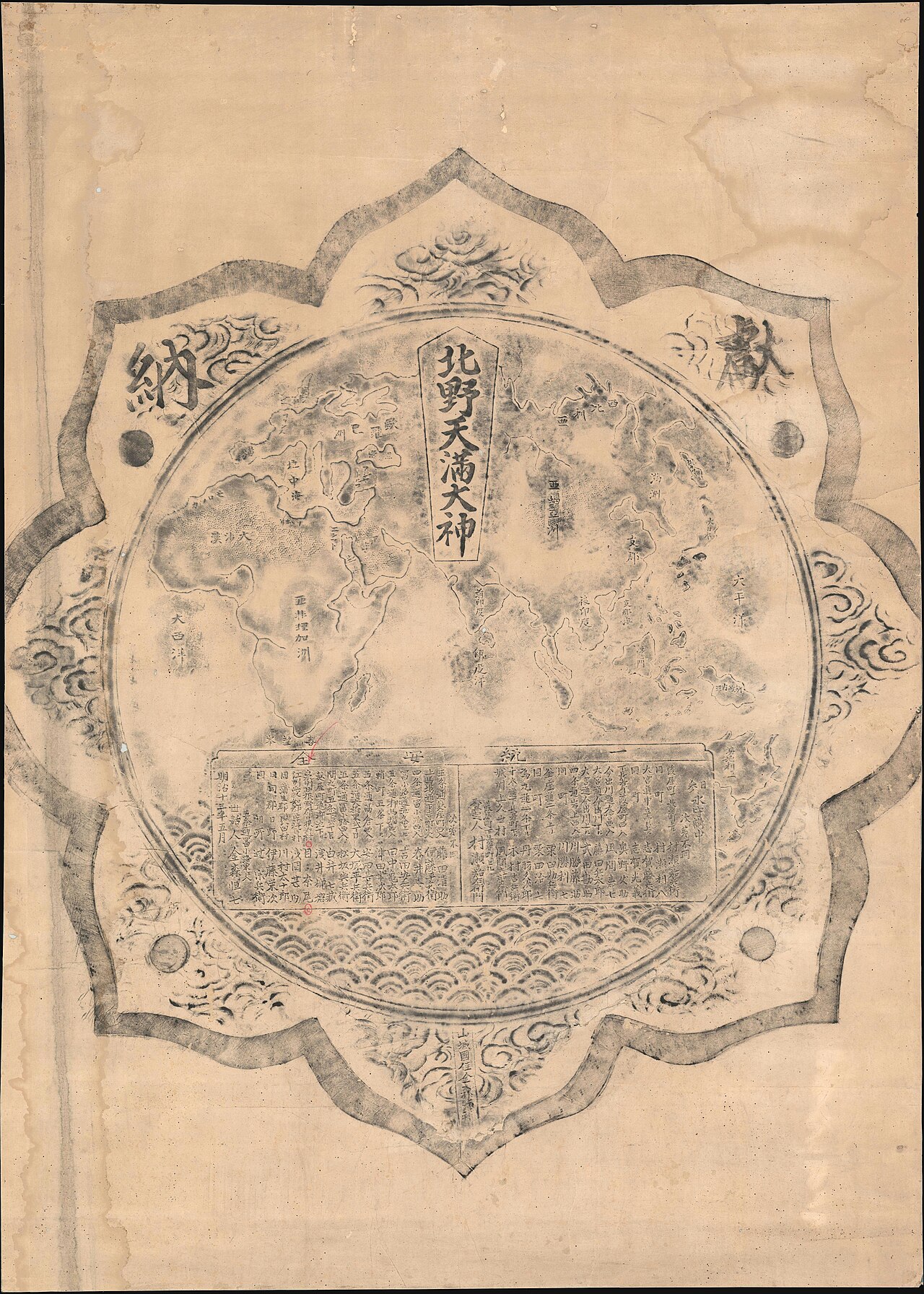
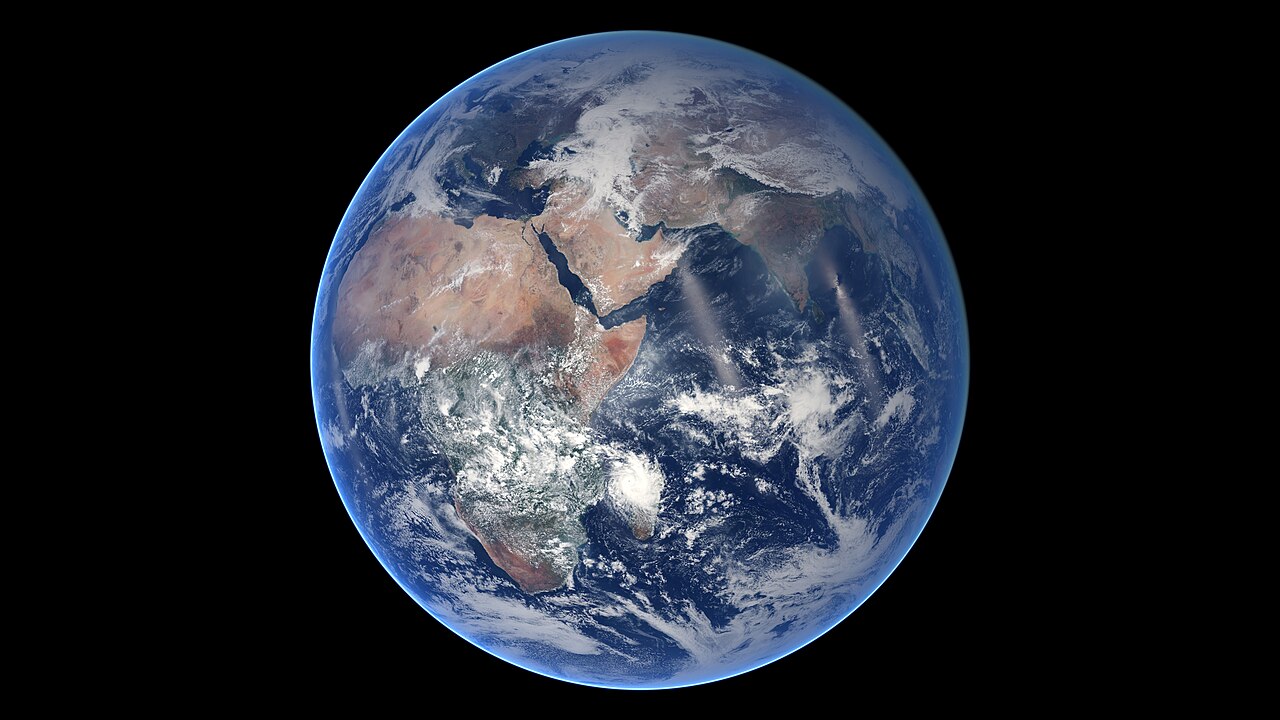
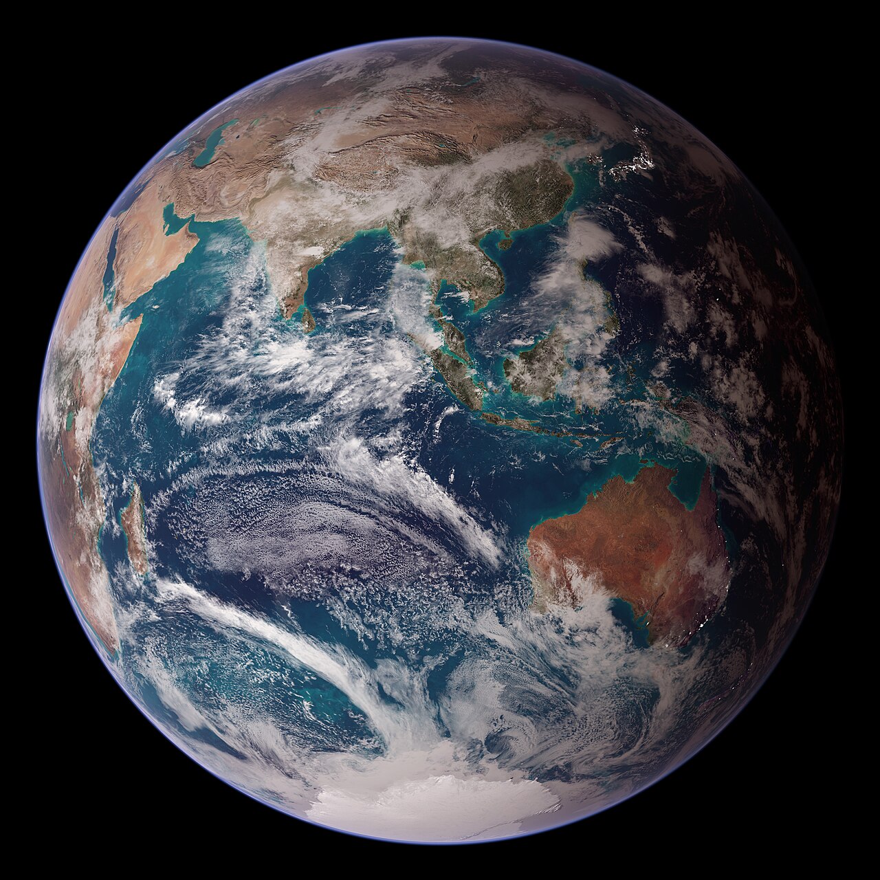
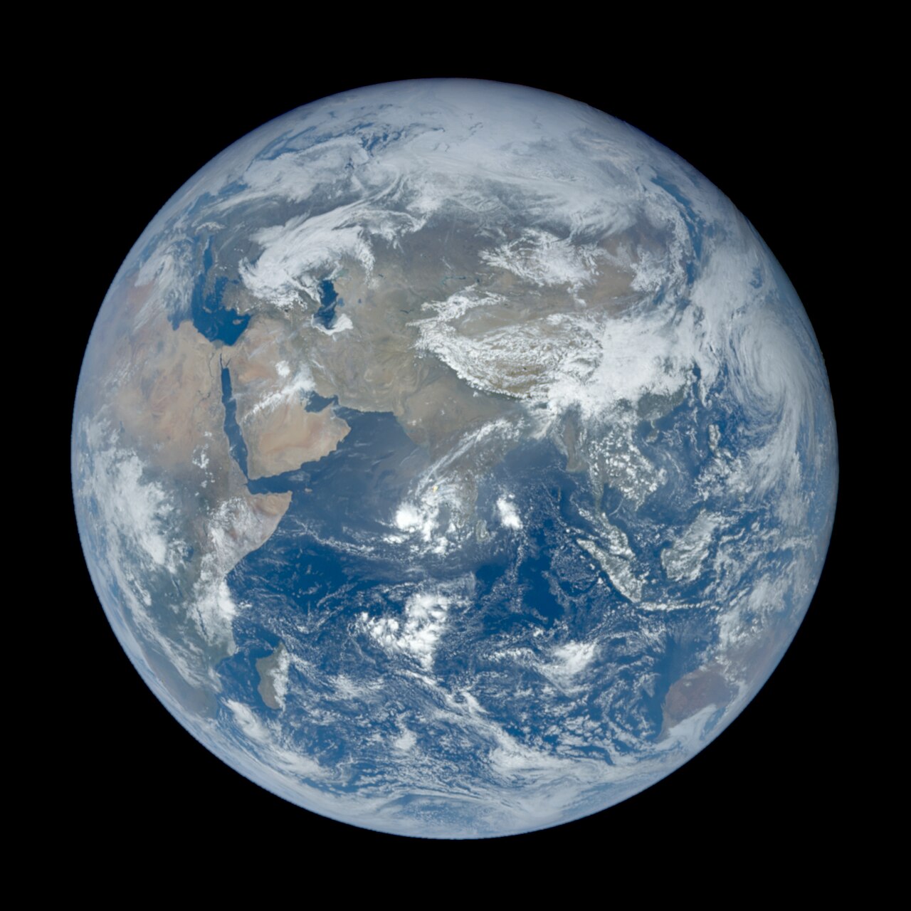
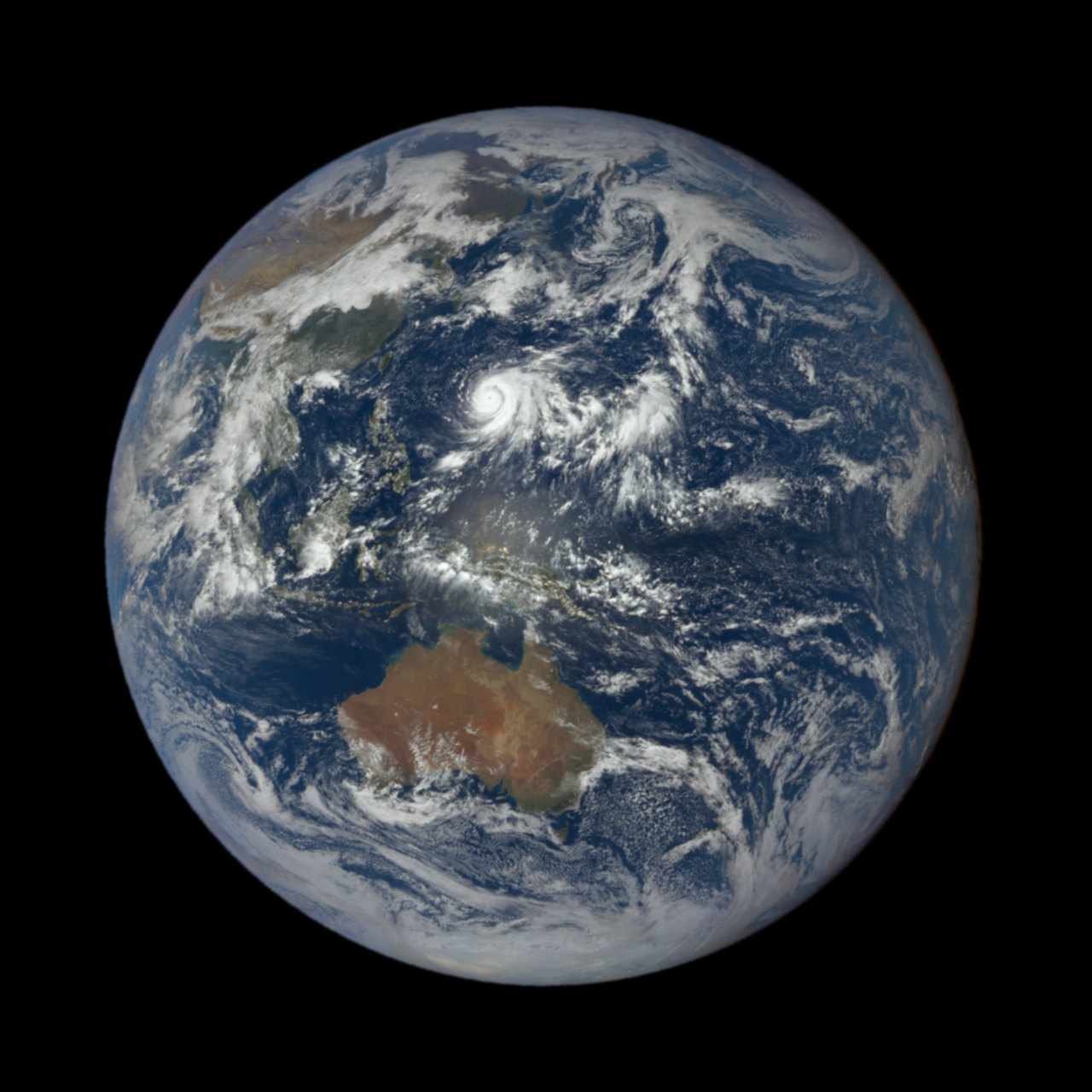
The Eastern Hemisphere covers the half of Earth located east of the prime meridian (which runs through Greenwich, London) and west of the antimeridian (the 180° longitude line crossing the Pacific Ocean, touching little land from pole to pole). The term often refers to Afro-Eurasia (Africa and Eurasia) together with Australia, as opposed to the Western Hemisphere, which primarily includes North and South America. It can also be called the "Oriental Hemisphere" and, in a cultural or geopolitical context, serves as a synonym for the European concept of the "Old World."
The boundary between the Western and Eastern Hemispheres forms an almost perfect circle—Earth is an oblate spheroid, wider at the equator. Unlike the equator, which naturally divides the Northern and Southern Hemispheres, this boundary is an arbitrary convention. The prime meridian at 0° longitude and the antimeridian at 180° longitude are the accepted dividing lines, separating eastern from western longitudes. This convention was set in 1884 at the International Meridian Conference in Washington, D.C., where the standard time ideas of Canadian railroad engineer Sir Sandford Fleming were adopted. The hemispheres do not align neatly with continents: parts of Western Europe, West Africa, Oceania, and far northeastern Russia fall in the Western Hemisphere, differing from the split between the "Old World" and the "New World" (the Americas).
Sometimes, outside physics and navigation, the meridians of 20°W and 160°E are used instead. This arrangement is favored by some because it keeps all of mainland Europe and Africa within the Eastern Hemisphere, though it includes a small part of northeast Greenland (usually considered part of North America) and excludes more of eastern Russia and Oceania, such as New Zealand's main islands. Before standard time was adopted globally, many countries decreed their own prime meridians based on local noon.
The Indian Ocean is the only ocean entirely within the Eastern Hemisphere. Its center lies at the intersection of the equator and the 90th meridian east, 910 km west of Indonesia along the Ninety East Ridge. The nearest land is Simeulue Island. The Eastern Hemisphere's landmass is larger than the Western Hemisphere's and contains a wide variety of habitats. The center of all its land (excluding Antarctica) is in southern Afghanistan. While Russia holds the most total land in the Eastern Hemisphere, the largest country entirely within it is China, at 9,596,961 km².
Eighteen independent countries lie entirely in the Eastern Hemisphere with no land borders: Australia, Comoros, Federated States of Micronesia, Japan, Madagascar, Maldives, Malta, Marshall Islands, Mauritius, Nauru, Palau, Philippines, São Tomé and Príncipe, Seychelles, Solomon Islands, Sri Lanka, Tuvalu, and Vanuatu. Fiji, Kiribati, and New Zealand have land in both hemispheres and are also borderless. Brunei, Cyprus, Indonesia, Papua New Guinea, and Timor-Leste are divided island countries with land borders. The United Kingdom is another divided island country, though most of it is in the Western Hemisphere. Bahrain and Singapore lack natural land borders but are connected to Saudi Arabia and Malaysia by man-made bridges and causeways.
Of Africa's 54 independent countries, 39 are entirely in the Eastern Hemisphere. The five largest are DR Congo (2,345,409 km²), Sudan (1,886,068 km²), Libya (1,759,541 km²), Chad (1,280,000 km²), and Niger (1,267,000 km²). After Sudan and South Sudan split in 2011, Algeria became Africa's largest country at 2,381,741 km², straddling the prime meridian with most of its land east of it. Besides Algeria, four other African countries have land in both hemispheres, and ten are entirely in the Western Hemisphere.
In Europe, 34 of 44 independent countries are entirely in the Eastern Hemisphere. All countries associated with Eastern Europe are wholly within it, except Russia. Seven European countries are partially in the Eastern Hemisphere, and three—Iceland, Ireland, and Portugal—are entirely in the Western Hemisphere. The five largest European countries entirely in the Eastern Hemisphere are Ukraine (603,628 km²), Sweden (450,295 km²), Germany (357,022 km²), Finland (338,455 km²), and Poland (312,696 km²). Norway is larger than Germany, Finland, and Poland at 385,207 km², but it has land in the Western Hemisphere because the remote island of Jan Mayen lies west of the prime meridian. Mainland France straddles the prime meridian, with most of its 543,940 km² European land area east of it. The majority of Spain's 506,030 km² land area is west of the prime meridian.
Most Polynesian islands are entirely in the Western Hemisphere, including the countries of Samoa and Tonga and various semi-independent territories. However, no countries or territories in the neighboring regions of Melanesia and Micronesia are entirely in the Western Hemisphere.
Quick Facts
- Boundary
- Prime meridian (0°) and antimeridian (180°)
- Established
- 1884 International Meridian Conference, Washington, D.C.
- Largest entirely eastern country
- China (9,596,961 km²)
- Center of land mass
- 30°00′00″N 62°15′00″E (southern Afghanistan)
- Lowest temperature
- −89.2 °C at Vostok Station, Antarctica (July 21, 1983)
- Only ocean entirely within
- Indian Ocean
Facts from the source article.
Lore & Background
The boundary line between the Western and Eastern Hemispheres is an almost perfect circle (the Earth is an oblate spheroid, i.e. wider around the equator). The position of this boundary line must be an arbitrary convention, unlike the equator. The prime meridian at 0° longitude and the antimeridian, at 180° longitude, are the conventionally accepted boundaries, since they divide eastern longitudes from western longitudes. This convention was established in 1884 at the International Meridian Conference held in Washington, D.C., where the standard time concepts of Canadian railroad engineer Sir Sandford Fleming were adopted. The hemispheres agreed do not precisely correspond with continents. Portions of Western Europe, West Africa, Oceania, and extreme northeastern Russia are in the Western Hemisphere, in contrast to the split between the "Old World" and the "New World" or the Americas. Alternatively, meridians of 20°W and the diametrically opposed 160°E are sometimes used outside of matters of physics and navigation. This arrangement is preferred by some since it includes all of the European and African mainlands as part of the Eastern Hemisphere. However, it also includes a small portion of northeast Greenland (typically reckoned as part of North America) and excludes more of eastern Russia and Oceania (e.g., New Zealand's two main islands). Prior to the global adoption of standard time, numerous prime meridians were decreed by various countries where time was defined by local noon.
Reader's Guide
The Eastern Hemisphere is a fundamental geographic and cultural concept, dividing the world along a conventional meridian line. Its significance lies in its use as a reference for time zones, navigation, and geopolitical classification (Old World vs. New World). The hemisphere contains the majority of the world's land area and population, including Africa, Europe, Asia, and Australia. Its boundaries, though arbitrary, have shaped global mapping and historical narratives. The hemisphere's extreme temperatures—both the coldest and some of the hottest recorded on Earth—highlight its climatic diversity. The Eastern Hemisphere also hosts unique fauna, such as pandas and kangaroos, that are not found in the Western Hemisphere. Its definition remains a standard in geography, though alternative boundaries are sometimes used for specific purposes.
Did You Know?
- The lowest temperature ever recorded on Earth was −89.2 °C at Antarctica's Vostok Station on July 21, 1983, in the Eastern Hemisphere.
- The highest temperature ever recorded in the Eastern Hemisphere is 55.0°C (131°F) at Kebili, Tunisia, on July 7, 1931, though some weather historians question its accuracy.
The Naming of the Old World
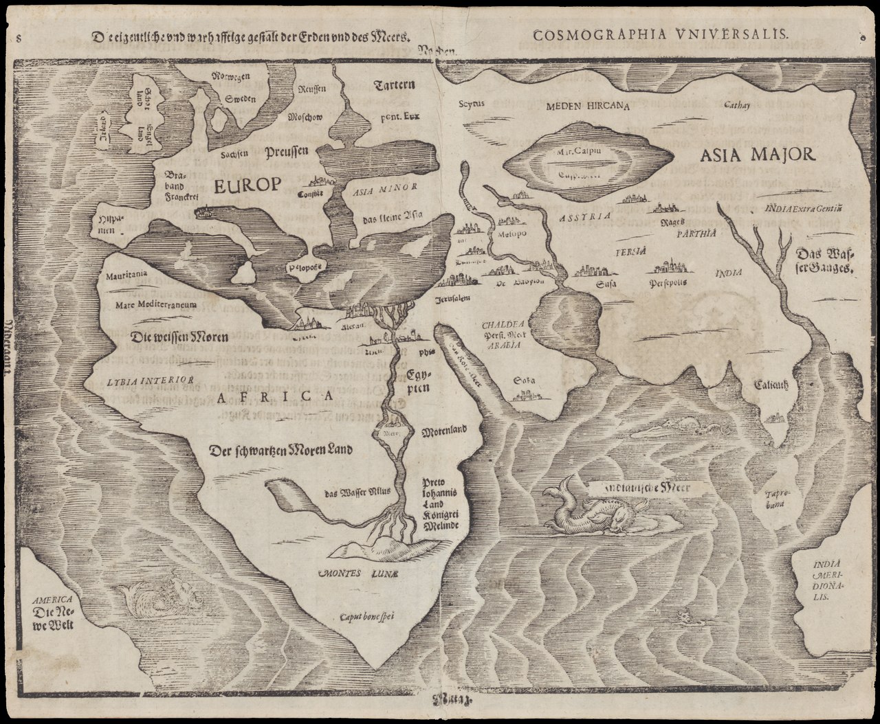
The designation 'Old World,' drawn from the Latin Mundus vetustus, emerged from a profound shift in European self-understanding. Before 1493, the peoples of Europe, Africa, and Asia had no reason to imagine any land beyond their familiar continents; those three landmasses simply were the world. The arrival of knowledge about the Americas, Oceania, and Antarctica shattered that assumption, and Europeans needed a linguistic way to distinguish what they already knew from what they had just encountered. The term 'Old World' was born from that moment of cognitive reorganization, serving as a label for the Afro-Eurasian landmasses of the Eastern Hemisphere. Its counterpart, the 'New World,' pointed specifically toward the newly encountered territories of the Western Hemisphere, particularly the Americas. What makes the phrase historically revealing is its perspective: it encodes a European vantage point, framing entire civilizations that had existed for millennia as 'old' only in relation to a single continent's late-fifteenth-century awakening. The term thus carries within it the weight of a worldview being forced to expand, and the quiet assumption that the European observer is the one doing the naming.
A Continent Woven by Trade and Time
In the vocabulary of archaeology and world history, the 'Old World' takes on a more precise and expansive meaning than a simple geographic label. It designates every region that participated, even indirectly, in the web of cultural contact that stretched from the Bronze Age forward. This network was concentrated in a temperate band running roughly between the forty-fifth and twenty-fifth parallels north, a zone that encompassed the Mediterranean basin, North Africa, Mesopotamia, the Persian plateau, the Indian subcontinent, China, and portions of sub-Saharan Africa. These regions were not isolated pockets; they were linked by trade arteries such as the Silk Road, which allowed ideas, materials, and technologies to flow across vast distances. Following the Bronze Age, these connected societies entered a pronounced Iron Age, a transition that reshaped warfare, agriculture, and social organization. The geographic scope of the term therefore reflects not arbitrary borders but the actual reach of shared human development, a continuum of civilizations that, while distinct in their local expressions, were woven together by millennia of exchange.
The Axial Age and the Flowering of Civilizations
Among the most consequential outcomes of the interconnected Old World was what scholars call the Axial Age, a period of extraordinary intellectual and spiritual ferment that followed the Iron Age. During this era, the regions of Afro-Eurasia gave rise to the philosophical, religious, and cultural frameworks that would define their subsequent histories. In the West, this produced Hellenism and the classical tradition. In the Near East, it yielded Zoroastrianism and the Abrahamic faiths. In the Far East, the flowering was even more diverse, spawning Hinduism, Buddhism, Jainism, Sikhism, Confucianism, and Taoism. What unites these developments is their shared context: they emerged within a world already linked by Bronze Age and Iron Age trade networks, meaning that ideas and cultural motifs had been traveling along routes like the Silk Road long before any single tradition crystallized. The Axial Age thus represents not a series of isolated inventions but a collective flowering, a period in which the Old World's interconnected civilizations simultaneously reached toward questions of meaning, ethics, and the structure of reality, each arriving at answers shaped by its own local soil yet informed by a shared human heritage.
The World Island: Geography as Geopolitics
Beyond the familiar label 'Old World,' the contiguous mainland of Afro-Eurasia has carried another evocative name: the World Island. This term specifically refers to the solid landmass of Africa, Europe, and Asia taken together, deliberately excluding island groups and individual islands such as the British Isles, Japan, Sri Lanka, Madagascar, and the Malay Archipelago. The distinction matters because it draws attention to the sheer physical unity of the landmass, a single unbroken expanse of terrain that dwarfs every other continental formation on Earth. The phrase 'World Island' is often attributed to Sir Halford John Mackinder, who introduced it in his influential work The Geographical Pivot of History. Mackinder's framing was not merely descriptive; it was a geopolitical argument, suggesting that the control of this vast, interconnected landmass would determine the balance of power among nations. By naming the Old World a 'World Island,' the term reinforces the idea that Afro-Eurasia functions as a single strategic and cultural entity, its interior connected by land routes in ways that no oceanic civilization can replicate.
Gallery
More in Regions & Cultural Spheres
Related in Regions & Cultural Spheres
Links follow this subject's own source article.
Spotted an error? Know more?
Reader corrections go straight into our review queue. Suggest an edit · How this site is sourced