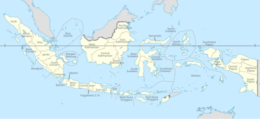
Bengkulu
Indonesian province on Sumatra's southwest coast, formerly British Bencoolen.

Bennylin · CC BY-SA 3.0
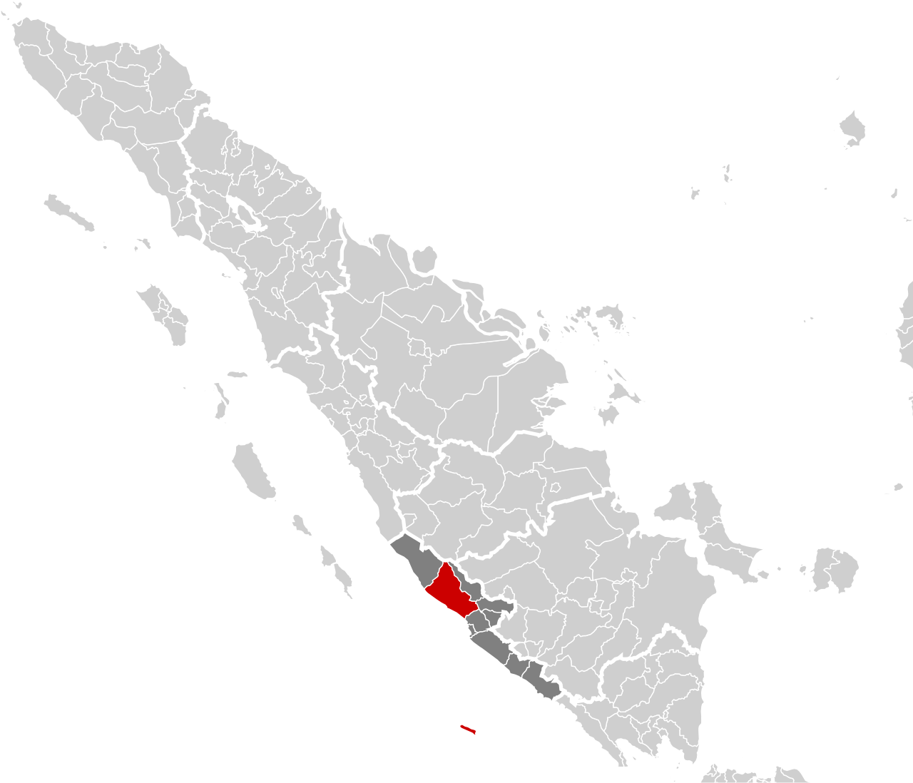
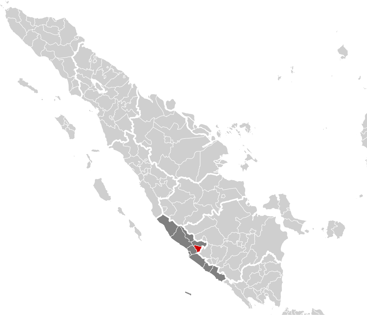
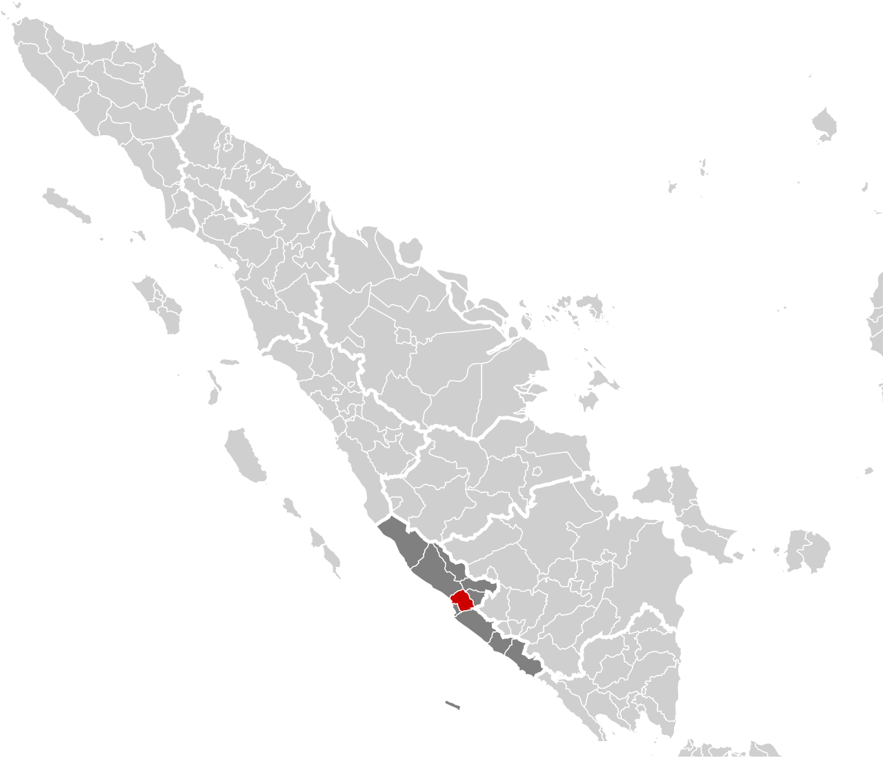
Bengkulu, historically known as Bencoolen, is a province of Indonesia situated on the southwest coast of Sumatra. Established as a separate province on 18 November 1968, it was formed by detaching the historic Bencoolen Residency from South Sumatra, a process finalized under Law No. 9 of 1967 and Government Regulation No. 20 of 1968. Covering an area of 20,122.21 square kilometers—comparable in size to Slovenia or the U.S. state of Massachusetts—the province shares borders with West Sumatra to the north, Jambi to the northeast, Lampung to the southeast, and South Sumatra to the east, while its western, southern, and northwestern sides face the Indian Ocean. Bengkulu is the 28th largest province by area and is divided into nine regencies plus the capital city of Bengkulu, the only independent city. As of the 2020 Census, the population stood at 2,010,670, with a mid-2025 estimate of 2,138,044. The province ranks eleventh in Indonesia for its Human Development Index, scoring about 0.744 in 2013, and twentieth in life expectancy at 70.35 years. Its territory includes offshore islands such as Mega Island and Enggano, and it possesses 525 kilometers of coastline along the Indian Ocean. Rich in natural resources like coal and gold, and with significant geothermal potential, Bengkulu remains less developed than other Sumatran provinces. Historically, the region was influenced by the Buddhist Srivijaya empire in the 8th century and later became a vassal of the Banten Sultanate. The British East India Company established a pepper-trading post here in 1685, building Fort Marlborough in 1714, which still stands. The area was ceded to the Dutch in the Anglo-Dutch Treaty of 1824. During the early 1930s, future president Sukarno was exiled in Bengkulu, where he met his wife Fatmawati, mother of future president Megawati Sukarnoputri. The province lies near the Sunda Fault, making it prone to earthquakes and tsunamis, including a deadly 2000 earthquake on Enggano and a series of quakes in September 2007.
- Largest ethnic group
- Rejang (22-30%)
Lore & Background
Bengkulu, historically known as Bencoolen, is a province of Indonesia located on the southwest coast of Sumatra. It was formed on 18 November 1968 by separating the historic Bencoolen Residency from South Sumatra. The province spans 20,122.21 square kilometers, a land area comparable to Slovenia, Massachusetts, or Ivanovo Oblast. It is bordered by West Sumatra to the north, Jambi to the northeast, Lampung to the southeast, South Sumatra to the east, and the Indian Ocean to the northwest, south, southwest, and west. Bengkulu is the 28th largest province by area and includes offshore Mega Island and Enggano Island. It has 525 kilometers of coastline along the Indian Ocean, from Dusun Baru Pelokan in Mukomuko Regency to Tebing Nasal in Kaur Regency. The province is divided into nine regencies and the capital city of Bengkulu, its only independent city. It is the 26th most populous province in Indonesia, with an official mid-2025 estimate of 2,138,044 inhabitants. Bengkulu possesses natural resources including coal and gold, as well as significant geothermal potential, though it remains less developed than other Sumatran provinces. The region lies near the Sunda Fault, making it prone to earthquakes and tsunamis; the June 2000 Enggano earthquake killed at least 100 people, and a series of earthquakes in September 2007 killed 13. Historically, the area was subject to the Buddhist Srivijaya empire in the 8th century, later ruled by the Minangkabau's Inderapura Sultanate from the 17th century, and briefly influenced by the Banten Sultanate. The British East India Company established a pepper-trading center and garrison here in 1685, building Fort Marlborough in 1714, which still stands. The trading post was never profitable, hampered by an unpleasant location and insufficient pepper. Sir Stamford Raffles served as Lieutenant-Governor of Bencoolen from 1818 to 1824, abolishing slavery. The British ceded Bengkulu to the Dutch in the Anglo-Dutch Treaty of 1824 in exchange for Malacca. During the early 1930s, future president Sukarno was imprisoned here and met his wife Fatmawati; their daughter Megawati Sukarnoputri later became Indonesia's first female president.
Reader's Guide
Bengkulu’s significance is rooted in its distinctive colonial history as a British outpost within the Dutch-dominated Indonesian archipelago. The British East India Company established a pepper-trading settlement there in 1685 and later built Fort Marlborough in 1714, which remains a historical site. The territory was integrated into the British Empire as Bencoolen in 1785, and Sir Stamford Raffles served as its Lieutenant-Governor from 1818 to 1824, implementing reforms such as the abolition of slavery. The British maintained control for roughly 140 years before ceding Bengkulu to the Dutch in the Anglo-Dutch Treaty of 1824 in exchange for Malacca. During the early 1930s, future Indonesian president Sukarno was exiled in Bengkulu, where he met his wife Fatmawati, and their daughter Megawati Sukarnoputri later became Indonesia’s first female president. Ecologically, Bengkulu lies near the Sunda Fault, making it prone to earthquakes and tsunamis; the June 2000 Enggano earthquake killed at least 100 people, and a series of earthquakes in September 2007 killed 13. The province includes offshore islands such as Mega Island and Enggano Island, and has 525 kilometres of coastline along the Indian Ocean. Its natural resources include coal, gold, and significant geothermal potential, yet it remains less developed than other Sumatran provinces. Bengkulu was formed as a province on 18 November 1968, separating from South Sumatra, and is divided into nine regencies and the capital city of Bengkulu.
Did You Know?
- Bengkulu's name is traditionally said to derive from 'bangkai' and 'hulu', meaning 'carcasses upstream', from a war between small kingdoms.
- Sukarno, Indonesia's first president, was exiled in Bengkulu and met his wife Fatmawati there; their daughter Megawati Sukarnoputri became Indonesia's first female president.
Colonial Crossroads: Two Empires, One Coast
For nearly two centuries, Bengkulu sat at the crossroads of European imperial ambition on Sumatra's southwest shore. The Portuguese were the first Europeans to reach the area, followed by the Dutch in 1596, but it was the British East India Company that planted the deepest roots. In 1685 the EIC established a pepper-trading post and garrison, and in 1714 they raised Fort Marlborough, a structure that still stands today. The venture, however, never turned a profit; Europeans found the climate unpleasant and local pepper supplies proved insufficient, reducing the outpost to an occasional stop for East Indiamen. In 1785 the territory was formally folded into the British Empire as Bencoolen, while the rest of Sumatra fell under the Dutch East Indies. Sir Stamford Raffles served as Lieutenant-Governor from 1818 to 1824, enacting reforms that included the abolition of slavery and leaving behind monuments and forts. After roughly 140 years of British presence, the Anglo-Dutch Treaty of 1824 ceded Bengkulu to the Netherlands in exchange for Malacca, and the region remained under Dutch rule until the Japanese occupation of World War II.
The Exile That Shaped a Nation
In the early 1930s, the Dutch colonial authorities imprisoned Sukarno, the man who would go on to become Indonesia's first president, and briefly held him in Bengkulu. It was during this period of confinement that he met Fatmawati, who would become his wife. Their union produced several children, most notably Megawati Sukarnoputri, who decades later made history as Indonesia's first female President. The small coastal province thus became, in an ironic twist, the cradle of a political dynasty that would shape the nation's modern trajectory. After independence, Bengkulu was initially absorbed into the larger South Sumatra Province, a territory that also encompassed Lampung, the Bangka-Belitung Islands, and what is now South Sumatra itself. It was not until 18 November 1968, when Law No. 9 of 1967 and Government Regulation No. 20 of 1968 took effect, that the historic Bencoolen Residency was formally carved out as Indonesia's 26th province, preceding East Timor in the sequence of provincial creations.
A Land of Riches and Risks
Stretching roughly 20,122 square kilometres—comparable in size to Slovenia or the U.S. state of Massachusetts—Bengkulu occupies the western flank of the Bukit Barisan mountain range, with a hilly eastern interior and a plateau vulnerable to erosion. Its western edge is defined by 525 kilometres of Indian Ocean coastline, running from Dusun Baru Pelokan in Mukomuko Regency to Tebing Nasal in Kaur Regency, and it also encompasses the offshore Mega Island and Enggano Island. Beneath the surface lie substantial deposits of coal and gold, alongside large untapped geothermal potential. Yet the province remains less developed than its Sumatran neighbours. Compounding this, Bengkulu sits near the Sunda Fault, making it acutely vulnerable to seismic events. The June 2000 Enggano earthquake claimed at least 100 lives, and a series of tremors in September 2007 killed 13 more. Recent assessments warn that undersea earthquakes along Sumatra's coast could inundate coastal areas over the coming decades.
Administrative Identity and the Human Development Question
Today Bengkulu is divided into nine regencies and the city of Bengkulu, which serves as both capital and the province's sole independent city. It ranks 28th among Indonesian provinces by area and 26th by population, with the 2020 Census recording 2,010,670 residents and a mid-2025 official estimate projecting 2,138,044 inhabitants, slightly more male than female. The province borders West Sumatra to the north, Jambi to the northeast, Lampung to the southeast, and South Sumatra to the east, while the Indian Ocean wraps around its western, southern, and northwestern shores. On the human development front, Badan Pusat Statistik data placed Bengkulu at the eleventh-highest HDI score among provinces, with a 2013 index of roughly 0.744. Life expectancy reached 70.35 years by 2014, positioning the province 20th nationally, though its gross domestic product ranked only 28th. These figures paint a picture of a province with meaningful human capital yet still catching up economically to its better-resourced neighbours on the island.
Gallery
Frequently Asked Questions
What is Bengkulu's role in national history?
The province spent much of the 18th and 19th centuries as a British trading outpost on Sumatra's coast. It also carries deep personal significance in Indonesia's founding story, since it was the exile island where Sukarno met the woman who would become his wife, Fatmawati.
Where exactly is Bengkulu located?
It sits along the southwest coastline of the island of Sumatra, facing the Indian Ocean. The provincial capital, the city of Bengkulu, anchors that same stretch of coast.
Who makes up Bengkulu's population?
The Rejang people are the single largest ethnic group in the province, representing roughly a quarter to a third of all residents. The rest of the population is a mix of other Sumatran and migrant communities.
More in Provinces Of Indonesia 1-24
Spotted an error? Know more?
This is a living reference — every entry is fact-audited, and reader corrections feed straight into our audit queue. Suggest an edit · See this site's audit record