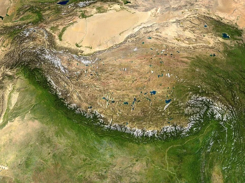
Gulf Coastal Plain
Low coastal region around the Gulf of Mexico.

via Wikipedia: Gulf Coastal Plain · see source
The Gulf Coastal Plain wraps around the Gulf of Mexico, covering parts of the southern United States and eastern Mexico. On the U.S. side, it stretches from the Florida Panhandle and southwest Georgia, through the southern two-thirds of Alabama, most of Mississippi, western Tennessee and Kentucky, the very southern tip of Illinois, the Missouri Bootheel, eastern and southern Arkansas, all of Louisiana, the southeast corner of Oklahoma, and the easternmost part of Texas. In Mexico, it continues along the Gulf through the states of Tamaulipas and Veracruz, reaching Tabasco and the Yucatán Peninsula on the Bay of Campeche.
To the south, the plain is bounded by the Gulf of Mexico in the U.S. and by the Sierra Madre de Chiapas in Mexico. Its northern edge meets the Ouachita Highlands of the Interior Low Plateaus and the southern Appalachian Mountains, with the farthest northern reach following the Mississippi embayment—the Mississippi Alluvial Valley—up to the southern tip of Illinois. The eastern boundary meets the South Atlantic Coastal Plain in southern Georgia, along the divide between rivers flowing into the Gulf and those flowing to the Atlantic, and then south along the Apalachicola River through the Florida Panhandle. The landscape is generally flat to rolling, broken up by numerous streams, river floodplains, and marsh wetlands.
The Gulf Coastal Plain is essentially a westward extension of the Atlantic Coastal Plain around the Gulf. Only the lower, seaward part truly qualifies as a plain, since that area is mostly flat and unbroken by hills or valleys. The inner part, originally a plain, has been heavily eroded over time into a complex of hills and valleys, with altitude and relief increasing as you move inland. Features unique to the Gulf Plain include the peninsular extension of Florida, the belted arrangement of relief and soils in Alabama and Texas, and the Mississippi embayment—an inland extension that pushes the plain halfway up the Mississippi River to where it meets the Ohio River at Cairo, Illinois, including the Mississippi floodplain there.
In Florida, a broad, low crustal arch extends southward where the Atlantic and Gulf coastal plains meet. The emerged half of this arch forms the visible lowland peninsula of Florida, while the submerged half stretches westward under the shallow Gulf waters. The northern part of the peninsula is made mostly of weak limestone, where much of the drainage goes underground, creating many sinkholes. Numerous small lakes in this lowland likely owe their basins to the dissolving of limestone. Valuable phosphate deposits are found in certain areas. The southern part of the state contains the Everglades—a vast, low, flat, marshy region overgrown with tall reedy grass. The eastern coast is lined with long sand reefs that enclose narrow, continuous lagoons often called rivers. At the southern tip of the peninsula, a chain of coral islands—the Florida Keys—appears to have formed as corals and other lime-secreting organisms grew outward toward the strong Gulf Stream current for food. The western coast has fewer and shorter offshore reefs, and much of it has a minutely irregular outline.
A classic example of a belted coastal plain is found in Alabama and the adjacent part of Mississippi, where the plain is about 150 miles (240 km) wide. The base layer is mostly weak limestone, which has been stripped from its original inland extent and worn down into a flat inner lowland with rich black soil, known as the Black Belt. This lowland is enclosed by an upland or escarpment called Chunnenuggee Ridge, held up by partly consolidated sandy strata. The upland is not continuous but a heavily eroded escarpment, dropping steeply toward the inner lowland and sloping very gradually down to the coastal prairies, which become extremely low, flat, and marshy before dipping under the Gulf, often fringed by offshore reefs.
The coastal plain extends about 500 miles (800 km) inland along the axis of the Mississippi embayment. Its inner edge provides striking examples of topographical discordance, sweeping northwestward directly across the trend of the Piedmont belt, the ridges and valleys, and the Appalachian Plateau—all of which dip gently beneath the unconformable cover of coastal plain strata. Similarly, the western side of the embayment, trending south and southwest, runs along the lower southeastern side of the dissected Ozark Plateau of southern Missouri and northern and central Arkansas. This Ozark region resembles the Appalachian Plateau in many ways. Together, the Ozarks and Ouachitas make up the U.S. Interior Highlands, the only major mountainous region between the Rocky Mountains and the Appalachians. As the coastal plain turns westward toward Texas, it borders the Ouachita Mountains of Arkansas and Oklahoma and the Arbuckle Mountains in southern Oklahoma, which may be considered an analog of—and possible extension of—the Appalachian fold and crystalline belts.
Within the embayment, some low escarpment-like belts of hills and associated strips of lowlands suggest features of a belted coastal plain. The most distinct is the hilly belt or dissected escarpment formed by the Grand Gulf formation in western Mississippi. Important salt deposits occur in the coastal plain strata near the coast. The most striking feature of the embayment is the broad valley that the Mississippi River has eroded across it.
- type
- Geographical region
- location
- Southern United States and eastern Mexico
- northernmost_extent
- Southern tip of Illinois
- southern_boundary
- Gulf of Mexico and Sierra Madre de Chiapas
- eastern_boundary
- South Atlantic Coastal Plain in southern Georgia
- notable_feature
- Mississippi embayment extends 500 miles inland
- width_in_Alabama
- About 150 miles
Lore & Background
The Gulf Coastal Plain is a westward extension of the Atlantic Coastal Plain around the Gulf of Mexico. It is only the lower, seaward part that deserves the name of plain, for there alone is the surface unbroken by hills or valleys. The inner part, initially a plain, has been maturely dissected into an elaborate complex of hills and valleys. Unique features include the peninsular extension of the plain in Florida, the belted arrangement of relief and soils in Alabama and in Texas, and the Mississippi embayment, which extends inland half-way up the course of the Mississippi River to its junction with the Ohio River at Cairo, Illinois. The Florida peninsula is a broad, low crustal arch extending southward at the junction of the Atlantic and Gulf coastal plains. The northern part of the peninsula is composed largely of a weak limestone, where much of the lowland drainage is underground forming many sinkholes. The southern part includes the Everglades, a large area of low, flat, marshy land overgrown with tall reedy grass. At the southern end of the peninsula is a series of coral islands known as the Florida Keys.
Reader's Guide
The Gulf Coastal Plain's belted plain in Alabama and adjacent Mississippi is about 150 miles wide. The basal formation is chiefly a weak limestone, stripped down to a flat inner lowland of rich black soil called the black belt. This lowland is enclosed by an upland or escarpment known as Chunnenuggee Ridge, sustained by partly consolidated sandy strata. The coastal plain extends 500 miles inland on the axis of the Mississippi embayment. Its inner border sweeps northwestward square across the trend of the piedmont belt, the ridges and valleys, and the plateau of the Appalachians, all of which dip gently beneath the coastal plain strata. In the embayment, the most striking feature is the broad valley which the Mississippi has eroded across it. The river has eroded a valley about 40 to 50 miles wide enclosed by bluffs one or two hundred feet high in the northern part. The valley floor is covered with a floodplain of fine silt, having a southward slope of only half a foot to a mile. Valuable phosphate deposits occur in certain districts of Florida, and important salt deposits occur in the coastal plain strata near the coast.
Did You Know?
- The Gulf Coastal Plain extends 500 miles inland on the axis of the Mississippi embayment.
- The belted plain in Alabama and Mississippi is about 150 miles wide and includes a region called the black belt due to its rich black soil.
- The Florida peninsula is a broad, low crustal arch, with its northern part composed largely of weak limestone that forms many sinkholes.
- The Mississippi River has eroded a valley about 40 to 50 miles wide through the coastal plain, enclosed by bluffs one or two hundred feet high in the northern part.
- Valuable phosphate deposits occur in certain districts of Florida, and important salt deposits occur in the coastal plain strata near the coast.
Geographic Extent and Continental Scale
The Gulf Coastal Plain of North America is a vast stretch of flat, low-lying terrain that runs northward from the shores of the Gulf of Mexico, following the course of the Lower Mississippi River all the way up to the Ohio River. This gives the plain a total length of roughly 981 miles, or about 1,579 kilometers, making it one of the most extensive coastal lowland regions on the continent. It ranks alongside the coastal plains of Alaska and the broader southeastern United States as among the largest of their kind in the world. The plain's defining characteristic is its proximity to the sea coast, with its surface remaining relatively level and low-elevated throughout its entire span.
Formation and Geologic Origins
Coastal plains like the Gulf Coastal Plain come into being through one of two primary geological processes. In the first scenario, the land began as a continental shelf—a broad, flat expanse sitting below sea level—and was later exposed when global ocean levels dropped, revealing what had long been submerged. In the second, river currents carried sediment out to sea, where it settled and accumulated layer upon layer over vast stretches of time until a recognizable plain took shape. The Gulf Coastal Plain's close association with the Lower Mississippi River suggests the sediment-deposition pathway played a significant role in its development. Regardless of which mechanism dominated, these plains are typically set apart from the surrounding interior by nearby landforms such as mountain ranges, creating a natural boundary between the low coastal terrain and the higher uplands beyond.
The Fall Line and Physical Boundaries
One of the most recognizable features marking the edge of the Gulf Coastal Plain is the fall line, a natural boundary where the flat, low-lying coastal terrain gives way to higher upland areas. This transition zone often represents a sharp change in elevation and geology, separating the gentle, sediment-rich plain from the more rugged interior landscapes. The plain itself is characterized by its level surface and low elevation, stretching unbroken from the Gulf of Mexico's coastline northward. While the interior beyond the fall line may feature mountains or other prominent landforms, the plain remains distinctly flat and adjacent to the sea.
Global Context Among Coastal Plains
The Gulf Coastal Plain does not exist in isolation; it is part of a global family of coastal lowlands that share similar characteristics of flatness, low elevation, and adjacency to ocean shores. Across the Pacific, India's coastal plains stretch an extraordinary 6,150 kilometers, divided into western and eastern strips that flank the Deccan Plateau and converge at Kanyakumari, the southernmost point of the Indian mainland. Together, these plains illustrate how the same fundamental geologic processes produce remarkably similar landscapes on every inhabited continent.
Gallery
Frequently Asked Questions
What is the Gulf Coastal Plain?
The Gulf Coastal Plain is a low-lying geographical region that wraps around the Gulf of Mexico, covering parts of the Southern United States and extending into eastern Mexico. It is classified as a coastal plain and forms one of the major physiographic divisions of the continent.
Where exactly does the Gulf Coastal Plain stretch?
In the U.S. it spans from the Florida Panhandle and southwest Georgia through Alabama, Mississippi, western Tennessee, Kentucky, the southern tip of Illinois, the Missouri Bootheel, Arkansas, Louisiana, southeast Oklahoma, and easternmost Texas. It then continues into Mexico through Tamaulipas, Veracruz, Tabasco, and onto the Yucatán Peninsula.
What is the Gulf Coastal Plain's most notable feature?
The Mississippi embayment is its standout landmark, a broad lowland that plunges roughly 500 miles inland from the Gulf coast. This deep interior basin makes the plain far more extensive than a typical narrow coastal strip.
What are the Gulf Coastal Plain's boundaries?
To the south it is bounded by the Gulf of Mexico and, in Mexico, the Sierra Madre de Chiapas; to the east it meets the South Atlantic Coastal Plain in southern Georgia. Its northernmost reach touches the southern tip of Illinois, while the western edge fades into the high plains of Texas and Oklahoma.
Why is the Gulf Coastal Plain geographically significant?
It forms one of the largest continuous lowland areas in North America, linking the U.S. Gulf states directly to the Mexican coast and the Yucatán. Its flat, sediment-rich terrain supports major river systems, dense agriculture, and a chain of ecosystems that stretch across two countries.
More in Plateaus And Plains 1-24
Spotted an error? Know more?
This is a living reference — every entry is fact-audited, and reader corrections feed straight into our audit queue. Suggest an edit · See this site's audit record