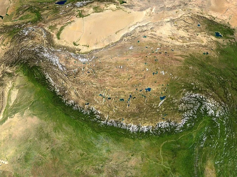
Basin and Range Province
A vast region of alternating mountain ranges and arid basins.

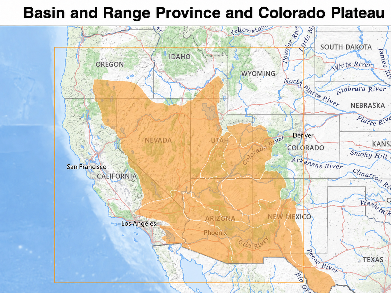
Original image: Kathleen Smith vectorization: AntiCompositeNumber · CC BY 3.0
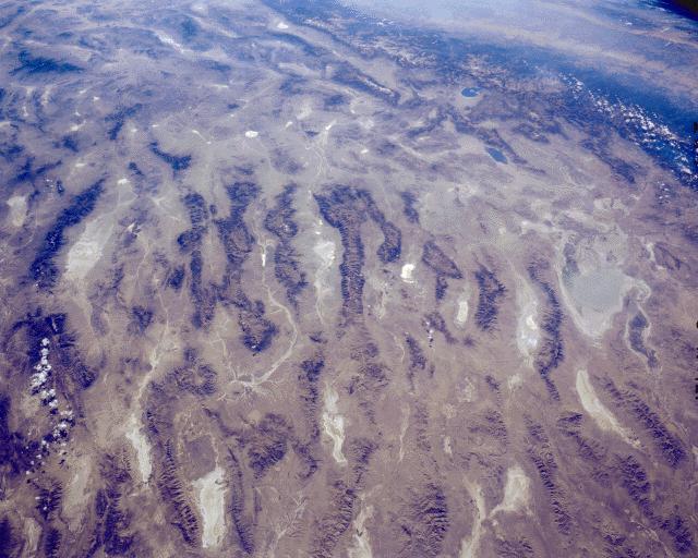
The Basin and Range Province is a huge physiographic region spanning much of the inland western United States and northwestern Mexico. Its defining feature is a landscape of alternating narrow, faulted mountain ranges and flat, arid valleys or basins, created by abrupt elevation changes. This topography results from tectonic extension that started roughly 17 million years ago during the early Miocene.
The many ranges in the U.S. part of the province are often called the "Great Basin Ranges," though many lie outside the actual Great Basin. Notable ranges include the Ruby Mountains, Snake Range, Panamint Range, White Mountains, Toiyabe Range, Sandia Mountains, and Chiricahua Mountains. The highest point entirely within the province is White Mountain Peak in California; the lowest is Badwater Basin in Death Valley, at 282 feet below sea level. The climate is arid, supporting numerous ecoregions, and most North American deserts fall within its boundaries. The Basin and Range Province should not be confused with the Great Basin, a region defined by internal drainage that overlaps much of the province, nor with the Basin and Range National Monument in southern Nevada, which is just a small part of the larger area.
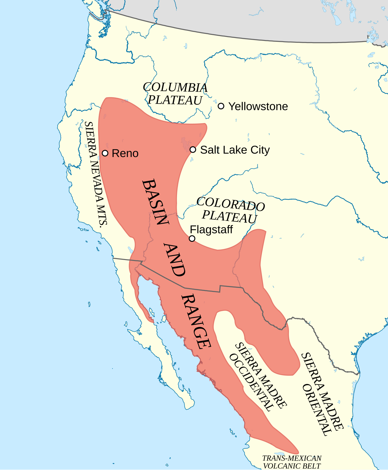
Geographically, the province covers much of western North America. In the U.S., its western border is the eastern fault scarp of the Sierra Nevada, and it extends over 500 miles east to the Wasatch Fault, Colorado Plateau, and Rio Grande Rift. It reaches north to the Columbia Plateau and south to the Trans-Mexican Volcanic Belt in Mexico, though its southern limits are debated. In Mexico, the province largely coincides with the Mexican Plateau. Evidence suggests its southern portion is bounded east by the Laramide Thrust Front of the Sierra Madre Oriental and west by the Gulf of California and Baja Peninsula, with less faulting in the Sierra Madre Occidental. Common features include endorheic basins, ephemeral lakes, plateaus, and bolson valleys alternating with mountains. The area is mostly arid and sparsely populated, but contains major cities like Reno, Las Vegas, Salt Lake City, Phoenix, Tucson, El Paso–Ciudad Juárez, Mexicali, and Hermosillo.
Geologically, the basin and range topography results from extension and thinning of the lithosphere (crust and upper mantle). Extensional settings like this feature listric normal faults that level out with depth. Opposing normal faults link underground to create a horst and graben pattern, where horsts are uplifted blocks and grabens are down-dropped ones. The average crustal thickness here is about 30–35 km, similar to other extended continental crust. The lithosphere’s base is estimated at 60–70 km deep. Estimates of total extension vary, but the median is about 100% lateral spread. Total lateral displacement since the early Miocene ranges from 60 to 300 km, with greater displacement in the south, suggesting extension began there and spread north. Clarence Dutton compared the many narrow parallel ranges to an "army of caterpillars crawling northward."
Tectonically, the causes of lithospheric extension are debated. Key preceding events include a long period of compression from Farallon plate subduction under North America, which thickened the crust. Most relevant plate movement occurred in the Neogene period (23.03–2.58 million years ago) and continues today. By the early Miocene, much of the Farallon plate was consumed, and the Pacific-Farallon Ridge approached North America. In the middle Miocene, this ridge was subducted, ending subduction along that part of the margin, though the Farallon plate continued sinking. This boundary split the ridge and created the San Andreas transform fault, adding an oblique strike-slip component. Today, the Pacific plate moves northwest relative to North America, increasing shearing along the margin. The most accepted hypothesis suggests that crustal shearing from the San Andreas Fault triggered spontaneous extensional faulting, similar to that in the Great Basin, though plate movement alone does not fully explain the extension.
- Highest point
- Mount Whitney, California
Lore & Background
The Basin and Range Province includes much of western North America. In the United States, it is bordered on the west by the eastern fault scarp of the Sierra Nevada and spans over 500 miles to its eastern border marked by the Wasatch Fault, the Colorado Plateau and the Rio Grande Rift. The province extends north to the Columbia Plateau and south as far as the Trans-Mexican Volcanic Belt in Mexico, though the southern boundaries are debated. Common geographic features include numerous endorheic basins, ephemeral lakes, plateaus, and bolson valleys alternating with mountains. The area is mostly arid and sparsely populated, although there are several major metropolitan areas, such as Reno, Las Vegas, Salt Lake City, Phoenix, Tucson, El Paso—Ciudad Juárez, Mexicali, and Hermosillo.
Reader's Guide
The Basin and Range Province is significant for its distinctive topography, which results from tectonic extension and thinning of the lithosphere beginning in the early Miocene. The province's numerous ranges in the United States are collectively referred to as the 'Great Basin Ranges,' though many are not actually in the Great Basin. The tectonic mechanisms responsible for extension are controversial, with the most accepted hypothesis suggesting crustal shearing associated with the San Andreas Fault caused spontaneous extensional faulting. The province is also notable for its high heat flow, which lowers lithospheric density and stimulates isostatic uplift. Metamorphic core complexes in the province, where lower crust is brought to the surface, have provided valuable insight into extensional processes. The Basin and Range Province supplies nearly all the copper and most of the gold, silver, and barite mined in the United States.
Did You Know?
- The Basin and Range Province should not be confused with the Great Basin, a region defined by internal drainage that overlaps much of the greater physiographic region.
- Clarence Dutton compared the many narrow parallel mountain ranges to an 'army of caterpillars crawling northward.'
- The province's extension is widely attributed to mantle upwelling and gravitational collapse related to the same broad tectonic processes that cause narrow rift zones like the Afar triple junction.
Position Within the Intermontane Plateaus
The Basin and Range Province occupies the central and southwestern portion of the Intermontane Plateaus, one of eight major physiographic regions that make up the contiguous United States. This parent region is defined by its position between two great mountain systems: the Rocky Mountains form its eastern boundary, while the Cascade Range and the Sierra Nevada mark its western edge. Within this vast intermontane corridor, the landscape is dominated by alternating plateaus and mountain ranges. The Intermontane Plateaus are further divided into three distinct physiographic provinces. The Columbia Plateau Province occupies the northern reaches, the Colorado Plateau Province stretches across the southeast, and the Basin and Range Province fills the central and southwestern expanse. Each of these three provinces is itself broken down into smaller physiographic sections, creating a layered hierarchy of geographic classification. The Basin and Range Province thus sits at the heart of a region where the interplay of uplifted blocks and eroded plains creates one of the most distinctive topographic patterns in North America.
Tectonic Origins and Defining Mechanism
The Basin and Range Province is defined by a topography of alternating basins and ranges, a pattern that arises directly from crustal extension, also known as extensional tectonics. In this process, the Earth's crust is pulled apart rather than compressed, causing it to fracture along faults and creating a distinctive landscape of sunken lowlands bordered by uplifted blocks. This extensional mechanism is the fundamental geological force that gives the province its name and its characteristic shape. The province spans a large area across the Western United States, and the basin-and-range pattern is the dominant expression of this tectonic regime. This sets the Basin and Range Province apart from its two sibling provinces within the Intermontane Plateaus. The Columbia Plateau Province to the north is characterized by flood basalt eruptions from the Miocene and early Pliocene epochs, while the Colorado Plateau Province to the southeast is shaped by long cycles of uplift, faulting, and deep canyon erosion. The Basin and Range Province, by contrast, owes its form primarily to the stretching of the crust, producing a topography fundamentally different in origin from the volcanic or erosional landscapes of its neighbors.
Geographic Extent Across Two Nations
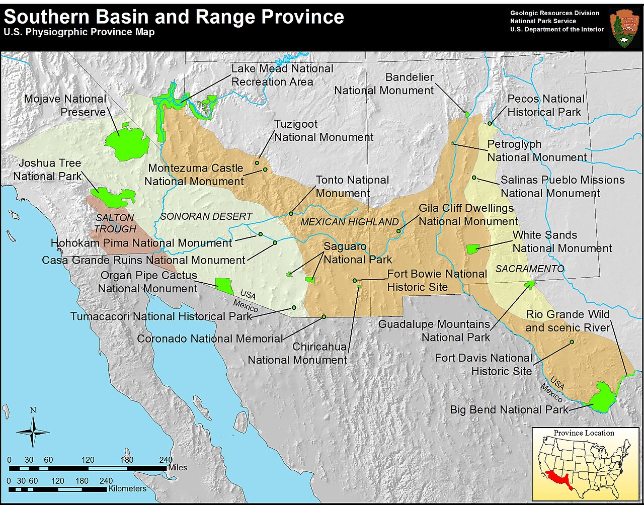
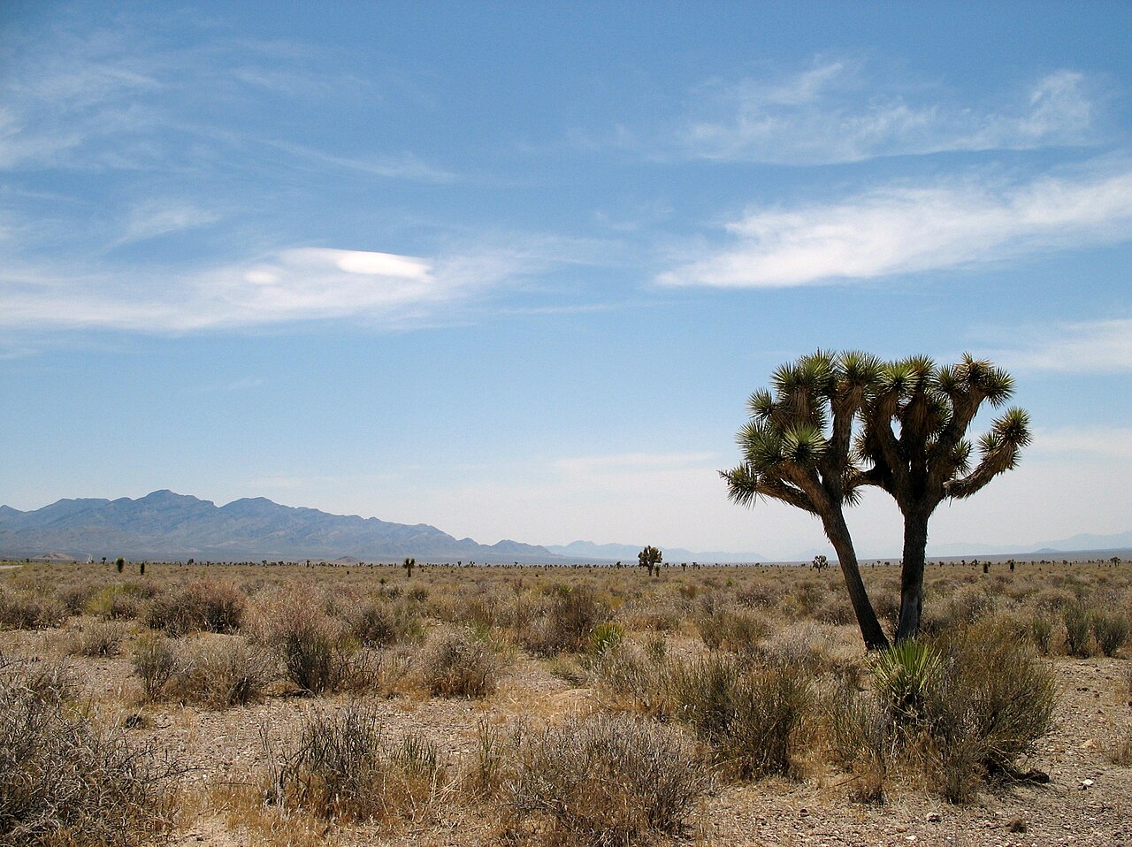
The Basin and Range Province covers a vast stretch of the American West, extending through all or portions of seven U.S. states: Oregon, Idaho, Nevada, California, Utah, New Mexico, and Arizona. Its reach does not stop at the international border. The province continues southward into Mexico, encompassing all or parts of the states of Sonora, Chihuahua, and Sinaloa, among others. This transboundary extent underscores that the extensional tectonics responsible for the province's formation operate across a continuous stretch of crust that political boundaries simply overlay. Within the broader Intermontane Plateaus, the Basin and Range Province occupies the central and southwestern portion, situated between the Rocky Mountains on the east and the Cascade and Sierra Nevada ranges on the west. The Sonoran Desert, identified as part of the Basin and Range Province, illustrates the diverse terrain found within its boundaries. The province's sheer geographic scale, spanning multiple states in two countries, makes it one of the most extensive physiographic regions in the Western Hemisphere.
Boundaries and Transition Zones
The Basin and Range Province does not end abruptly at its borders; rather, it transitions gradually into neighboring physiographic provinces. One notable boundary feature is the Mogollon Rim escarpment, which marks the transition zone between the Mogollon Plateau, part of the Colorado Plateau Province, and the Sonoran Desert, which belongs to the Basin and Range Province. This escarpment serves as a tangible geological boundary where two fundamentally different tectonic regimes meet: the extensional stretching that created the Basin and Range topography on one side, and the uplift-and-erosion history of the Colorado Plateau on the other. The Intermontane Plateaus as a whole are bounded by the Rocky Mountains to the east and the Cascade and Sierra Nevada ranges to the west, framing the Basin and Range Province within a corridor of plateaus and mountain ranges. The province's central and southwestern position within this corridor means it shares boundaries with both the Columbia Plateau Province to the north and the Colorado Plateau Province to the southeast, each of which is further subdivided into its own set of physiographic sections.
Gallery
Frequently Asked Questions
Who is Basin and Range Province?
Basin and Range Province is a sprawling physiographic region spanning much of the inland Western United States and reaching into northwestern Mexico. As entry 24 in the Plateaus And Plains series, it represents one of the most visually striking landscapes in North America.
What are Basin and Range Province's powers/role?
Its signature trait is a dramatic sawtooth pattern of narrow, fault-broken mountain ridges alternating with flat, arid valley floors, producing abrupt elevation swings across the terrain. This topography is the product of tectonic extension that has been pulling the crust apart since roughly 17 million years ago in the early Miocene.
How does Basin and Range Province's story end?
The province's arc concludes where the alternating basin-and-range pattern fades into neighboring physiographic provinces, such as the Colorado Plateau to the east or the Pacific coastal ranges to the west. Its southern narrative tapers into northwestern Mexico, where the same extensional geology continues at a smaller scale.
Why is Basin and Range Province important?
It acts as a living textbook of continental extension, demonstrating how a sustained tectonic regime can fracture a stable landmass into hundreds of parallel fault blocks over millions of years. Its arid climate also preserves an exceptionally clear record of Miocene-to-present geological history.
What is Basin and Range Province's highest point?
The province's crown jewel is Mount Whitney in California, rising to 14,505 feet and standing as the highest peak in the contiguous United States. Its dramatic perch above the surrounding Owens Valley basin perfectly captures the province's signature contrast between extreme highs and low, flat floors.
More in Plateaus And Plains 1-24
Spotted an error? Know more?
This is a living reference — every entry is fact-audited, and reader corrections feed straight into our audit queue. Suggest an edit · See this site's audit record